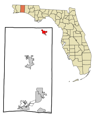
Okaloosa County is a county located in the northwestern portion of the U.S. state of Florida, extending from the Gulf of Mexico to the Alabama state line. As of the 2020 census, the population was 211,668. Its county seat is Crestview. Okaloosa County is included in the Crestview-Fort Walton Beach-Destin, FL Metropolitan Statistical Area.

Santa Rosa County is a county located in the northwestern portion of the U.S. state of Florida. As of 2020, the population was 188,000. The county seat is Milton, which lies in the geographic center of the county. Other major communities within Santa Rosa County are Navarre, Pace, and Gulf Breeze. Navarre is the most populated community with a population of approximately 45,000 residents. Santa Rosa County is included in the Pensacola—Ferry Pass—Brent, Florida Metropolitan Statistical Area, which also includes Escambia County.

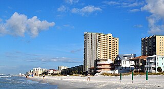
Fort Walton Beach, often referred to by the initialism FWB, is a city in southern Okaloosa County, Florida, United States. As of the 2020 U.S. census, the population was 20,922, up from 19,507 in 2010. It is a principal city of the Crestview−Fort Walton Beach−Destin, Florida Metropolitan Statistical Area.
Laurel Hill is a city in Okaloosa County, Florida, United States. It is part of the Crestview–Fort Walton Beach–Destin, Florida Metropolitan Statistical Area. The population was 584 at the 2020 US Census, up from 537 at the 2010 census.
Shalimar is a town in Okaloosa County, Florida, United States. It is part of the Crestview–Fort Walton Beach–Destin, Florida Metropolitan Statistical Area. The population was 737 at the 2020 census, up from 717 at the 2010 census.

Valparaiso is a city in Okaloosa County, Florida, United States. It is part of the Crestview–Fort Walton Beach–Destin, Florida Metropolitan Statistical Area. As of the 2020 census, the city population was 4,752, down from 5,036 at the 2010 census.
Miramar Beach is a census-designated place (CDP) in Walton County, Florida, United States. The population was 8,002 at the 2020 census, up from 6,146 at the 2010 census. It is part of the Crestview—Fort Walton Beach–Destin, Florida Metropolitan Statistical Area. Although many other coastal localities in Florida have appended "Beach" to their names to distinguish themselves from an adjacent inland or cross-bay municipality – such as Miami Beach, St. Pete Beach, Fort Myers Beach, Panama City Beach, Melbourne Beach, Cocoa Beach, and Jacksonville Beach – the city of Miramar, Florida is actually over 450 miles (720 km) away in South Florida. Miramar Beach is due east of Destin, Florida. It is often considered to be part of the city of Destin. However, it has its own ZIP code (32550) and is in Walton County, whereas Destin is in Okaloosa County.
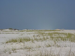
Santa Rosa Island is a 40-mile (64 km) barrier island located in the U.S. state of Florida, thirty miles (50 km) east of the Alabama state border. The communities of Pensacola Beach, Navarre Beach, and Okaloosa Island are located on the island. On the northern side of the island, are Pensacola Bay on the west and Choctawhatchee Bay on the east, joined through Santa Rosa Sound.

The Emerald Coast is an unofficial name for the coastal area in the US state of Florida on the Gulf of Mexico that stretches about 100 miles (160 km) through five counties, Escambia, Santa Rosa, Okaloosa, Walton, and Bay, which include Pensacola Beach, Navarre Beach, Fort Walton Beach, Destin, and Panama City Beach. Some south Alabama communities on the coast of Baldwin County, such as Gulf Shores, Orange Beach, and Fort Morgan embrace the term as well.

The East Bay River in Florida is a 15-mile-long (24 km) river located in Santa Rosa and Okaloosa counties. It flows from east to west, forming near Hurlburt Field, and empties into the eastern portion of East Bay (Florida) near the towns Holley and Navarre. The river forms part of the southern boundary of Eglin Air Force Base.

The Pensacola metropolitan area is the metropolitan area centered on Pensacola, Florida. It is also known as the Pensacola–Ferry Pass–Brent Metropolitan Statistical Area, a metropolitan statistical area (MSA) used for statistical purposes by the United States Census Bureau and other agencies. The Pensacola Standard Metropolitan Statistical Area was first defined in 1958, with Pensacola as the principal city, and included Escambia and Santa Rosa counties. The MSA was renamed Pensacola–Ferry Pass–Brent MSA in 2003, with the unincorporated census-designated places Ferry Pass and Brent added as principal cities. The population of the MSA in the 2020 census was 511,502.

The Blackwater River of Florida is a 56.6-mile-long (91.1 km) river rising in southern Alabama and flowing through the Florida Panhandle to the Gulf of Mexico. The river enters Florida in Okaloosa County and flows through Santa Rosa County to Blackwater Bay, an arm of Pensacola Bay. The river passes through Blackwater River State Forest and Blackwater River State Park. Milton, the county seat of Santa Rosa County, is located on the river.
Sarver is an unincorporated community in Buffalo Township, Butler County, Pennsylvania. It is located in the south-eastern part of the county. Sarver is generally known as most of the area near and west/southwest of State Route 356 in the township. Until around the late 1990s- early 2000s, Sarver was home to only a few residents. Its economy was very small and was based solely on a grocery store, a few small restaurants, along with a few gas stations and car dealerships. It has since grown to hold many new medium to high income housing plans, with the addition of many new shopping centers and businesses. The ZIP code is 16055. The population of the zip code is 8,486.
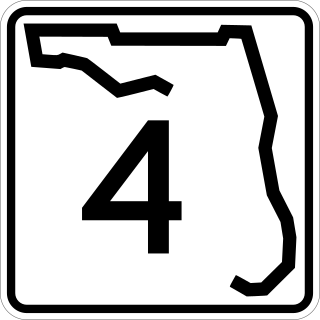
State Road 4 is a 43.705-mile-long (70.336 km) two-lane state highway in Escambia, Santa Rosa, and Okaloosa counties in the western corner of the Florida Panhandle. It is signed east–west, but the road is slightly diagonal. The road runs from Century near the Alabama state line at an intersection with U.S. Highway 29 (US 29), to the farming community of Milligan at an intersection with US 90.
Destin Executive Airport, also known as Coleman Kelly Field, is a public use airport owned by and located in Okaloosa County, Florida. The airport is one nautical mile (2 km) east of the central business district of Destin, Florida. It is included in the National Plan of Integrated Airport Systems for 2021–2025, which categorized it as a general aviation facility.

Okaloosa Island is an area on Santa Rosa Island, Florida, United States.

Northwest Florida State College is a public college in Niceville, Florida. It is part of the Florida College System and is accredited by the Southern Association of Colleges and Schools to award associate and baccalaureate degrees. Northwest Florida State College has multiple campuses but has operated continuously on its Niceville campus since 1963. The college also operates a charter high school, the Collegiate High School at Northwest Florida State College, which opened in 2000.
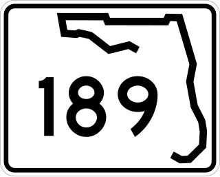
State Road 189 is a north–south highway in the panhandle of Florida. It leads from U.S. Route 98 in downtown Fort Walton Beach to just east of State Road 85 at the Eglin AFB West Gate where its southern section terminates. The northern section begins at an intersection with State Road 4 in Baker, Florida north to the Alabama / Florida state line where Alabama State Route 137 begins upon crossing the Alabama state line.
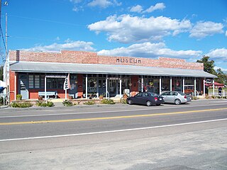
The Baker Block Museum is a local history and genealogy museum located in Baker, Florida, focused on the history of the Florida panhandle with emphasis on Okaloosa County.

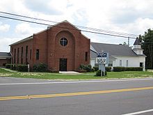
Almarante is an unincorporated area in northeastern Okaloosa County, Florida, just southwest of Laurel Hill on State Road 85. Although the name is no longer in common use, the Almarante Cemetery and Almarante Volunteer Fire Department retain the name.