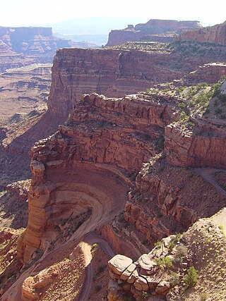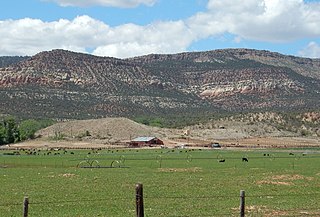
The exposed geology of the Canyonlands area is complex and diverse; 12 formations are exposed in Canyonlands National Park that range in age from Pennsylvanian to Cretaceous. The oldest and perhaps most interesting was created from evaporites deposited from evaporating seawater. Various fossil-rich limestones, sandstones, and shales were deposited by advancing and retreating warm shallow seas through much of the remaining Paleozoic.

Goosenecks State Park is a state park in the U.S. state of Utah, overlooking a deep meander of the San Juan River. The park is located near the southern border of the state a short distance from Mexican Hat, Utah. Millions of years ago, the Monument Upwarp forced the river to carve incised meanders over 1,000 feet (300 m) deep as the surrounding landscape slowly rose in elevation. Eroded by water, wind, frost, and gravity, this is a classic location for observing incised meanders.

The Cutler Formation or Cutler Group is a rock unit that is exposed across the U.S. states of Arizona, northwest New Mexico, southeast Utah and southwest Colorado. It was laid down in the Early Permian during the Wolfcampian epoch.
The Honaker Trail is a hiking trail located near Goosenecks State Park in southeastern Utah. Built in the late 1890s and early 1900s as a supply route for gold prospectors, the 2.5-mile (4.0 km) trail connects the deeply entrenched San Juan River with the canyon rim over 1,200 feet (370 m) above. Popular with geologists, the trail serves as the type locality for the Pennsylvanian Honaker Trail Formation. Fossilized crinoids and brachiopods, as well as trace fossils of other organisms are visible along portions of the trail.
Toxolophosaurus was a sphenodont which lived in North America during the Early Cretaceous.

In geology, the Paradox Formation Is a Pennsylvanian age formation which consists of abundant evaporites with lesser interbedded shale, sandstone, and limestone. The evaporites are largely composed of gypsum, anhydrite, and halite. The formation is found mostly in the subsurface, but there are scattered exposures in anticlines in eastern Utah and western Colorado. These surface exposures occur in the Black Mesa, San Juan and Paradox Basins and the formation is found in the subsurface in southwestern Colorado, southeastern Utah, northeastern Arizona and northeastern New Mexico.

The Supai Group is a slope-forming section of red bed deposits found in the Colorado Plateau. The group was laid down during the Pennsylvanian to Lower Permian. Cliff-forming interbeds of sandstone are noticeable throughout the group. The Supai Group is especially exposed throughout the Grand Canyon in northwest Arizona, as well as local regions of southwest Utah, such as the Virgin River valley region. It occurs in Arizona at Chino Point, Sycamore Canyon, and famously at Sedona as parts of Oak Creek Canyon. In the Sedona region, it is overlain by the Hermit Formation, and the colorful Schnebly Hill Formation.
The Pioche Formation is a geologic formation in Utah and Nevada. It preserves fossils dating back to the Cambrian period.
The Dunderberg Shale is a geologic formation in Nevada and Utah.
The Chainman Shale is a geologic formation in Utah, mostly identical to the White Pine Shale. It preserves fossils dating back to the Carboniferous period.
The Manning Canyon Shale is a geologic formation in Utah, United States. It preserves fossils dating back to the Carboniferous period.
The Fish Haven Dolomite is an Ordovician period geologic formation in southern Idaho, northeastern Nevada, and northwestern Utah.
The Elephant Canyon Formation is the basal Permian geologic formation of the Cutler Group overlying an unconformity on the Pennsylvanian Honaker Trail Formation in the Paradox Basin of southern Utah.
The Goughs Canyon Formation is a geologic formation in southeastern Humboldt County, Nevada.
The Joana Limestone is a limestone geologic formation in White Pine County and Nye County Nevada.
The Stirling Quartzite Formation is a geologic formation in the northern Mojave Desert of Inyo County, California and Nye County and Clark County, Nevada.
The Lone Mountain Dolomite is a dolomite geologic formation in Nevada.
The Halgaito Formation is the basal Permian geologic member of the Cutler Group in southern Utah. The member consists of silty sandstone, siltstone and limestone. The Elephant Canyon may grade into the Halgaito and grades northward into the Cedar Mesa Formation.

The (Upper) Late Pennsylvanian Manakacha Formation is a cliff-forming, sandstone, red-orange geologic unit, formed from an addition of eolian sand, added to marine transgression deposits,, and found throughout sections of the Grand Canyon. It is one of the lower members of the Supai Group, with the Supai Group found in other sections of Arizona, especially in the Verde Valley region, or as a basement unit below the Mogollon Rim, just eastwards or part of the basement Supai Group of the southwest & south Colorado Plateau.


