

Hook Point (Indigenous name: Torerr) is the southernmost tip of Fraser Island (also known as K'Gari and Gari) in Queensland, Australia. [1] It is the landing point for ferry services from Inskip Point, which is some 1,200 meters further south. [2]
Hook Point (Indigenous name: Torerr) is the southernmost tip of Fraser Island (also known as K'Gari and Gari) in Queensland, Australia. [1] It is the landing point for ferry services from Inskip Point, which is some 1,200 meters further south. [2]

Great Sandy National Park is a coastal national park in the Fraser Coast Region, Queensland, Australia.

Fraser Island is a World Heritage-listed island along the south-eastern coast in the Wide Bay–Burnett region, Queensland, Australia. The island is approximately 250 kilometres (160 mi) north of the state capital, Brisbane, and is within the Fraser Coast Region local government area. The world heritage listing includes the island, its surrounding waters and parts of the nearby mainland.

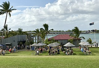
Hervey Bay is a city on the coast of the Fraser Coast Region of Queensland, Australia. The city is situated approximately 290 kilometres (180 mi) or 3½ hours' highway drive north of the state capital, Brisbane. It is located on the bay of the same name open to the Coral Sea between the Queensland mainland and nearby Fraser Island. The local economy relies on tourism which is based primarily around whale watching in Platypus Bay to the north, ferry access to Fraser Island, accessible recreational fishing and boating and the natural north facing, calm beaches with wide undeveloped foreshore zones. In October 2019, Hervey Bay was named the First Whale Heritage Site in the world by the World Cetacean Alliance, for its commitment to and practices of sustainable whale and dolphin watching. A 2010 study by Deakin University showed that people on the Fraser Coast area including Hervey Bay, were the happiest in Australia. At June 2018, there were an estimated 54,674 people in Hervey Bay, having grown by an annual average of 1.31% year-on-year over the preceding five years.

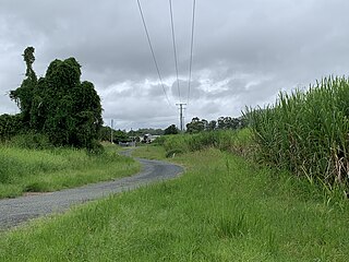
Inskip Point is a peninsula in the north of the locality of Inskip to the north of the town of Rainbow Beach in south-east Queensland, Australia. It is the vehicular gateway to Fraser Island, a popular recreational area.

Indian Head is a coastal headland on the eastern (ocean) side of Fraser Island off the coast of Queensland, Australia.

The Great Sandy Strait is a strait in the Australian state of Queensland of 70 kilometres (43 mi) length which separates mainland Queensland from Fraser Island. It is also a locality in the Fraser Coast Region local government area. In the 2016 census, Great Sandy Strait had a population of 4 people.

Rainbow Beach is a coastal rural town and locality in the Gympie Region, Queensland, Australia. In the 2016 census, Rainbow Beach had a population of 1,249 people.

Fraser Island is a locality on the island of Fraser Island in the Fraser Coast Region, Queensland, Australia. It consists of most but not all of the land on the island. In the 2016 census the locality of Fraser Island had a population of 182 people.

Ferry transport in Queensland provides both historical and current information relating to scheduled public passenger ferry services in Queensland. The first ferry started on 1 January 1843 at Russell Street with a service across the Brisbane River.

Tin Can Bay is a coastal town and locality in the Wide Bay–Burnett region in Queensland, Australia. The locality is split between the Fraser Coast Region and the Gympie Region, but the town itself is within Gympie Region. In the 2016 census, Tin Can Bay had a population of 2,242 people.

Macleay Island is an island in Moreton Bay, South East Queensland, Australia. The island constitutes a town and locality within the City of Redland. In the 2016 census, the locality of Macleay Island had a population of 2,681 people.
Sandstone Point is a coastal locality in the Moreton Bay Region, Queensland, Australia. In the 2016 census, Sandstone Point had a population of 3,959 people.

Sandy Cape is the most northern point on Fraser Island off the coast of Queensland, Australia. The place was named Sandy Cape for its appearance by James Cook during his 1770 voyage up the eastern coast of Australia aboard the Endeavour. To the south the next two ocean headlands are Waddy Point and Indian Head.
Alberton is a rural locality in the City of Gold Coast, Queensland, Australia. In the 2016 census, the locality of Alberton had a population of 590 people.
Karragarra Island is one of the inhabited Southern Moreton Bay Islands, near Brisbane, in Queensland, Australia. It is also a town and locality in the City of Redland, Queensland, Australia. In the 2016 census, the locality of Karragarra Island had a population of 204 people.
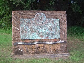
The Butchulla, also written Butchella, Badjala, Badjula, Badjela, Bajellah, Badtjala and Budjilla are an Aboriginal Australian people of K'gari, Queensland, and a small area of the nearby mainland of southern Queensland.
Eurong is a town and a locality on Fraser Island in the Fraser Coast Region, Queensland, Australia. In the 2016 census, Eurong had a population of 47 people.

Inskip is a coastal locality in the Gympie Region, Queensland, Australia. In the 2016 census, Inskip had a population of 52 people. Inskip Point at the north of the locality is a vehicular gateway to Fraser Island.
Beaver Rock is a rural locality in the Fraser Coast Region, Queensland, Australia. In the 2016 census, Beaver Rock had a population of 49 people.
Olga Eunice Miller, often known as AuntyOlga or by her traditional name Wandi, was an Australian historian, artist, author and Aboriginal elder of the Butchulla people. She often acted as an advocate for K'gari and Butchulla issues, and illustrated The Legends of Moonie Jarl, the first known Australian Aboriginal–written children's book to be published. In 2002 she was named a Queensland Great.
Coordinates: 25°47′30″S153°04′36″E / 25.79167°S 153.0767°E