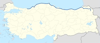
Hopa River is the main water stream of Hopa in the eastern Black Sea Region of Turkey. [1] Hopa River basin is rich in terms of Alluvial deposits which formed in Pleistocene era. [2]

Hopa River is the main water stream of Hopa in the eastern Black Sea Region of Turkey. [1] Hopa River basin is rich in terms of Alluvial deposits which formed in Pleistocene era. [2]

Armenia is a landlocked country in the South Caucasus region of the Caucasus. The country spans Eastern Europe and West Asia, with cultural ties to both regions. Armenia is bordered on the north and east by Georgia and Azerbaijan and on the south and west by Iran, Azerbaijan's exclave Nakhchivan, and Turkey.

The Black Sea is a marginal mediterranean sea of the Atlantic Ocean lying between Europe and Asia, east of the Balkans, south of the East European Plain, west of the Caucasus, and north of Anatolia. It is bounded by Turkey, Bulgaria, Romania, Ukraine, Russia and Georgia. The Black Sea is supplied by major rivers, principally the Danube, Dnieper and Don. Consequently, while six countries have a coastline on the sea, its drainage basin includes parts of 24 countries in Europe.

Karabük Province is a landlocked province in the northern part of Anatolia, located about 200 km (124 mi) north of Ankara, 115 km (71 mi) away from Zonguldak and 113 km (70 mi) away from Kastamonu. In 2022 it had a population of 252,058. The main city is Karabük which is located about 100 km (62 mi) south of the Black Sea coast.

Western Thrace or West Thrace, also known as Greek Thrace, is a geographic and historical region of Greece, between the Nestos and Evros rivers in the northeast of the country; East Thrace, which lies east of the river Evros, forms the European part of Turkey, and the area to the north, in Bulgaria, is known as Northern Thrace.

The Hemshin people, also known as Hemshinli or Hamshenis or Homshetsi, are a bilingual small group of Armenians who practice Sunni Islam after they had been converted from Christianity in the beginning of the 18th century and are affiliated with the Hemşin and Çamlıhemşin districts in the province of Rize, Turkey. They are Armenian in origin, and were originally Christian members of the Armenian Apostolic Church, but over the centuries evolved into a distinct community and converted to Sunni Islam after the conquest of the region by the Ottomans during the second half of the 15th century.

Artvin Province is a province in Turkey, on the Black Sea coast in the northeastern corner of the country, on the border with Georgia. Artvin also borders the Turkish provinces of Erzurum, Ardahan and Rize.

Rize is a coastal city in the eastern part of the Black Sea Region of Turkey. It is the seat of Rize Province and Rize District. Its population is 119,828 (2021). Rize is a typically Turkish provincial capital with little in the way of nightlife or entertainment. However the border with Georgia has been open since the early 1990s, the Black Sea coast road has been widened and the town is much wealthier than it used to be. Current Turkish President Recep Tayyip Erdoğan's family has its roots in Rize and the local university is named after him. The city is linked by road with Trabzon, Hopa (55 miles [88 km] east on the Georgian border, and Erzurum. Rize–Artvin Airport started operating in 2022.

Arhavi is a town in Artvin Province located in the Black Sea Region of Turkey. It is the seat of Arhavi District. Its population is 17,526 (2021), making it the third most populous municipality in Artvin Province. Laz people form a large portion of the population. The terrain is hilly and mountainous. Area of the city center is about 6 km2 (2.3 sq mi). The length of the coast is about 10 km (6.2 mi). Arhavi is famous by the Culture and Art Festival that celebrated since 1973.

Hopa is a town in Artvin Province in northeast Turkey. It is located on the eastern Turkish Black Sea coast about 67 km (42 mi) from the city of Artvin and 18 kilometres from the border with Georgia. It is the seat of Hopa District. Its population is 23,846 (2021).

Kaspi is a district of Georgia, in the region of Shida Kartli. Given a District status within Transcaucasian SFSR in 1930. District center is Kaspi.
Tripolis, formerly Ischopolis (Ἰσχόπολις), was an ancient fortress city in Pontus Polemoniacus, on a river of the same name, and with a tolerably good harbour; it is now the site and namesake of the city of Tirebolu in Giresun Province, Black Sea Region, Turkey. It belonged to the Mossynoeci and was situated at a distance of 18 km east from Cape Zephyrium. The place is situated on a rocky headland.

The Black Sea Region is a geographical region of Turkey. The largest city in the region is Samsun. Other big cities are Zonguldak, Trabzon, Ordu, Tokat, Giresun, Rize, Amasya and Sinop.

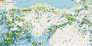
The geology of Turkey is the product of a wide variety of tectonic processes that have shaped Anatolia over millions of years, a process which continues today as evidenced by frequent earthquakes and occasional volcanic eruptions.
Çakmak Dam is a dam in Samsun Province, Turkey. Its reservoir has been found to house Capoeta tinca, a species of scraper, as well as 136 recorded taxa of phytoplankton, with members of the phylum Chlorophyta dominant in population density, and Bacillariophyta dominant in terms of species richness. The dam is a source of water for the city of Samsun.

D.010, aka Black Sea Coastal Road, is a major west-east state road in northern Turkey that serves the Black Sea coast. The 1,427 km (887 mi) route starts in the west at the intersection D.014, 5 km (3.1 mi) southeast of Karasu, Sakarya Province, and terminates at the intersection D.060, 25 km (16 mi) northeast of Kars in eastern Anatolia. However, it is discontinued between Zonguldak and 10 km (6.2 mi) southwest of Çaycuma. The gap of 37 km (23 mi) distance is on the highway D.750.
Sugören is a neighbourhood of the town Hopa, Hopa District, Artvin Province, Turkey. Its population is 1,076 (2021). It is a coastal village on the Black Sea and on the newly constructed motorway. It is almost merged to Hopa at the east and 80 kilometres (50 mi) to Artvin. The main economic activities of the village are fishing and tea agriculture.
Hopa is a city and a district in the Artvin Province of Turkey.

The Cankurtaran Tunnel, a.k.a.Hopa Cankurtaran Tunnel, is a road tunnel located in Artvin Province. It forms part of the Hopa-Borçka Highway D.010 in northeastern Turkey.
The Selimiye Tunnel is a road tunnel constructed on the Black Sea Coastal Highway D.010 E70 between Hopa and Kemalpaşa in Artvin Province, northeastern Turkey.
Kissa was a town of ancient Pontus on the Black Sea coast, on the road from Trapezus to Apsarus.
{{cite book}}: CS1 maint: multiple names: authors list (link)