
A valley is an elongated low area often running between hills or mountains which will typically contain a river or stream running from one end to the other. Most valleys are formed by erosion of the land surface by rivers or streams over a very long period of time. Some valleys are formed through erosion by glacial ice. These glaciers may remain present in valleys in high mountain or polar areas. At lower latitudes and latitudes, these glacially-formed valleys may have been created or enlarged during ice ages but now be ice-free and occupied by streams or rivers. In desert areas, valleys may be entirely dry or carry a watercourse only rarely. In areas of limestone bedrock, dry valleys may also result from drainage taking place underground rather than at the surface. Rift valleys arise principally from earth movements, rather than erosion. Many different types of valley are described by geographers, using terms that may be global in use or else applied only locally.

The Thuringian Forest, is a mountain range in the southern parts of the German state of Thuringia, running northwest to southeast. Skirting from its southerly source in foothills to a gorge on its north-west side is the Werra valley. On the other side of the Forest is an upper outcrop of the North German Plain, the Thuringian Basin, which includes the city Erfurt. The south and south-east continuation of the range is the highland often called the Thuringian-Vogtlandian Slate Mountains.

Saxe-Coburg and Gotha, or Saxe-Coburg-Gotha, was an Ernestine, Thuringian duchy ruled by a branch of the House of Wettin, consisting of territories in the present-day states of Thuringia and Bavaria in Germany. It lasted from 1826 to 1918. In November 1918, Charles Edward, Duke of Saxe-Coburg and Gotha, was forced to abdicate. In 1920, the northern part of the duchy was merged with six other Thuringian free states to form the state of Thuringia: Saxe-Weimar-Eisenach, Saxe-Altenburg and Saxe-Meiningen, Schwarzburg-Rudolstadt and Schwarzburg-Sondershausen, as well as the People's State of Reuss. The southern part of the duchy, as southernmost of the Thuringian states, was the only one which, after a referendum, became part of Bavaria.

Saxon Switzerland is a hilly climbing area and national park around the Elbe valley south-east of Dresden in Saxony, Germany. Together with the Bohemian Switzerland in the Czech Republic it forms the Elbe Sandstone Mountains.
Gotha is the fifth-largest city in Thuringia, Germany, 20 kilometres west of Erfurt and 25 km east of Eisenach with a population of 44,000. The city is the capital of the district of Gotha and was also a residence of the Ernestine Wettins from 1640 until the end of monarchy in Germany in 1918. The House of Saxe-Coburg and Gotha originating here spawned many European rulers, including the royal houses of the United Kingdom, Belgium, Portugal and Bulgaria.
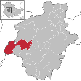
Waltershausen is a town in the south-western part of the district of Gotha in the state of Thuringia, Germany.

Hainich is a forested hill chain in the state of Thuringia in Germany, between the towns of Eisenach, Mühlhausen and Bad Langensalza. Hainich covers an area of around 160 km², of which, since 31 December 1997, half has been designated as Hainich National Park. The highest point in Hainich is Alte Berg at 1621 ft. The Mühlhäuser Stadtwald in the northern part of Hainich is the largest municipal forest in Thuringia. The landmark of Hainich is Betteleiche, a 600-year-old common oak at Ihlefeld.

Frauensee is a village and a former municipality in the Wartburgkreis district of Thuringia, Germany. Since July 2018, it is part of the town Bad Salzungen.
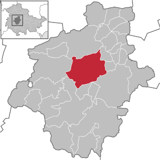
Emsetal is a former municipality in the district of Gotha, in Thuringia, Germany. It took its name from the river Emse. It consisted of the villages Fischbach, Schmerbach, Schwarzhausen and Winterstein. Since 31 December 2013, it is part of the town Waltershausen.

The Thuringian Highland, Thuringian Highlands or Thuringian-Vogtlandian Slate Mountains is a low range of mountains in the German state of Thuringia.

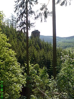
The Falkenstein lies southeast of the small town of Tambach-Dietharz in Schmalwasser bottom (Schmalwassergrund) and is the most important rock formation in the Thuringian Forest in central Germany. It consists of porphyry. On the valley side the crags are 96 metres (315 ft) high. Because of its situation on the side of a hill it appears most striking when one stands immediately in front of it.
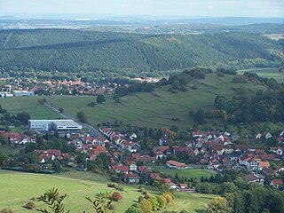
The Kilianstein is a free-standing rock tower on the Hopfenberg hill in the eastern part of the Sembach valley in central Germany. It stands about 800 m east of the (upper) village of Winterstein on the northern slopes of the Thuringian Forest in Germany.

The Winterstein, also called the Hinteres Raubschloss, is an isolated, elongated rock massif in the hinterland of Saxon Switzerland in East Germany. On the summit there was once a medieval castle, also called Winterstein, of which remains such as rebates for timber beams, hewn-out steps and cisterns are still visible.

The Veste Coburg is one of the most well-preserved medieval fortresses of Germany. It is situated on a hill above the town of Coburg, in the Upper Franconia region of Bavaria.
The Wasgau is a Franco-German hill range in the German state of Rhineland-Palatinate and the French departments of Bas-Rhin and Moselle. It is formed from the southern part of the Palatine Forest and the northern part of the Vosges mountains, and extends from the River Queich in the north over the French border to the Col de Saverne in the south.
Hopfenberg is German and literally means "hop hill". It may refer to the following:

A Steilhang is a geoscientific term for a steep mountainside or hillside, the average slope of which is greater than 1:2 or 30°. Leser defines a steilhang as a mountainside with an incline of between 16° and 60°, slopes of between 30° and 60° being described as "very steep" (übersteil) and anything over 60° being a rock face (wand).

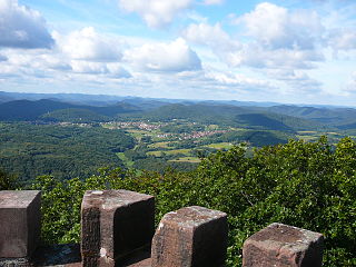
Großer Inselsberg is a mountain in the Thuringian Forest with a height of 916.5 m (3,007 ft) above sea level, located on Rennsteig in the districts of Gotha and Schmalkalden-Meiningen. It is the fourth-highest distinct mountain of Thuringia, after Großer Beerberg, Schneekopf and Großer Finsterberg and forms a landmark that can be viewed in particular from northern and western directions.

The Hornungskuppe is a wooded hill, 439 m above sea level (NHN), in the Thuringian Zipfel on the border of Hesse and Thuringia in Germany. It is part of the natural region of the Seulingswald.

Bocksberg is a levelled, medieval hilltop castle on the top of the cone-shaped hill of Bocksberg in the Rhön Mountains near Geisa and Schleid.

