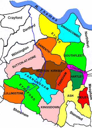
The Borough of Dartford is a local government district with borough status in the north-west of the county of Kent, England. It is named after its main town of Dartford, where the council is based. Other notable settlements include Greenhithe, Stone and Swanscombe, along with an emerging new town at Ebbsfleet, and a number of smaller villages. It also includes Bluewater, one of the UK's largest shopping centres. The borough lies just outside the administrative boundary of Greater London, but a sizeable part of it lies within the M25 motorway which encircles London. Many of the borough's urban areas form part of the Greater London Built-up Area. The borough had a population of 116,800 at the 2021 census.

Sevenoaks is a local government district in west Kent, England. Its council is based in the town of Sevenoaks.

The Darent is a Kentish tributary of the River Thames and takes the waters of the River Cray as a tributary in the tidal portion of the Darent near Crayford. 'Darenth' is frequently found as the spelling of the river's name in older books and maps, Bartholomew's Canals and River of England being one example. Bartholomew's Gazetteer (1954) demonstrates that Darent means "clear water", a result of it springing from and running through chalk. The purity of the water was a major factor in the development of paper and pharmaceuticals in the area.

Greenhithe is a village in the Borough of Dartford in Kent, England, and the civil parish of Swanscombe and Greenhithe. It is located 4 miles east of Dartford and 5 miles west of Gravesend.

Hartley is a village and civil parish in the Sevenoaks district of Kent, England. It is located 7 miles (11 km) south west of Gravesend and the same distance south east of Dartford.

Sevenoaks is a constituency in Kent represented in the House of Commons of the UK Parliament since 2019 by Laura Trott, a Conservative who currently serves as Shadow Secretary of State for Education. She was Chief Secretary to the Treasury from November 2023 to July 2024. The seat was previously held by Michael Fallon, who served as Secretary of State for Defence from 2014 to 2017.

Dartford is a constituency in Kent represented in the House of Commons of the UK Parliament by Jim Dickson of the Labour Party since 2024.

Darenth is a village and civil parish in the Borough of Dartford, Kent, England. It is located 3.4 miles south east of Dartford and 4.6 miles north east of Swanley.

Horton Kirby is a village in the Sevenoaks District of Kent, England. It is located 3.9 miles east of Swanley & 4.9 miles south of Dartford. Together with the nearby village of South Darenth, it forms the Horton Kirby and South Darenth civil parish.

South Darenth is a village in the civil parish of Horton Kirby and South Darenth in the Sevenoaks District of Kent, England. It is located 4.2 miles east of Swanley & 4.4 miles south of Dartford.

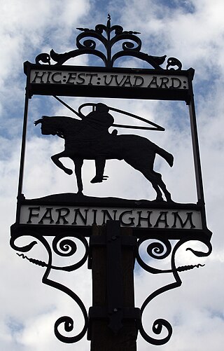
Farningham is a village and civil parish in the Sevenoaks District of Kent, England. It is located 3 miles (5 km) south-east of Swanley. It has a population of 1,314.

Fawkham is a village and civil parish in the Sevenoaks District of Kent, England. Fawkham is defined as a hamlet by Sevenoaks District Council, with a population of 429. Fawkham is a low density, linear settlement along the bottom of a dry chalk valley some 3 mi (5 km) in length, with secondary lanes intersecting. There is no discernible village centre, although clusters of buildings occur near the Church/junction with Castle Hill, and around the village green and public house at the junction with Fawkham Green Road. There are around 220 houses.
Dartford Rural District was a rural district with an area of 34,037 acres (138 km2) in the county of Kent, England. In 1971 it had a population of 64,561 and an electorate of 43,911. At dissolution it was the most populous rural district council in Kent, but had once been larger, having lost territory when Crayford Urban District was created in 1920, and Swanscombe Urban District in 1926.

The waymarked path Darent Valley Path is 19 miles (31 km) long, following the River Darent from the banks of the River Thames at Dartford through the Kent Downs Area of Outstanding Natural Beauty to the Greensand Hills above Sevenoaks. It runs through the villages of Shoreham and Otford.

Axstane was a hundred in the county of Kent, England. The Hundred of Axstane lay south-east of Dartford and Wilmington Hundred. It is called Achestan in Domesday Book, but by the reign of Edward I it was called Axstane.

The 2015 Sevenoaks District Council election took place on 7 May 2015 to elect members of the Sevenoaks District Council in England. It was held on the same day as other local elections.
Sevenoaks District Council elections are held every four years to elect Sevenoaks District Council in Kent, England. Since the last full review of boundaries in 2003 the council has comprised 54 councillors, representing 26 wards.

Go-Coachhire Limited, trading as Go-Coach, is a bus operator running a total of 40 bus services across Kent and Sussex. The majority of these services are operated on behalf of Kent County Council from their depot in Swanley.


