Horwich Urban District

Last updated
Horwich Urban District
Area
  19113,257 acres (13.2 km2) [1]
  19713,257 acres (13.2 km2) [1]
Population
  189112,850 [2]
  197116,465 [3]
History
  Created1872
  Abolished1974
  Succeeded by Metropolitan Borough of Bolton
Status
   HQ Horwich Public Hall

Horwich was, from 1872 to 1974, a local government district centred on the town of Horwich in the administrative county of Lancashire, England.

Horwich town and civil parish in Greater Manchester

Horwich is a town and civil parish in the Metropolitan Borough of Bolton, Greater Manchester, England. Historically in Lancashire, it is 5.3 miles (8.5 km) southeast of Chorley, 5.8 miles (9.3 km) northwest of Bolton and 20 miles (32 km) northwest of Manchester. It lies at the southern edge of the West Pennine Moors with the M61 motorway passing close to the south and west. At the 2011 Census, Horwich had a population of 20,067.

Administrative counties of England Former subnational divisions of England

Administrative counties were a level of subnational division of England used for the purposes of local government from 1889 to 1974. They were created by the Local Government Act 1888 as the areas for which county councils were elected. Some large counties were divided into several administrative counties, each with its own county council. The administrative counties were abolished by the Local Government Act 1972 and were replaced by the metropolitan and non-metropolitan counties of England.

Lancashire County of England

Lancashire is a ceremonial county in North West England. The administrative centre is Preston. The county has a population of 1,449,300 and an area of 1,189 square miles (3,080 km2). People from Lancashire are known as Lancastrians.

Contents

History

Horwich was a township and chapelry in the civil and ecclesiastical parish of Deane in the Salford Hundred of Lancashire. [4] The township became part of the Bolton Poor Law Union on 1 February 1837 which took responsibility for funding the Poor Law within that Union area. [5] In 1866, Horwich was given the status of a civil parish. [6] [7]

In England, a township is a local division or district of a large parish containing a village or small town usually having its own church. A township may or may not be coterminous with a chapelry, manor, or any other minor area of local administration.

A chapelry was a subdivision of an ecclesiastical parish in England and parts of Lowland Scotland up to the mid 19th century.

Civil parish Territorial designation and lowest tier of local government in England

In England, a civil parish is a type of administrative parish used for local government, they are a territorial designation which is the lowest tier of local government below districts and counties, or their combined form, the unitary authority. Civil parishes can trace their origin to the ancient system of ecclesiastical parishes which historically played a role in both civil and ecclesiastical administration; civil and religious parishes were formally split into two types in the 19th century and are now entirely separate. The unit was devised and rolled out across England in the 1860s.

In 1872, a local board of health was adopted for the civil parish of Horwich. [8] After the Public Health Act 1875 was passed by Parliament in that year, Horwich Local Board of Health assumed extra duties as an urban sanitary district, although the Local Board's title did not change. [9]

Local boards or local boards of health were local authorities in urban areas of England and Wales from 1848 to 1894. They were formed in response to cholera epidemics and were given powers to control sewers, clean the streets, regulate environmental health risks including slaughterhouses and ensure the proper supply of water to their districts. Local boards were eventually merged with the corporations of municipal boroughs in 1873, or became urban districts in 1894.

Public Health Act 1875 United Kingdom legislation

The Public Health Act 1875 is an Act of the Parliament of the United Kingdom, one of the Public Health Acts, and a significant step in the advance of public health in Britain.

Parliament of the United Kingdom Supreme legislative body of the United Kingdom

The Parliament of the United Kingdom of Great Britain and Northern Ireland, commonly known internationally as the UK Parliament, British Parliament, or Westminster Parliament, and domestically simply as Parliament, is the supreme legislative body of the United Kingdom, the Crown dependencies and the British Overseas Territories. It alone possesses legislative supremacy and thereby ultimate power over all other political bodies in the UK and the overseas territories. Parliament is bicameral but has three parts, consisting of the Sovereign, the House of Lords, and the House of Commons. The two houses meet in the Palace of Westminster in the City of Westminster, one of the inner boroughs of the capital city, London.

Following the implementation of the Local Government Act 1894, Horwich Local Board was replaced by an elected urban district council of twelve members. [8] Horwich Urban District Council had four electoral wards: Central, East, North, and South, each represented by three councillors. [10]

Local Government Act 1894 United Kingdom legislation

The Local Government Act 1894 was an Act of the Parliament of the United Kingdom that reformed local government in England and Wales outside the County of London. The Act followed the reforms carried out at county level under the Local Government Act 1888. The 1894 legislation introduced elected councils at district and parish level.

In England and Wales, Northern Ireland, and the Republic of Ireland, an urban district was a type of local government district that covered an urbanised area. Urban districts had an elected urban district council (UDC), which shared local government responsibilities with a county council.

The wards and electoral divisions in the United Kingdom are electoral districts at sub-national level represented by one or more councillors. The ward is the primary unit of English electoral geography for civil parishes and borough and district councils, electoral ward is the unit used by Welsh principal councils, while the electoral division is the unit used by English county councils and some unitary authorities. Each ward/division has an average electorate of about 5,500 people, but ward-population counts can vary substantially. As at the end of 2014 there were 9,456 electoral wards/divisions in the UK.

Under the Local Government Act 1972, Horwich Urban District was abolished on 1 April 1974 and its former area became a successor parish in the Metropolitan Borough of Bolton in Greater Manchester. [11] [12]

Local Government Act 1972 United Kingdom legislation

The Local Government Act 1972 is an Act of the Parliament of the United Kingdom that reformed local government in England and Wales on 1 April 1974.

Successor parishes are civil parishes with a parish council created by the Local Government Act 1972 in England. They replaced, with the same boundaries, a selected group of urban districts and municipal boroughs that were abolished in 1974. Most successor parish councils exercised the right to call themselves towns. A total of 300 successor parishes were formed from the former area of 78 municipal boroughs and 221 urban districts. Civil parishes are not permitted to cross district or county boundaries and where the creation of a successor parish would cause this to happen, only part of the former area became a parish or two parishes were formed.

Metropolitan Borough of Bolton Metropolitan borough in England

The Metropolitan Borough of Bolton is a metropolitan borough of Greater Manchester, England, named after its largest town, Bolton, but covering a far larger area which includes Blackrod, Farnworth, Horwich, Kearsley, Westhoughton, and part of the West Pennine Moors. It has a population of 276,800.

See also

Notes

  1. 1 2 Great Britain Historical GIS Project. "Horwich UD: Area (acres)". A Vision of Britain through Time. University of Portsmouth. Retrieved 24 July 2016.
  2. Great Britain Historical GIS Project. "Horwich USD: Males & Females". A Vision of Britain through Time. University of Portsmouth. Retrieved 24 July 2016.
  3. Great Britain Historical GIS Project. "Horwich UD: Total Population". A Vision of Britain through Time. University of Portsmouth. Retrieved 24 July 2016.
  4. Farrer, William; Brownbill, J., eds. (1911). "Salford hundred: The parish of Deane". A History of the County of Lancaster. Victoria County History . Volume 5. British History Online. pp. 1–5. Retrieved 24 July 2016.
  5. Higginbotham, Peter. "The Workhouse: Bolton, Lancashire". The Workhouse: The story of an institution... Retrieved 24 July 2016.
  6. Great Britain Historical GIS Project. "Horwich CP/Ch: Relationships and changes". A Vision of Britain through Time. University of Portsmouth. Retrieved 24 July 2016.
  7. Great Britain Historical GIS Project. "Status details for Civil Parish". A Vision of Britain through Time. University of Portsmouth. Retrieved 24 July 2016.
  8. 1 2 Farrer, William; Brownbill, J., eds. (1911). "Townships: Horwich". A History of the County of Lancaster. Victoria County History . Volume 5. British History Online. pp. 6–9. Retrieved 24 July 2016.
  9. Great Britain Historical GIS Project. "Horwich USD: Relationships and changes". A Vision of Britain through Time. University of Portsmouth. Retrieved 24 July 2016.
  10. Tatton, Pauline. Local population statistics 1801–1986: abbreviated tables compiled from census statistics for Bolton. Bolton Libraries.
  11. "Greater Manchester Gazetteer". Greater Manchester County Record Office. Place names – G to H. Archived from the original on 18 July 2011. Retrieved 24 July 2016.
  12. Links in a Chain Project. "Horwich 1872–Present". Links in a Chain. Retrieved 24 July 2016.

Coordinates: 53°35′32″N2°32′29″W / 53.5922°N 2.5414°W / 53.5922; -2.5414

Geographic coordinate system Coordinate system

A geographic coordinate system is a coordinate system that enables every location on Earth to be specified by a set of numbers, letters or symbols. The coordinates are often chosen such that one of the numbers represents a vertical position and two or three of the numbers represent a horizontal position; alternatively, a geographic position may be expressed in a combined three-dimensional Cartesian vector. A common choice of coordinates is latitude, longitude and elevation. To specify a location on a plane requires a map projection.

Related Research Articles

Blackrod town in Bolton, United Kindom

Blackrod is a town and civil parish in the Metropolitan Borough of Bolton, Greater Manchester, England. It is 3.9 miles (6.3 km) north-northeast of Wigan and 6.6 miles (10.6 km) west of Bolton. According to the United Kingdom Census 2001, Blackrod had a population of 5,300, but reduced to 5,001 at the United Kingdom Census 2011.

Turton Urban District Historical government district in Lancashire, England

Turton Urban District was, from 1873 to 1974, a local government district centred on the historical area of Turton in the administrative county of Lancashire, England.

Westhoughton was a parliamentary constituency in Lancashire, England. Centred on the former mining and cotton town of Westhoughton, it returned one Member of Parliament (MP) to the House of Commons of the Parliament of the United Kingdom.

Municipal Borough of Leigh

The Municipal Borough of Leigh was, from 1899 to 1974, a local government district of the administrative county of Lancashire, England, consisting of the townships of Pennington, Westleigh, Bedford and part of the township of Atherton and named after the ancient ecclesiastical parish. The area contained the market town of Leigh that served as its administrative centre until its dissolution in 1974. The borough council built Leigh Town Hall which was completed in 1907.

Bradshaw, Greater Manchester human settlement in United Kingdom

Bradshaw is a village of the unparished area of South Turton in the Metropolitan Borough of Bolton in Greater Manchester, England. It gives its name to the larger Bradshaw electoral ward, which includes Harwood. Historically a part of Lancashire, Bradshaw lies on the southern edge of the West Pennine Moors.

Royton Urban District

Royton was, from 1863 to 1974, a local government district in Lancashire, England which covered the modern-day town of Royton, and its suburbs and districts.

Municipal Borough of Farnworth

The Municipal Borough of Farnworth was a local government district centred on the town of Farnworth in the administrative county of Greater Manchester, England. A local board of health had been established for Farnworth in 1863, which was reconstituted as an urban district in 1899, before being granted a charter of incorporation to become a municipal borough in 1939. Following abolition of the local authority in 1974, Farnworth became an unparished area of the Metropolitan Borough of Bolton in Greater Manchester.

Tyldesley Urban District

Tyldesley cum Shakerley Urban District and its successor Tyldesley Urban District was, from 1894 to 1974, a local government district in Lancashire, England.

Atherton Urban District fromer local government district in Lancashire, England

Atherton was, from 1863 to 1974, a local government district in Lancashire, England.
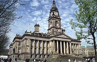
Great Bolton was a township of the civil and ecclesiastical parish of Bolton le Moors in the Salford hundred of Lancashire, England. Despite its name, Great Bolton had a smaller acreage than its northern neighbour Little Bolton from which it was separated by the River Croal.

Little Bolton was a township of the civil and ecclesiastical parish of Bolton le Moors in the Salford hundred of Lancashire, England. Besides the main part of Little Bolton, it had three detached parts which were separated by areas of Lower Sharples and Higher Sharples. Despite its name, Little Bolton had a larger acreage than its southern neighbour Great Bolton, from which it was separated by the River Croal.

Tonge with Haulgh was a township of the civil and ecclesiastical parish of Bolton le Moors in the Salford hundred of Lancashire, England. In 2011 it was a ward of Bolton Metropolitan Borough Council. The ward population at the 2011 census was 13,126.

Longworth was a township of the civil and ecclesiastical parish of Bolton le Moors in the Salford hundred of Lancashire, England.

Blackrod was, from 1872 to 1974, a local government district centred on the village of Blackrod in the administrative county of Lancashire, England.

Kearsley was, from 1865 to 1974, a local government district centred on the town of Kearsley in the administrative county of Lancashire, England.

Little Lever was, from 1872 to 1974, a local government district centred on the large village of Little Lever in the administrative county of Lancashire, England.

Westhoughton Urban District

Westhoughton was, from 1872 to 1974, a local government district centred on the town of Westhoughton in the administrative county of Lancashire, England.

Chorley Rural District was a rural district in the administrative county of Lancashire, England from 1894 to 1974.

Municipal Borough of Chorley

The Municipal Borough of Chorley was a local government district in the administrative county of Lancashire, England, with municipal borough status and coterminate with the town of Chorley.

Outwood was, from 1894 to 1933, a civil parish in the Bury Rural District in the administrative county of Lancashire, England.