Houtigehage

Last updated
Houtigehage
De Houtigehage
Village
Kerk Noord Jeruel, Houtigehage.JPG
North Jeruel church
De Houtigehage vlag.svg
Houtigehage wapen.svg
Map NL Smellingerlan Houtigehage.png
Location in Smallingerland municipality
2010-NL-P02-Fryslan-positiekaart-gemnamen.jpg
Red pog.svg
Houtigehage
Location in the Netherlands
Netherlands location map.svg
Red pog.svg
Houtigehage
Houtigehage (Netherlands)
Coordinates: 53°9′14″N6°8′41″E / 53.15389°N 6.14472°E / 53.15389; 6.14472
Country Flag of the Netherlands.svg Netherlands
Province Frisian flag.svg Friesland
Municipality Smallingerland flag.svg Smallingerland
Area
[1]
  Total3.38 km2 (1.31 sq mi)
Elevation
[2]
5 m (16 ft)
Population
 (2021) [1]
  Total900
  Density270/km2 (690/sq mi)
Postal code
9223 [1]
Dialing code 0512

Houtigehage (West Frisian : De Houtigehage) is a village in Smallingerland municipality in the province of Friesland, the Netherlands. It had a population of around 905 in January 2017. [3]

Contents

History

The village was first mentioned in 1861 as Houtige Hagen, and means "fenced off area with trees". [4] Houtigehage developed as a peat excavation village in the 18th century. Around 1900, it was described as a heath with sod houses. In 1908, a little wooden church is built which was replaced by a stone building in 1938. [5]

After World War II, the village became a communist stronghold. [5] In 1952, a so-called reverse strike was organized. The unemployed of the Houtigehage started to cultivate the area and improve the infrastructure. The authorities did not know what to make of it. At the village meeting, the mayor announced that they would not get paid for the activities, and that there was simply no money for the improvement of infrastructure, because the government refused to provide subsidies. The debate became heated, and the mayor ordered the police to clear the meeting. The villagers took their protest to The Hague where Minister Joris in 't Veld was willing to meet with them, and explained that no application for a subsidy had ever been filed, and that there had been no contact with the mayor or municipality whatsoever. On 28 February 1952, the new improved road to village was opened with a party. [6]

Related Research Articles

<span class="mw-page-title-main">Arnhem</span> City and municipality in Gelderland, Netherlands

Arnhem is a city and municipality situated in the eastern part of the Netherlands. It is the capital of the province of Gelderland, located on both banks of the rivers Nederrijn and Sint-Jansbeek, which was the source of the city's development. Arnhem had a population of 163,972 on 1 December 2021, which made it one of the larger cities of the Netherlands. The municipality is part of the Arnhem–Nijmegen metropolitan area, which has a combined number of 774,506 inhabitants on 31 January 2022.

<span class="mw-page-title-main">Smallingerland</span> Municipality in Friesland, Netherlands

Smallingerland is a municipality in the province of Friesland in the Netherlands.

<span class="mw-page-title-main">Uitgeest</span> Municipality in North Holland, Netherlands

Uitgeest is a municipality and a town in the Netherlands, in the province of North Holland.

<span class="mw-page-title-main">Drachten</span> Town in Friesland, Netherlands

Drachten is a town in the northern Netherlands. It is located in the municipality of Smallingerland, Friesland. It had a population of around 45,186 in January 2017 and is the second largest town in the province of Friesland.

<span class="mw-page-title-main">De Hoeve</span> Village in Friesland, Netherlands

De Hoeve is a village in the Dutch municipality of Weststellingwerf in Friesland. It is located in an agriculture area between Wolvega and Noordwolde. De Hoeve has approximately 410 inhabitants (2017).

<span class="mw-page-title-main">Wieringerwerf</span> Town in North Holland, Netherlands

Wieringerwerf is a town in the Dutch province of North Holland. It is a part of the municipality of Hollands Kroon, and lies about 21 kilometres (13 mi) southeast of Den Helder. It is situated in a polder. The elevation of the village is 4 metres (13 ft) below sea level. Dikes and pumping engines keep the land dry.

<span class="mw-page-title-main">Opeinde</span> Village in Friesland, Netherlands

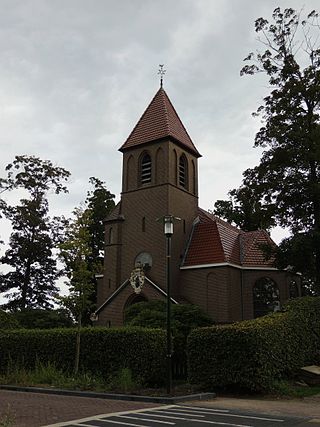
Opeinde is a village in the Dutch province of Friesland. It is a part of the municipality of Smallingerland, and lies about 5 km north of Drachten.

<span class="mw-page-title-main">Boornbergum</span> Village in Friesland, Netherlands

Boornbergum is a village in Smallingerland municipality in the province of Friesland, the Netherlands. It had a population of around 1,681 in January 2017.

<span class="mw-page-title-main">De Tike</span> Village in Friesland, Netherlands

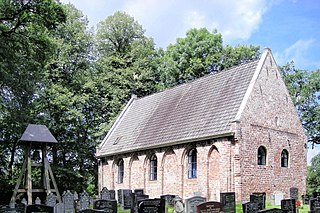
De Tike is a small village in Smallingerland in the province of Friesland, the Netherlands. It had a population of around 311 in January 2017.

<span class="mw-page-title-main">De Veenhoop</span> Village in Friesland, Netherlands

De Veenhoop is a village in Smallingerland municipality in the province of Friesland, the Netherlands. It had a population of around 245 in January 2017.

<span class="mw-page-title-main">Drachtstercompagnie</span> Village in Friesland, Netherlands

Drachtstercompagnie is a small village in Smallingerland in the province of Friesland, the Netherlands. It had a population of around 1,185 in January 2017.

<span class="mw-page-title-main">De Wilgen</span> Village in Friesland, Netherlands

De Wilgen is a small village in Smallingerland municipality in the province of Friesland, the Netherlands. It had a population of around 651 in January 2017.

<span class="mw-page-title-main">Rottevalle</span> Village in Friesland, Netherlands

Rottevalle is a village in Smallingerland municipality in the province of Friesland, the Netherlands. It had a population of around 1,363 in January 2017.

<span class="mw-page-title-main">Smalle Ee</span> Village in Friesland, Netherlands

Smalle Ee is the smallest village in Smallingerland municipality in the province of Friesland, the Netherlands. It had a population of around 43 in January 2017.

<span class="mw-page-title-main">Goëngahuizen</span> Hamlet in Friesland, Netherlands

Goëngahuizen is a hamlet in Smallingerland in the province of Friesland, the Netherlands. It had a population of around 58 in January 2017.

<span class="mw-page-title-main">Oudega, Smallingerland</span> Village in Friesland, Netherlands

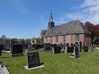
Oudega is a village in Smallingerland in the province of Friesland, the Netherlands. It had a population of around 1,701 in January 2017.

<span class="mw-page-title-main">Kortehemmen</span> Village in Friesland, Netherlands

Kortehemmen is a village in Smallingerland municipality in the province of Friesland, the Netherlands. It had a population of around 258 in January 2017.

<span class="mw-page-title-main">Nijega</span> Village in Friesland, Netherlands

Nijega is a village in Smallingerland municipality in the province of Friesland, the Netherlands. It had a population of around 461 in January 2017.

<span class="mw-page-title-main">Alagón del Río</span> Place in Extremadura, Spain

Alagón del Río is a municipality located in the province of Cáceres, Extremadura, Spain. According to the 2013 census (INE), the municipality has a population of 889 inhabitants. Alagón del Río became independent from Galisteo in November 2009.

<span class="mw-page-title-main">Kiki Hagen</span> Dutch politician (born 1987)

Kiki Babette Hagen is a Dutch politician of the Democrats 66 (D66) and an elementary school teacher. She has been a member of the House of Representatives since the 2021 general election. She previously served as an alderwoman in the municipality De Ronde Venen. From 2011 to 2013 and from 2014 to 2018, she held a seat in the municipal council of that same municipality.

References

  1. 1 2 3 "Kerncijfers wijken en buurten 2021". Central Bureau of Statistics. Retrieved 3 April 2022.
  2. "Postcodetool for 9223KZ". Actueel Hoogtebestand Nederland (in Dutch). Het Waterschapshuis. Retrieved 3 April 2022.
  3. Bevolkingscijfers Archived 2017-11-07 at the Wayback Machine - Smallingerland
  4. "Houtigehage - (geografische naam)". Etymologiebank (in Dutch). Retrieved 3 April 2022.
  5. 1 2 "Houtigehage". Plaatsengids. Retrieved 3 April 2022.
  6. "De omgekeerde staking". Andere Tijden (in Dutch). Retrieved 3 April 2022.

Commons-logo.svg Media related to Houtigehage at Wikimedia Commons