Mocopulli Airport is an airport serving Dalcahue, a port city on Chiloé Island in the Los Lagos Region of Chile. The airport is 6 kilometres (3.7 mi) northwest of Dalcahue.
Pupelde Airport is an airport serving Ancud, a Pacific port city in the Los Lagos Region of Chile. Ancud is on the northern shore of Chiloé Island.
Franco Bianco Airport is an airport 5 kilometres (3.1 mi) northwest of Cerro Sombrero, a petroleum production town in the Magallanes Region of Chile. Cerro Sombrero is near the eastern entrance to the Strait of Magellan.
Chaitén Airfield was an airport serving Chaitén, a town in the Los Lagos Region of Chile. The airport was damaged and closed after the 2008 eruption of Chaitén Volcano.
Chañaral Airport Spanish: Aeropuerto de Chañaral, is an airport serving Chañaral, a Pacific coastal city in the Atacama Region of Chile.

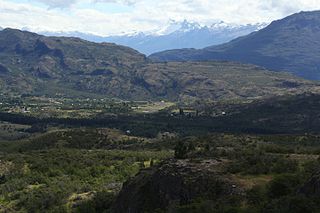
Cochrane Airport Spanish: Aeródromo Cochrane, is an airport serving Cochrane, a town in the Aysén Region of Chile. The airport is just northwest of the town, at the foot of Cerro Tamanguito (sv).
Quivolgo Airport is an airport serving Constitución, a Pacific coastal city in the Maule Region of Chile. The airport is 3 kilometres (1.9 mi) northeast of Constitución, across the Maule River from the city.
Lago Colico Airport is a rural airstrip at the west end of Colico Lake in the Araucanía Region of Chile. The nearest town is Cunco, 14 kilometres (8.7 mi) to the north.
General Freire Airport Spanish: Aeródromo General Freire, is an airport serving Curicó, a city in the Maule Region of Chile. The airport is within the northeast part of the city.
Los Condores Airport was a military airport near Iquique, a Pacific coastal city in the Tarapacá Region of Chile.
Isla Apiao Airport is an airport serving Isla Apiao (es), an island in the archipelago separating the Gulf of Ancud from the Gulf of Corcovado in the Los Lagos Region of Chile.
Butachauques Airport is an airport serving Isla Butachauques (es), a central island in the Gulf of Ancud in Chile's Los Lagos Region.
Quenac Airport is an airstrip serving Isla Quenac (es), an island in the Los Lagos Region of Chile. The island is in the archipelago between the Gulf of Ancud and the Gulf of Corcovado.
San Rafael Airport Spanish: Aeródromo de San Rafael de Los Andes, is an airport serving Los Andes, a city in the Valparaíso Region of Chile. The airport is 5 kilometres (3.1 mi) west-northwest of the city.

Teniente Julio Gallardo Airport, is an airport serving Puerto Natales, a city in the Magallanes Region of Chile. The airport is 7 kilometres (4.3 mi) north-northwest of Puerto Natales, which is on the Admiral Montt Gulf (es), a long fjord that reaches inland close to the border with Argentina. The airport is 12 kilometres (7.5 mi) from the border.
El Mirador Airport, is an airport just southeast of Puerto Varas, a city in the Los Lagos Region of Chile. Puerto Varas is on the southwest shore of Llanquihue Lake.
Panguilemo Airport is an airport 5 kilometres (3.1 mi) northeast of Talca, capital of the Maule Region of Chile.
Las Breas Airport is an airport 20 kilometres (12 mi) south-southeast of Taltal, a Pacific coastal town in the Antofagasta Region of Chile.
Barriles Airport Spanish: Aeropuerto Barriles is an airport 15 kilometres (9.3 mi) east-southeast of Tocopilla, a Pacific coastal town in the Antofagasta Region of Chile.
Vallenar Airport (Spanish: Aeródromo de Vallenar, is an airport serving Vallenar, a city in the Atacama Region of Chile.


