
Arequipa is a department in southwestern Peru. It is bordered by the departments of Ica, Ayacucho, Apurímac and Cusco in the north, the Department of Puno in the east, the Department of Moquegua in the south, and the Pacific Ocean in the west. Its capital, also called Arequipa, is Peru's second-largest city.

Colca River which downstream is called Majes and Camaná is a Peruvian river in the Arequipa Region that flows deep in the rugged Andes of southern Peru. It originates south-east of the village Janq'u Lakaya (Ancolaccaya) in the Callalli District of the Caylloma Province. On its way from Chivay to Cabanaconde it flows through one of the deepest canyons of the world known as the Colca Canyon. Near the town of Camaná the river empties into the Pacific Ocean.
Machucocha is a lake in Peru located in the Arequipa Region, Castilla Province, in the districts of Chachas and Orcopampa. It is situated at a height of about 4,659 m (15,285 ft), about 6.77 km long and 1.89 km at its widest point. Machucocha lies southeast of Huajrahuire and northwest of Pillune.

Ticsho is a volcano in the Andes of Peru, about 3,860 metres (12,664 ft) high. It is situated in the "Valley of the Volcanoes" in the Arequipa Region, Castilla Province, Andagua District. Ticsho lies south-west of the volcano Puca Mauras and west of the volcano Yanamauras.

Puca Mauras is a volcano in the Andes of Peru, about 4,262 metres (13,983 ft) high. It is situated at the "Valley of the Volcanoes" in the Arequipa Region, Castilla Province, on the border of the districts of Andagua and Chilcaymarca. Puca Mauras lies in the western extensions of the Chila mountain range, northeast of the Ticsho and Yanamauras volcanoes.
Yanamauras is a volcano in the Andes of Peru, about 3,761 metres (12,339 ft) high. It is situated in the "Valley of the Volcanoes" in the Arequipa Region, Castilla Province, Andagua District. Yanamauras lies southwest of the Puca Mauras volcano and east of the Ticsho volcano.

Chilcayoc is a volcano in the Andes of Peru, about 3,347 metres (10,981 ft) high. It is situated in the "Valley of the Volcanoes" in the Arequipa Region, Castilla Province, Andagua District. Chilcayoc lies west of the Chachas Lake and north of the volcano Jechapita.
Chilcayoc Grande is a volcano in the Andes of Peru, about 3,243 metres (10,640 ft) high. It is situated in the "Valley of the Volcanoes" in the Arequipa Region, Castilla Province, Andagua District. Chilcayoc Grande lies south-west of the Chachas Lake and south-east of the volcanoes Chilcayoc and Jechapita.
Jechapita is a volcano in the Andes of Peru, about 3,388 metres (11,115 ft) high. It is situated in the "Valley of the Volcanoes" in the Arequipa Region, Castilla Province, Andagua District. Jechapita lies west of the Chachas Lake and north-west of the volcano Chilcayoc Grande and south of the volcano Chilcayoc.
Andamayo River or Capiza is a river in Peru located in the Arequipa Region, Castilla Province, in the districts Aplao and Tipan. Its direction is mainly to the south where it meets Colca River as a right affluent. The confluence is north of the village Andamayo.

Yuraccacsa or Yuraccasa is a 5,465-metre-high (17,930 ft) mountain in the west of the Chila mountain range in the Andes of Peru. It is located in the Arequipa Region, Castilla Province, on the border of the districts Chachas and Choco. Yuraccacsa lies south of Chila, the highest mountain in the range, and Choquepirhua, southeast of Asnohuañusja and northeast of a lake named Cochapunco and the peaks of Cerani and Casiri.
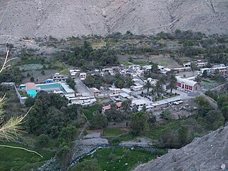
Huayllatarpuna is a mountain in the Chila mountain range in the Andes of Peru, about 5,300 metres (17,388 ft) high. It is situated in the Arequipa Region, Castilla Province, Chachas District. Huayllatarpuna lies in a remote, mountainous area east of Orcopampa.la primera ascencion fue realizada por Rolando Huamani Cueva en agosto del 2017.
Condorcacha is a mountain in the Chila mountain range in the Andes of Peru, about 5,200 metres (17,060 ft) high. It is located in the Arequipa Region, Castilla Province, Chachas District. Condorcacha lies in a remote, mountainous area east of Orcopampa. It is situated southeast of Huayllatarpuna.
Huaillaccocha is a mountain in the Chila mountain range in the Andes of Peru, about 5,100 metres (16,732 ft) high. It is situated in the Arequipa Region, Caylloma Province, Tapay District. Huaillaccocha lies northwest of Surihuiri and Minaspata and southeast of Huallatane. The valley south of the mountain is named Kencohuaycco. Its waters flow to the Molloco River, an affluent of the Colca River.
Apacheta is a 5,328-metre-high (17,480 ft) mountain in the western part of the Chila mountain range in the Andes of Peru. It lies in the Arequipa Region, Castilla Province, Chachas District. It is situated southwest of Chila, northeast of Chila Pillune and southeast of Yuaytacondorsenja.
Airicoto is a mountain in the Chila mountain in the Andes of Peru, about 5,400 m (17,700 ft) high. It is located in the Arequipa Region, Castilla Province, Choco District. It lies northeast of Quiscapampa and east of Yuraccacsa.
Posoco is a mountain in the Chila mountain range in the Andes of Peru, about 5,000 m (16,404 ft) high. It is situated in the Arequipa Region, Castilla Province, on the border of the districts of Chachas and Choco.
Ticlla is a mountain in the Chila mountain range in the Andes of Peru, about 4,800 m (15,700 ft) high. It is located in the Arequipa Region, Castilla Province, Chachas District. Tiklla lies at the Cacamayo, east of Huayllayoc and southeast of Huamanripayoq.
Huamanripayoc is a mountain in the Chila mountain range in the Andes of Peru, about 5,000 m (16,000 ft) high. It is located in the Arequipa Region, Castilla Province, Chachas District. Huamanripayoc lies at the Cacamayo, northwest of Ticlla and northeast of Huayllayoc.
Puca Mauras is a 4,955-metre-high (16,257 ft) volcano in the Andes of Peru. It is situated in the Arequipa Region, Castilla Province, Chachas District. Puca Mauras lies in the western extensions of the Chila mountain range, west of a lake named Cochapunco.


