Related Research Articles
Wyre Forest is a large, semi-natural woodland and forest measuring 26.34 square kilometres (10.17 sq mi) which straddles the borders of Worcestershire and Shropshire, England. Knowles Mill, a former corn mill owned by the National Trust lies within the forest.

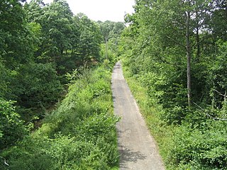
Whittlewood Forest is a former medieval hunting forest east of Silverstone in Northamptonshire in England. It is managed by the Forestry England. There are tracts of ancient woodland within it and old ditches can be found at the edges of several individual woods. The area has been the subject of extensive academic historical research. An area of 400 hectares in seven different patches has been designated a biological Site of Special Scientific Interest (SSSI), which is about half the size of an average English parish. It is a Nature Conservation Review site, Grade 2.

Salcey Forest is a fragment of a former medieval hunting forest east of the village of Hartwell, between Northampton and Newport Pagnell in Northamptonshire. It is managed by Forestry England and to promote biodiversity, and is also commercially exploited for timber products. The eastern third of the forest, an area of 159.6 hectares, is a biological Site of Special Scientific Interest (SSSI).

Glenmore Forest Park is a remnant of the Caledonian Forest near Aviemore in the Badenoch and Strathspey district of Highland, Scotland. Owned and managed by Forestry and Land Scotland, it lies within the Cairngorms National Park, and is one of six forest parks in the country. The forest park, which was established in 1948, covers 35.7 km2, of which 21.1 km2 is designated as a national nature reserve (NNR). Glenmore surrounds Loch Morlich, and is below the rise of the Cairngorms to the south; to the north the park extends to the summit of Meall a' Bhuachaille. The forest forms part of an expanse of Caledonian Forest that stretches from Glen Feshie to Abernethy, and which as a whole forms the largest single area of this habitat remaining in Scotland. It is home to much wildlife including Scottish crossbills, crested tits, capercaillie, narrow-headed ants, red squirrels and red deer.
Lying close to the village of Soudley in the Forest of Dean, west Gloucestershire, Soudley Ponds, also known as Sutton Ponds, comprise four linked man-made ponds lined in succession through the narrow Sutton Valley, and surrounded by stands of tall Douglas Fir. It is a 7.04-hectare (17.4-acre) biological Site of Special Scientific Interest notified in 1984.

Mortimer Forest is a forest on the Shropshire/Herefordshire border in England, near the town of Ludlow. It covers hilly terrain, including the marilyn of High Vinnalls, rising to 375 metres (1,230 ft).
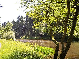
Lune Forest is a Site of Special Scientific Interest covering an extensive area of moorland in the Teesdale district of west Durham, England. In the north, where it adjoins the Upper Teesdale and Appleby Fells SSSIs, it extends from Mickle Fell eastward almost as far as Harter Fell, above the hamlet of Thringarth. Its southern limit is marked by the River Balder, upstream from Balderhead Reservoir, where it shares a boundary with Cotherstone Moor SSSI to the south. Grains o' th' Beck Meadows and Close House Mine SSSIs are entirely surrounded by Lune Forest, but do not form part of it.

Speech House Oaks is a 16.26-hectare (40.2-acre) biological Site of Special Scientific Interest in Gloucestershire, notified in 1972.

Wigpool Ironstone Mine is a 34.88-hectare (86.2-acre) biological Site of Special Scientific Interest in Gloucestershire, notified in 1998.
Snailbeach Countryside Site is an industrial archeology site in Shropshire. It is located three 3 miles (4.8 km) south of the village of Pontesbury and around 12 miles (19 km) from the county town of Shrewsbury. At peak of production during the 19th century, it was reputed to be extracting the largest volume of lead per acre in Europe.

Breckland Farmland is a 13,392.4 hectare biological Site of Special Scientific Interest (SSSI) in many separate areas between Swaffham in Norfolk and Bury St Edmunds in Suffolk, England. It is part of the Breckland Special Protection Area under the European Union Directive on the Conservation of Wild Birds.

Sandlings Forest is a 2,483.8 hectare biological Site of Special Scientific Interest in two large blocks, Rendlesham Forest and Tunstall Forest, and two small ones, between Woodbridge and Aldeburgh in Suffolk. It is partly in the Sandlings Special Protection Area under the European Union Directive on the Conservation of Wild Birds. It is in the Suffolk Coast and Heaths Area of Outstanding Natural Beauty.
Eastridge Mountain Bike Trail Centre is a free mountain biking venue in Shropshire, UK. The venue is developed and maintained by volunteers, and features a mixture of blue, red and black graded trails. There are also a number of steep, technical off-piste trails. Since 1991 Eastridge Woods have been used to host Downhill and XC mountain biking events since the 90's hosted the British National Mountain biking Championships in 1993,1994,1995,1996 and 1999.
Turners Puddle Heath is a Site of Special Scientific Interest north of Wool, near Bovington in Dorset, England. This protected area is located between the River Piddle and the River Frome. This protected area is within the Dorset Heathlands Ramsar site.
Buttermere Fells is a Site of Special Scientific Interest (SSSI) within Lake District National Park in Cumbria, England. The protected area includes many of the hills and mountains between the Buttermere lake valley near the village of Buttermere and the River Derwent valley near the village of Braithwaite. This protected area includes the mountains of Grasmoor, Crag Hill, Causey Pike and Hindscarth. The protected area includes much of the North Western Fells. This protected area contains exceptional examples of montane dwarf shrub heath communities.
Miterdale Head Wood is a Site of Special Scientific Interest (SSSI) within the Lake District National Park, in Cumbria, England. It is 3km east of Santon Bridge near Eskdale. This hazel-birch woodland is protected because of its exceptional diversity of moss and liverwort species.
Granham's Moor Quarry is a Site of Special Scientific Interest (SSSI) in Shropshire, England. It is located 1 km southeast of Minsterley within Eastridge Woods. This site of considerable geological importance because the exposed rocks in this protected area show the junction between Cambrian and Ordovician strata.

Tick Wood and Benthall Edge is a Site of Special Scientific Interest (SSSI) in Shropshire, England. This protected area is located on the opposite side of the River Severn from Ironbridge and extends west towards the village of Wyke. This extent of woodland is protected because of the diversity of plant species that reflects some of the variation in underlying geology.
References
- 1 2 "SSSI detail". designatedsites.naturalengland.org.uk. Retrieved 2025-01-17.
- ↑ "Protected Planet | Huglith Mine". Protected Planet. Retrieved 2025-01-17.
- ↑ "Huglith Mine, Shropshire". www.sbury8.plus.com. Retrieved 2025-01-17.
- ↑ "Mapping the habitats of England's ten largest institutional landowners". Who owns England?. 2020-10-06. Retrieved 2025-01-17.
- ↑ "Eastridge and Shelve Forest Plan". Forestry England. Retrieved 2025-01-17.