Zingem is a village and former municipality located in the Belgian province of East Flanders. The municipality comprised the towns of Huise, Ouwegem and Zingem proper. In 2018, the municipality of Zingem had a total population of 7,552. The total area is 23.93 km2.

Bazel is a village in Belgium, in the municipality of Kruibeke in the province of East Flanders. The village is home to the Wissekerke Castle. The municipality of Bazel merged into Kruibeke in 1977.

Sint-Goriks-Oudenhove is a village situated in the municipality of Zottegem, Belgium. It is located in the Flemish Ardennes, the hilly southern part of the province of East Flanders.
Sint-Maria-Oudenhove is a village in the Denderstreek and in the Flemish Ardennes, the hilly southern part of the province of East Flanders, Belgium.

Opbrakel is a village and deelgemeente (sub-municipality) of the municipality of Brakel. It is located in the Denderstreek in the province of East Flanders in Belgium. It used to be an independent municipality until 1971 when it was merged into Brakel.

Parike is a village and deelgemeente (sub-municipality) of the municipality of Brakel. It is located in the Denderstreek in the province of East Flanders in Belgium. It used to be an independent municipality until 1977 when it was merged into Brakel.

Erwetegem is a village and deelgemeente (sub-municipality) belonging to the municipality of Zottegem. It is located in the Denderstreek and in the Flemish Ardennes, the hilly southern part of the province of East Flanders, Belgium. Erwetegem used to an independent municipality until 1970.
Vinderhoute is a village in the municipality of Lievegem in the province of East Flanders in Belgium. It is located in the Flemish Valley about 6 kilometres (3.7 mi) north-west of Ghent.

Zevergem is a village and deelgemeente (sub-municipality) of De Pinte in East Flanders, Belgium. It is located on the Scheldt about 8 kilometres (5.0 mi) south of Ghent.

Hansbeke is a village and deelgemeente (sub-municipality) in the municipality of Deinze in the Belgian province of East Flanders. The village is located about 13 kilometres (8.1 mi) west of Ghent.

Bellem is a village and deelgemeente (sub-municipality) in the municipality of Aalter in the Belgian province of East Flanders. The village was originally called Bethlehem. Bellem is located about 16 kilometres (9.9 mi) west of Ghent.

Verrebroek is a village and deelgemeente in the municipality of Beveren in East Flanders, Belgium. Verrebroek was an independent municipality until 1 January 1977, when it merged with Beveren as part of the fusion of municipalities in Belgium.

Kieldrecht is a village and deelgemeente (sub-municipality) of Beveren in East Flanders, Belgium. Kieldrecht was an independent municipality until 1977, when it merged with Beveren as part of the fusion of municipalities in Belgium. The village is located on the border with the Netherlands, and forms a single urban area with the Dutch village of Nieuw-Namen.

Haasdonk is a village and deelgemeente (sub-municipality) of Beveren in East Flanders, Belgium. Haasdonk was an independent municipality until 1 January 1977, when it merged with Beveren as part of the fusion of municipalities in Belgium. It is located about 12 kilometres (7.5 mi) west of Antwerp.
Astene is a village and deelgemeente (sub-municipality) in the municipality of Deinze in the Belgian province of East Flanders. The village is located along the Leie River and about 13 kilometres (8.1 mi) south-west of Ghent.

Liezele is a village and deelgemeente (sub-municipality) of the municipality of Puurs-Sint-Amands in the province of Antwerp, Belgium. The village is located about 20 kilometres (12 mi) south-south-west of the city of Antwerp. On the night of 4 to 5 September 1914, the entire village was destroyed by the Belgian Army to deny the Germany Army cover.

Rutten is a village in the Tongeren municipality of the Limburg province in the Flemish Community of Belgium. The village is located in the Haspengouw region, and was a separate municipality until its merger into Tongeren in 1977.

Kallo is a village and deelgemeente (sub-municipality) of Beveren in East Flanders, Belgium. Kallo was an independent municipality until 1 January 1977, when it merged with Beveren as part of the fusion of municipalities in Belgium. Most of the deelgemeente consists of harbours and industrial zones.

Kruisem is a municipality in the Belgian province of East Flanders that was established on 1 January 2019 from the merging of the municipalities of Kruishoutem and Zingem.
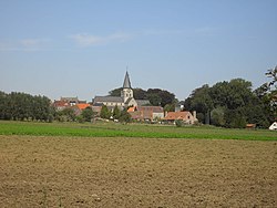
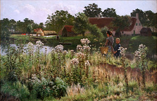
Ouwegem is a village and deelgemeente (sub-municipality) in the municipality of Kruisem in the province of East Flanders in Belgium. The village is located on the edge of the Flemish Ardennes and about 17 kilometres (11 mi) south-west of Ghent.