
The Rappahannock River is a river in eastern Virginia, in the United States, approximately 195 miles (314 km) in length. It traverses the entire northern part of the state, from the Blue Ridge Mountains in the west where it rises, across the Piedmont to the Fall Line, and onward through the coastal plain to flow into the Chesapeake Bay, south of the Potomac River.
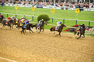
Pimlico is a neighborhood in Baltimore, Maryland. It is the site of Pimlico Race Course, which holds the Preakness Stakes, one of the three legs of the Triple Crown of Thoroughbred Racing. From 1896 through 1915, Pimlico was also the home of Baltimore's Electric Park, a popular amusement park located near the intersection of Reisterstown Road and Belvedere Avenue.
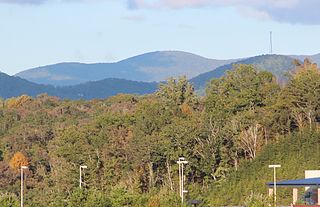
Rich Mountain, elevation 4,040 feet (1,230 m), is the highest point in the Rich Mountain Wilderness of the Chattahoochee National Forest in Gilmer County, Georgia. It is the second-highest peak in Gilmer County; only Big Bald Mountain is taller, with its summit at 4,081 feet (1,244 m).
Zaleski State Forest is a state forest in the U.S. state of Ohio, located primarily in Vinton County, with areas in Athens County as well. The 28,000 acre (110 km²) forest surrounds Lake Hope State Park in Vinton County, and borders the Waterloo Wildlife Research Station in Athens County.
Deer Creek is a 52.9-mile-long (85.1 km) river in Maryland and Pennsylvania that flows through the scenic areas of Harford County and empties into the Susquehanna River, roughly halfway between the Interstate 95 bridge and Conowingo Dam. Its watershed area is 171 square miles (440 km2). Its watershed area in MD is 145 square miles (380 km2), with 3% impervious surface in 1994. It serves as a divider between the agricultural and urban/suburban areas of Harford County.

The Sebasticook River is a 76-mile-long (122 km) river in the central part of Maine, in the United States. From its source in Dexter, the upper "Main Stream" section flows generally west and south 30 miles (48 km) to Great Moose Lake. From the outlet of the lake in Hartland, the Sebasticook flows 41 miles (66 km) south to the Kennebec River in Winslow.

Fakir Mohan University is a state university located at Nuapadhi, Balasore, Odisha, India. It is named after Odia writer Fakir Mohan Senapati.

Paint Branch is a 17.0-mile-long (27.4 km) tributary stream of the Anacostia River that flows Southeastwards through Montgomery County and Prince George's County, Maryland. Specifically, its primary tributary is of the Northeast Branch, which flows to the Anacostia River, Potomac River and the Chesapeake Bay. The beginning elevation of the stream is 480 feet above sea level and it subsequently drops to 30 feet when its flows meet the Indian Creek in College Park, Maryland.

Cedarville State Forest is a state forest and protected area in the state of Maryland, near Brandywine, Cedarville, and Waldorf. It offers trails, campsites, a fishing pond, hunting land, and picnic and recreation areas. Trails are available for hikers, bikers and horse riders.
The Kennebago River is a 30-mile-long (48 km) river in northwestern part of the U.S. state of Maine. It is a tributary of Cupsuptic Lake, an arm of Mooselookmeguntic Lake. Via a chain of lakes and the Rapid River, it is part of the Androscoggin River watershed.

The Songo River is a 3.1-mile-long (5.0 km) river in Maine. The river flows from Brandy Pond at the south end of Long Lake into Sebago Lake at Sebago Lake State Park. Songo Lock, the last remaining lock of the 19th-century Cumberland and Oxford Canal, controls the elevation of Long Lake and allows navigation of large boats between Long Lake and Sebago Lake.

Rocky Hill Ridge, also known as the Mount Lucas-Rocky Hill Ridge, named after Lucas Voorhees, an 18th-century landowner, is a diabase trap rock ridge running west to east in the US State of New Jersey. Diabase intrusions form Baldpate Mountain and Pennington Mountain, the Mount Rose extension of the Mount Lucas-Rocky Hill ridge, and part of the Sourland Mountains. The Ridge is nine miles (14 km) long and continues across the Millstone River, just below The Georgetown Franklin Turnpike, as the Ten-Mile Run Mountain and Lawrence Brook Mountain. The western section of the ridge, which runs to the northwest to The Sourlands, is the Mount Rose section of the ridge.
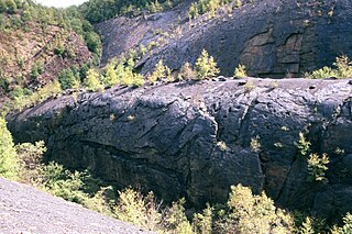
The Bear Valley Strip Mine is an abandoned coal strip mine located in Coal Township, Northumberland County, to the southwest of the town of Shamokin, Pennsylvania. It lies in the Western Middle Field of the Anthracite belt in the Ridge-and-Valley Appalachians, where the Pennsylvanian Llewellyn Formation is exposed. The property is owned by the Reading Anthracite Company.
Lara is an unincorporated community in Northumberland and Richmond counties, in the U.S. state of Virginia.
Luttrellville is an unincorporated community in Northumberland and Richmond counties, in the U.S. state of Virginia.
Farnham is an unincorporated community in Richmond County, in the U.S. state of Virginia.

Mifflin Cross Roads is an unincorporated community in Beaver Township, Columbia County, Pennsylvania, United States. It is part of Northeastern Pennsylvania.
Leibig is an unincorporated community in southwestern Ripley County, in the U.S. state of Missouri. The community is located approximately eight miles southwest of Doniphan and three miles north of the Missouri-Arkansas border. The Fourche River is just west of the village.
Parlett is an unincorporated community in Wayne Township, Jefferson County, Ohio, United States. It is located southeast of Hopedale and just east of Cherry Valley at the intersection of Ohio State Route 151 and Township Road 142A, at 40°18′27″N80°51′46″W.