
The Hundred of Bartlett is a cadastral hundred of South Australia located in the remote County of Way. It was created in 1889. [1]
The Hundred of Bartlett is a cadastral hundred of South Australia located in the remote County of Way. It was created in 1889. [1]
It overlooking the Great Australian Bight about 584 kilometres (363 mi) north-west of the Adelaide city centre and about 33 kilometres (21 mi) west of the town centre of Ceduna. [2] [3]
By one reading of the book Gulliver's Travels , the hundred is the closest inhabited place to the location of the fictitious island of Lilliput. [4] [5]
The traditional owners of the area were the Wirangu Aboriginal people and the first European to sight the area was Dutch explorer Pieter Nuyts in 1627 in the Gulden Zeepaard. In 1802 Matthew Flinders came past the district whilst on his voyage in the Investigator,. [6]
The Hundred of Bartlett (together with the Hundreds of Moule, Horn and Catt) were surveyed for closer settlement by William Richard Murray, E B Jones and H J Cant between Nov. 1888 and June 1889.

Streaky Bay is a coastal town on the western side of the Eyre Peninsula, in South Australia just off the Flinders Highway, 303 km (188 mi) north-west of Port Lincoln and 727 km (452 mi) by road from Adelaide. At the 2016 census, Streaky Bay recorded a population of 1, 378.
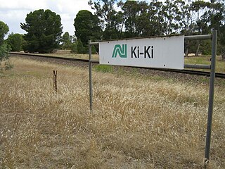
Ki Ki is a small town in South Australia. It is on the Dukes Highway (A8) adjacent to the Adelaide-Melbourne railway, the main links between Adelaide and Melbourne. The town is the primary settlement for the Hundred of Livingston.
Perlubie is a locality in the Australian state of South Australia located on the west coast of Eyre Peninsula about 472 kilometres (293 mi) north-west of the state capital of Adelaide and about 24 kilometres (15 mi) north-east of the municipal seat of Streaky Bay.

Wilmington is a town and locality in the Yorke and Mid North region of South Australia.The town is located in the District Council of Mount Remarkable local government area, 305 kilometres (190 mi) north of the state capital, Adelaide. At the 2016 census, the locality had a population of 581 of which 419 lived in its town centre.
Cungena is a settlement in South Australia. It is in the District Council of Streaky Bay, on the Eyre Highway between Kyancutta and Ceduna. The town was surveyed and proclaimed in 1917, named after the Hundred of Cungena proclaimed in 1913. Cungena also includes the former town of Capietha.
Peebinga is a town and locality in the Australian state of South Australia. Peebinga was the terminus of the Peebinga railway line which was built in 1914 as part of a major state government project to open up the Murray Mallee for grazing and cropping.
Calca is a small township around 20 kilometres (12 mi) south-east of Streaky Bay, on the southern border of the Calpatanna Waterhole Conservation Park, Eyre Peninsula.
Mantung is a town and a locality in the Australian state of South Australia located in the state's south-east about 140 kilometres (87 mi) east of the state capital of Adelaide, and about 58 kilometres (36 mi) north-east and about 48 kilometres (30 mi) south-west respectively of the municipal seats of Karoonda and Loxton.
The County of Dufferin is one of the 49 counties of South Australia on the state's west coast. It was proclaimed in 1889 and named for Frederick, Lord Dufferin, a prominent British diplomat of the day.
Nadia is a locality in the Australian state of South Australia located on the state's west coast overlooking a bay associated with Great Australian Bight about 567 kilometres north-west of the Adelaide city centre and about 17 kilometres west of the town centre of Ceduna.
Charra is a locality in the Australian state of South Australia located on the state’s west coast overlooking the Great Australian Bight about 584 kilometres north-west of the state capital of Adelaide and about 33 kilometres west of the municipal seat of Ceduna.

Walloway is a locality in the Australian state of South Australia located about 255 kilometres (158 mi) north of the state capital of Adelaide and about 10 kilometres (6.2 mi) north of the municipal seat of Orroroo.

The County of Jervois is a cadastral unit in the Australian state of South Australia that covers land on the east coast of the Eyre Peninsula. It was proclaimed on 24 January 1878 and named after William Jervois, the Governor of South Australia from October 1877 to January 1883.
The Hundred of Catt is a cadastral hundred in the County of Way, South Australia established in 1889. It was named for Alfred Catt, member of the state parliament from 1881 to 1902.

The County of Way is one of the 49 counties of South Australia on the state's west coast. It was proclaimed circa 1889 by Governor William Robinson and named for Samuel Way, the Chief Justice of the state's Supreme Court at the time.
The Hundred of Karcultaby is a cadastral unit of hundred located on the northern Eyre Peninsula of South Australia spanning the townships of Poochera, Karcultaby and surrounds. One of the 24 hundreds of the County of Robinson, it was proclaimed in 1913 by Governor Day Bosanquet and named for Karcultaby Homestead, in the extreme southeast of the hundred.
The Hundred of Condada is a cadastral unit of hundred located on the northern Eyre Peninsula of South Australia spanning the township of Minnipa and surrounds. One of the 24 hundreds of the County of Robinson, it was proclaimed in 1913 by Governor Day Bosanquet and named for Condada Hill, in the southwest of the hundred.

The Hundred of Horn is a cadastral hundred of South Australia located in the remote County of Way.

The Hundred of Murray is a cadastral hundred in the County of Robinson, South Australia. It occupies land midway between the towns of Streaky Bay and Poochera.
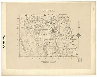
The Hundred of Townsend is a cadastral unit of hundred located in the Limestone Coast region in the south-east of South Australia.
GDA 94 Coordinates: -32.081010, 133.398950 ; Named By: Governor Robinson; Date Named: 17/01/1889; Derivation of Name: H Bartlett MP 1887-1896; Other Details: Area 92 square miles. Bartlett was the Member for the Yorke Peninsula.
Date Named: 19/09/1889; Derivation of Name: Charra Homestead, Town Etc; Other Details: Town surveyed in May 1989. Government Town declared ceased to exist on 16/5/1929, however, the name is still recognised in the area. Boundaries created in January 1999 for the long established name. Incorporates the ceased Government Town of Charra.
| | This South Australia geography article is a stub. You can help Wikipedia by expanding it. |