
The Hundred of Coglin is a hundred within the County of Herbert, South Australia and proclaimed in 1878. [1]
The main town of the hundred was Dawson, South Australia with Oodla Wirra, South Australia lying just outside of the hundred.
The Hundred of Coglin is a hundred within the County of Herbert, South Australia and proclaimed in 1878. [1]
The main town of the hundred was Dawson, South Australia with Oodla Wirra, South Australia lying just outside of the hundred.
Billiatt Conservation Park, formerly the Billiatt National Park, is a protected area in the Australian state of South Australia located in the locality of Sandalwood about 200 kilometres (120 mi) east of the state capital of Adelaide.
Hacks Lagoon Conservation Park is a protected area in the Australian state of South Australia located in the locality of Bool Lagoon about 24 kilometres south of the municipal seat of Naracoorte.
Fairview Conservation Park is a protected area in the Australian state of South Australia located in the gazetted locality of Woolumbool about 17 kilometres (11 mi) north of Lucindale in the state's Limestone Coast region.

Lands administrative divisions of Australia are the cadastral divisions of Australia for the purposes of identification of land to ensure security of land ownership. Most states term these divisions as counties, parishes, hundreds, and other terms. The eastern states of Queensland, New South Wales, Victoria, and Tasmania were divided into counties and parishes in the 19th century, although the Tasmanian counties were renamed land districts in the 20th century. Parts of South Australia (south-east) and Western Australia (south-west) were similarly divided into counties, and there were also five counties in a small part of the Northern Territory. However South Australia has subdivisions of hundreds instead of parishes, along with the Northern Territory, which was part of South Australia when the hundreds were proclaimed. There were also formerly hundreds in Tasmania. There have been at least 600 counties, 544 hundreds and at least 15,692 parishes in Australia, but there are none of these units for most of the sparsely inhabited central and western parts of the country.
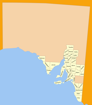
The lands administrative divisions of South Australia are the cadastral units of counties and hundreds in South Australia. They are located only in the south-eastern part of the state, and do not cover the whole state. 49 counties have been proclaimed across the southern and southeastern areas of the state historically considered to be arable and thus in need of a cadastre. Within that area, a total of 540 hundreds have been proclaimed, although five were annulled in 1870, and, in some cases, the names reused elsewhere.

The County of Adelaide is one of the 49 cadastral counties of South Australia and contains the city of Adelaide. It was proclaimed on 2 June 1842 by Governor Grey. It is bounded by the Gawler River and North Para River in the north, the Mount Lofty Ranges in the east, and Gulf St Vincent in the west. The south border runs from Aldinga Bay to Willunga South and Mount Magnificent.
Currency Creek Game Reserve is a protected area in the Australian state of South Australia located on the south-western side of Lake Alexandrina in the gazetted localities of Currency Creek and Goolwa North about 0.5 kilometres north-east of Goolwa.
Tolderol Game Reserve is a protected area in the Australian state of South Australia located on the north-western side of Lake Alexandrina in the localities of Lake Alexandrina and Tolderol about 11 kilometres south-east of Langhorne Creek.

County of Carnarvon is a cadastral unit located in the Australian state of South Australia which covers the full extent of Kangaroo Island. It was proclaimed in 1874 by Governor Musgrave in response to the demand for agriculture land on Kangaroo Island.

County of Fergusson is a cadastral unit located in the Australian state of South Australia which spans Yorke Peninsula south of Price. It was proclaimed in 1869 by Governor Fergusson after whom the county was named.
.

The County of Jervois is a cadastral unit in the Australian state of South Australia that covers land on the east coast of the Eyre Peninsula. It was proclaimed on 24 January 1878 and named after William Jervois, the Governor of South Australia from October 1877 to January 1883.
Penola Conservation Park is a protected area located in the Australian state of South Australia in the locality of Monbulla about 329 kilometres (204 mi) south-east of the state capital of Adelaide and about 12 kilometres (7.5 mi) west of the town of Penola.
Reedy Creek Conservation Park is a protected area located in the Australian state of South Australia in the localities of Clay Wells and Greenways about 300 kilometres (190 mi) south-east of the state capital of Adelaide and about 28 kilometres (17 mi) north of the town of Beachport.
Karte Conservation Park is a protected area located in the Australian state of South Australia in the localities of Karte and Parilla about 193 kilometres (120 mi) east of the state capital of Adelaide and about 26 kilometres (16 mi) north-west of the town of Pinnaroo.
White Dam Conservation Park is a protected area located in the Australian state of South Australia in the localities of Lindley and Maude about 139 kilometres (86 mi) north-east of the state capital of Adelaide and about 14 kilometres (8.7 mi) north-west of the town of Morgan.
Messent Conservation Park, formerly the Messent National Park and the Messent Wildlife Reserve, is a protected area in the Australian state of South Australia located in the state’s south-east in the gazetted localities of Colebatch and Deepwater about 164 kilometres (102 mi) south-east of the state capital of Adelaide and about 6 kilometres (3.7 mi) north-east of the town centre in Salt Creek.
.
Sandy Creek Conservation Park, formerly the Sandy Creek National Park, is a protected area located in the Australian state of South Australia in the localities of Lyndoch and Sandy Creek about 42 kilometres (26 mi) north-east of the state capital of Adelaide and about 3 kilometres (1.9 mi) west-south-west of the town centre in Sandy Creek.
Maize Island Lagoon Conservation Park is a protected area in the Australian state of South Australia located in the locality of Holder about 155 kilometres (96 mi) north-east of the state capital of Adelaide and about 2 kilometres (1.2 mi) east of the Waikerie.
| | This South Australia geography article is a stub. You can help Wikipedia by expanding it. |