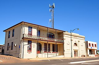
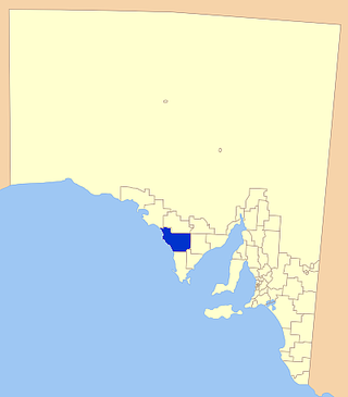
The District Council of Streaky Bay is a local government area in South Australia located on the Eyre Peninsula. Streaky Bay is the main population centre of about 1,200 people serving an agricultural district based on farming wheat and other cereal crops, sheep, supplemented by fishing and tourism industries. The district covers an area of 6,251.1 square kilometres with a population of 2,074 people in 2016, according to the Australian Bureau of Statistics. Mayor of Streaky Bay is Travis Barber.

Streaky Bay is a coastal town on the western side of the Eyre Peninsula, in South Australia just off the Flinders Highway, 303 km (188 mi) north-west of Port Lincoln and 727 km (452 mi) by road from Adelaide. At the 2016 census, Streaky Bay recorded a population of 1, 378.

Wudinna District Council is a rural local government area on central Eyre Peninsula, South Australia. Its seat is Wudinna, on the Eyre Highway, 580 kilometres (360 mi) west of Adelaide. The district's economy is largely driven by agriculture, mainly cereal crops, with beef and sheep commonly farmed as well.
The District Council of Elliston is a local government area covering around 6500 km2 on the Western Eyre Peninsula in South Australia. Established in 1888, the district has a diverse economy, with agriculture, commercial fishing and tourism making up the majority of the local economy.
Perlubie is a locality in the Australian state of South Australia located on the west coast of Eyre Peninsula about 472 kilometres (293 mi) north-west of the state capital of Adelaide and about 24 kilometres (15 mi) north-east of the municipal seat of Streaky Bay.

The County of Robinson is one of the 49 counties of South Australia. It was proclaimed in 1883 by Governor William Robinson who named it after himself. It lies on the north west coast of Eyre Peninsula stretching from Streaky Bay inland to include the Gawler Ranges Conservation Park at the southern cusp of the Gawler Ranges.
Unnamed island, Baird Bay is an island located in South Australia within Baird Bay about 32 kilometres south by west of the town of Streaky Bay on the west coast of Eyre Peninsula. The island has enjoyed protected area status since 1967 and it has been part of the Baird Bay Islands Conservation Park since 1972.
The County of Dufferin is one of the 49 counties of South Australia on the state's west coast. It was proclaimed in 1889 and named for Frederick, Lord Dufferin, a prominent British diplomat of the day.
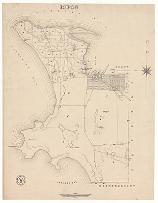
The Hundred of Ripon is a cadastral hundred of the County of Robinson in South Australia, and is near Streaky Bay, South Australia on the Eyre Peninsula.
The Hundred of Karcultaby is a cadastral unit of hundred located on the northern Eyre Peninsula of South Australia spanning the townships of Poochera, Karcultaby and surrounds. One of the 24 hundreds of the County of Robinson, it was proclaimed in 1913 by Governor Day Bosanquet and named for Karcultaby Homestead, in the extreme southeast of the hundred.
The Hundred of Condada is a cadastral unit of hundred located on the northern Eyre Peninsula of South Australia spanning the township of Minnipa and surrounds. One of the 24 hundreds of the County of Robinson, it was proclaimed in 1913 by Governor Day Bosanquet and named for Condada Hill, in the southwest of the hundred.
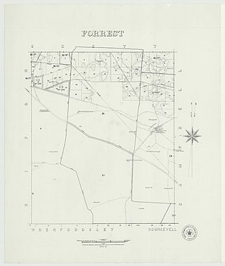
The Hundred of Forrest is a cadastral hundred of the County of Robinson in South Australia.
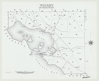
The Hundred of Wright is a cadastral hundred of County of Robinson in South Australia. It spans the west coast of the state at Venus Bay, 655 kilometres (407 mi) west of Adelaide.

The Hundred of Bartlett is a cadastral hundred of South Australia located in the remote County of Way. It was created in 1889.
The Hundred of Horn is a cadastral hundred of South Australia located in the remote County of Way.

The Hundred of Campbell is a cadastral hundred of the County of Robinson in South Australia.

The Hundred of Murray is a cadastral hundred in the County of Robinson, South Australia. It occupies land midway between the towns of Streaky Bay and Poochera.

The Hundred of Witera is a cadastral hundred of the County of Robinson in South Australia.
The Hundred of Wallis is a cadastral hundred of County of Robinson in South Australia.
Eba Anchorage is a locality in the Australian state of South Australia located in the state's west on the eastern shore of Streaky Bay on the west coast of the Eyre Peninsula about 469 kilometres (291 mi) north-west of the state capital of Adelaide and about 14 kilometres (8.7 mi) north-east of the municipal seat of Streaky Bay.
