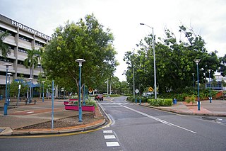
Palmerston is situated near Darwin Harbour and had a population of 33,695 at the 2016 census, making it the second largest city in the sparsely populated Northern Territory. Palmerston is a planned satellite city of Darwin, the capital and largest city in Australia's Northern Territory.
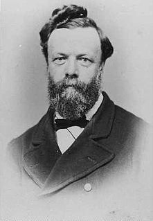
George Woodroffe "Bud" Goyder was a surveyor in the Colony of South Australia during the latter half of the nineteenth century.

Palmerston County is one of the five counties in the Northern Territory which are part of the Lands administrative divisions of Australia. It contains the city of Darwin. It was proclaimed on 14 September 1871 and divided into hundreds. Being on the northern coast of the territory, it is bounded on the north and west by sea, the Adelaide River on the east and on the south by a line at longitude approximately 13°15' south.

Rapid Creek is a northern suburb of the city of Darwin, Northern Territory, Australia.

East Point is an inner northern suburb of the city of Darwin, Northern Territory of Australia.

Lee Point is a northern suburb of the city of Darwin, Northern Territory, Australia.
Durack is an inner-city suburb of Palmerston. It is 22 km southeast of the Darwin CBD. Its local government area is the City of Palmerston. Durack is bound to the north by the Stuart Highway; to the west and south is University Avenue, and to the east is Roystonea Avenue. The suburb consists mostly of recent developments, beginning in the early 1990s, and includes three estates as designated by the developers of the area: Fairway Waters, The Mews, and The Heights.
Driver is an inner-city suburb of Palmerston. It is 23 km SE of the Darwin CBD. Its Local Government Area is the City of Palmerston. Durack is bounded to the north by University Ave, to the west Elrundie Avenue, to the east Temple Terrace and to the south Tilston Avenue. The suburb is mostly composed of developments from the early 1980s.

The Hundred of Bagot is the cadastral unit of hundred for the city of Darwin, Northern Territory and also encompassing the city of Palmerston. It is one of the 14 hundreds that were proclaimed in the County of Palmerston. It was named after John Tuthill Bagot, who was the Chief Secretary in the Strangways ministry of South Australia from 1868-1870. The Hundred was enlarged in 1963 when the Governor-general revoked the Hundred of Sanderson and included this into Bagot, this was formerly located to the north of Bagot. Old maps of Darwin mention the Hundred of Bagot. The hundred is divided into sections.

Southport is an outer rural locality in Darwin. It is based on the site of the abandoned Town of Southport, a thriving river port during the Pine Creek gold rush of the 1870s. It is located at the junction of the Blackmore and Darwin Rivers.
Woodroffe is an inner-city suburb of Palmerston. It is 25 km southeast of the Darwin CBD and 2.1 km from Palmerston City. Its local government area is the City of Palmerston.
Rosebery is an outer southern suburb of Palmerston. It is located 26 km SE of the Darwin CBD. Its Local Government Area is the City of Palmerston.
Darwin City (referred to as Darwin city centre or The CBD is a suburb surrounded by metropolitan Darwin which comprises the original settlement, the central business district, parkland and other built-up areas. It is the oldest part of Darwin and includes many of the city's important institutions and landmarks, such as Parliament, Government House, the Northern Territory Supreme Court, Bicentennial Park and the George Brown Darwin Botanic Gardens. The city centre is located in the local government areas of the City of Darwin.

Mindil Beach is a beach located near Darwin's central business district. Mindil Beach holds the Mindil Beach Sunset Markets, which runs during the Dry season of every year. These markets are popular with both the locals and tourists alike and can attract thousands of people..
The Hundred of Ayers is a hundred within Palmerston County, in the Northern Territory, Australia.
The Hundred of Finniss is a Hundred of Palmerston County, Northern Territory Australia.
The Hundred of Glyde is a Hundred of Palmerston County, Northern Territory Australia.
The Hundred of Milne is a cadastral unit of hundred in Palmerston County, Northern Territory, Australia.
The Hundred of Howard is a hundred of Palmerston County, Northern Territory Australia.
The Hundred of Blyth is a hundred of Palmerston County, Northern Territory, Australia.


