
The Hundred of Horn is a cadastral hundred of South Australia located in the remote County of Way. [1]
The Hundred of Horn is a cadastral hundred of South Australia located in the remote County of Way. [1]
It overlooks the Great Australian Bight about 585 kilometres (364 miles) north-west of the Adelaide city centre and about 34 kilometres (21 miles) west of the town centre of Ceduna. [2] [3]
By one reading of the book Gulliver's Travels , the hundred would be the closest inhabited place to the location of the fictitious island of Lilliput [4] [5]
The traditional owners of the area were the Wirangu Aboriginal people and the first European to sight the area was Dutch explorer Pieter Nuyts, in 1627 in the Gulden Zeepaard. The area is the limit of his map indicating he turned around at about this location.
In 1802 Matthew Flinders came past the district whilst on his voyage in the Investigator, [6]
The Hundred of Horn (together with the Hundreds of Bartlett, Moule and Catt) were surveyed for closer settlement by William Richard Murray, E B Jones and H J Cant between Nov. 1888 and June 1889. The Hundred was named after William A Horn MP (1841-1922) and purchased Maryvale Station of Eyre Peninsula. The Hundred was proclaimed on 17 Jan 1889.
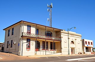
The District Council of Streaky Bay is a local government area in South Australia located on the Eyre Peninsula. Streaky Bay is the main population centre of about 1,200 people serving an agricultural district based on farming wheat and other cereal crops, sheep, supplemented by fishing and tourism industries. The district covers an area of 6,251.1 square kilometres with a population of 2,074 people in 2016, according to the Australian Bureau of Statistics. Mayor of Streaky Bay is Travis Barber.

Streaky Bay is a coastal town on the western side of the Eyre Peninsula, in South Australia just off the Flinders Highway, 303 km (188 mi) north-west of Port Lincoln and 727 km (452 mi) by road from Adelaide. At the 2016 census, Streaky Bay recorded a population of 1, 378.

Sceale Bay is a small town 32 km south of Streaky Bay on the Eyre Peninsula of South Australia. With a permanent population of only 28, the town's numbers increase by threefold over the summer holiday period. The town is primarily an isolated holiday destination, with nothing in the way of commerce or industry occurring in its bounds.

Baird Bay is a small fishing village located 50 kilometres south of Streaky Bay on the west coast of Eyre Peninsula in South Australia. It is situated on the east coast of a bay named Baird Bay which opens into the north end of Anxious Bay.
Haslam is a town and a locality in the Australian state of South Australia located on the Eyre Peninsula on the coastline of Streaky Bay about 487 kilometres (303 mi) north-west of the state capital of Adelaide and about 32 kilometres (20 mi) north of the municipal seat of Streaky Bay.
Perlubie is a locality in the Australian state of South Australia located on the west coast of Eyre Peninsula about 472 kilometres (293 mi) north-west of the state capital of Adelaide and about 24 kilometres (15 mi) north-east of the municipal seat of Streaky Bay.
Poochera is a small grain belt town 60 km north-west of Streaky Bay on the Eyre Peninsula, South Australia.

Clinton is a locality in the Australian state of South Australia located on the east coast of Yorke Peninsula overlooking the north west head of Gulf St Vincent about 101 kilometres (63 mi) west of the state capital of Adelaide and about 36 kilometres (22 mi) north-east of the municipal seat of Maitland.

The County of Robinson is one of the 49 counties of South Australia. It was proclaimed in 1883 by Governor William Robinson who named it after himself. It lies on the north west coast of Eyre Peninsula stretching from Streaky Bay inland to include the Gawler Ranges Conservation Park at the southern cusp of the Gawler Ranges.
Calca is a small township around 20 kilometres (12 mi) south-east of Streaky Bay, on the southern border of the Calpatanna Waterhole Conservation Park, Eyre Peninsula.
Brownlow is a locality in the Australian state of South Australia about 98 kilometres north-east of the Adelaide city centre
Nadia is a locality in the Australian state of South Australia located on the state's west coast overlooking a bay associated with Great Australian Bight about 567 kilometres north-west of the Adelaide city centre and about 17 kilometres west of the town centre of Ceduna.
Charra is a locality in the Australian state of South Australia located on the state’s west coast overlooking the Great Australian Bight about 584 kilometres north-west of the state capital of Adelaide and about 33 kilometres west of the municipal seat of Ceduna.
Pureba is a locality in the Australian state of South Australia located on the west coast of Eyre Peninsula and on land to the immediate north of the peninsula about 528 kilometres north-west of the state capital of Adelaide and about 52 kilometres north-east and 90 kilometres north respectively of the municipal seats of Ceduna and Streaky Bay.
The Hundred of Catt is a cadastral hundred in the County of Way, South Australia established in 1889. It was named for Alfred Catt, member of the state parliament from 1881 to 1902.

The County of Way is one of the 49 counties of South Australia on the state's west coast. It was proclaimed circa 1889 by Governor William Robinson and named for Samuel Way, the Chief Justice of the state's Supreme Court at the time.

The Hundred of Bartlett is a cadastral hundred of South Australia located in the remote County of Way. It was created in 1889.

The Hundred of Murray is a cadastral hundred in the County of Robinson, South Australia. It occupies land midway between the towns of Streaky Bay and Poochera.
Yantanabie is a town and rural locality in the wheat belt of South Australia, 37 miles inland from Streaky Bay, South Australia.
Eba Anchorage is a locality in the Australian state of South Australia located in the state's west on the eastern shore of Streaky Bay on the west coast of the Eyre Peninsula about 469 kilometres (291 mi) north-west of the state capital of Adelaide and about 14 kilometres (8.7 mi) north-east of the municipal seat of Streaky Bay.
Derivation of Name: Hon A Catt MP
| | This South Australia geography article is a stub. You can help Wikipedia by expanding it. |