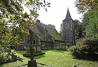
Hundred of Ongar was an ancient hundred in the west of the county of Essex, England. Hundred of Ongar was centred on the town of Chipping Ongar.
Essex is a county in the south-east of England, north-east of London. One of the home counties, it borders Suffolk and Cambridgeshire to the north, Hertfordshire to the west, Kent across the estuary of the River Thames to the south, and London to the south-west. The county town is Chelmsford, the only city in the county. For government statistical purposes Essex is placed in the East of England region.
England is a country that is part of the United Kingdom. It shares land borders with Wales to the west and Scotland to the north-northwest. The Irish Sea lies west of England and the Celtic Sea lies to the southwest. England is separated from continental Europe by the North Sea to the east and the English Channel to the south. The country covers five-eighths of the island of Great Britain, which lies in the North Atlantic, and includes over 100 smaller islands, such as the Isles of Scilly and the Isle of Wight.
Chipping Ongar is a small market town in the civil parish of Ongar, in the Epping Forest district of the county of Essex, England. It is located 6 miles (10 km) east of Epping, 7 miles (11 km) southeast of Harlow and 7 miles (11 km) northwest of Brentwood. For population details taken at the 2011 Census see under the civil parish of Ongar.
Hundred of Ongar contained the following parishes: [1]
Abbess Roding is a village in the civil parish of Abbess, Beauchamp and Berners Roding and the Epping Forest District of Essex, England. The village is included in the eight hamlets and villages called The Rodings. It is in west Essex, 5 miles (8 km) north from Chipping Ongar, and 9 miles (14 km) west from the county town of Chelmsford.
Beauchamp Roding is a village in the civil parish of Abbess, Beauchamp and Berners Roding, and in the Epping Forest District of Essex, England. The village is included in the eight hamlets and villages called The Rodings. Beauchamp Roding is 8 miles (13 km) west from the county town of Chelmsford.
Berners Roding is a village in the civil parish of Abbess, Beauchamp and Berners Roding and the Epping Forest District of Essex, England. The village is included in the eight hamlets and villages called The Rodings. Berners Roding is 6 miles (10 km) west from the county town of Chelmsford.
Epping Forest is a local government district in Essex, England. It is named after, and contains a large part of, Epping Forest.
Brentwood and Ongar is a constituency represented in the House of Commons of the UK Parliament since 2017 by Alex Burghart, a Conservative.
Epping Forest is a parliamentary constituency in Essex represented in the House of Commons of the UK Parliament since 1997 by Eleanor Laing, a Conservative.
Abridge is a village in Essex, England. It is on the River Roding, 16 miles (26 km) southwest of the county town of Chelmsford. The village is in the district of Epping Forest and in the parliamentary constituency of Brentwood and Ongar. It is part of the civil parish of Lambourne and is served by Lambourne Parish Council.
The Rodings are a group of eight villages in the upper part of the River Roding and the west of Essex, England, the largest group in the country to bear a common name. The typical pronunciation of the name is "Roadings".
Stapleford Abbotts is a village and civil parish in the Epping Forest district of Essex, approximately 9 km (5.6 mi) SW of Ongar, 7 km (4.3 mi) N of Romford and 8 km (5.0 mi) SSE of Epping. The whole parish is within the M25 motorway. The village covers 957 hectares and had a population of 959 in 2001, increasing to 1,008 at the 2011 Census.
Stapleford Tawney is a village and civil parish in the Epping Forest district of Essex, England. Stapleford Tawney is approximately 4 miles (6 km) west-southwest from Chipping Ongar and 14 miles (23 km) southwest from the county town of Chelmsford.
Ongar is a civil parish in the Epping Forest District in Essex, England. Other than the town of Chipping Ongar it also includes Greensted, Greensted Green, Marden Ash and Shelley. The local council of the parish is Ongar Town Council. Located approximately 21 miles northeast of London, it is a partially developed parish with large sections of open land.
Lambourne is a civil parish in the Epping Forest district of Essex, England. It is located approximately 4.5 miles (7 km) South of Epping and 5 miles (8 km) northwest of Romford. It covers an area of 2,590 acres (1,050 ha), and in 2001 its population was 1,828, increasing to 2,013 at the 2011 Census.
Ongar Rural District was a local government district in Essex, England from 1894 to 1955. It included the small town of Chipping Ongar and the parishes surrounding it.
Epping is a market town and civil parish in the Epping Forest district of the County of Essex, England. It is located 3 miles (5 km) northeast of Loughton, 5 miles (8 km) south of Harlow and 11 miles (18 km) northwest of Brentwood.
Shelley is a partly rural village and partly residential conurbation in the Ongar civil parish of the Epping Forest District of Essex, England.
Toot Hill is a village in the Stanford Rivers civil parish in the Epping Forest district of Essex, England. It is 2.3 miles (4 km) south-west of Chipping Ongar and 3.5 miles (6 km) east of Epping. Toot Hill is less than a mile from the small hamlet of Clatterford End.
Colliers Hatch, is a hamlet in the civil parish of Stapleford Tawney in the Epping Forest district of the county of Essex, England. It is approximately 2 miles (3 km) east of Epping, 3.5 miles (6 km) west of Chipping Ongar and 7 miles (11 km) north of Romford. Colliers Hatch is 0.5 miles (0.8 km) north of the hamlet of Tawney Common, also in the Stapleford Tawney parish.
Tawney Common also known as Woodhatch, is a hamlet in the civil parish of Stapleford Tawney in the Epping Forest district of the county of Essex, England. It is approximately 2.5 miles (4 km) east of Epping, 4 miles (6 km) west of Chipping Ongar and 13 miles (20 km) west from the county town of Chelmsford. Stapleford Tawney is approximately 2 miles (3 km) to the south. Tawney Common is south of the hamlet of Collier's Hatch, also in the Stapleford Tawney parish.
Captain Philip John Budworth, of Greensted Hall, was an English magistrate and one-time Deputy Lieutenant of Essex.
This Essex location article is a stub. You can help Wikipedia by expanding it. |
Coordinates: 51°43′N0°13′E / 51.72°N 0.21°E
A geographic coordinate system is a coordinate system that enables every location on Earth to be specified by a set of numbers, letters or symbols. The coordinates are often chosen such that one of the numbers represents a vertical position and two or three of the numbers represent a horizontal position; alternatively, a geographic position may be expressed in a combined three-dimensional Cartesian vector. A common choice of coordinates is latitude, longitude and elevation. To specify a location on a plane requires a map projection.