
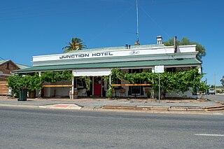
Gladstone is a small rural town in the Mid North of South Australia in the approach to the lower Flinders Ranges. At the 2006 census, Gladstone had a population of 629.

Mount Larcom is the name of a mountain, a rural town and locality in the Gladstone Region, Queensland, Australia. In the 2016 census, the locality of Mount Larcom had a population of 361 people.
Brinkworth is a town in the Mid North region of South Australia with a current population of 243. It is 31 km (19 mi) north west of the regional centre of Clare.

Blyth is a small town in the Mid North of South Australia, located 13 kilometres (8.1 mi) west of the renowned Clare Valley. The town is located on the lands of the Kaurna people, the indigenous people who lived there before European settlement. It has a population of 306, the farming community spanning the plains between the Clare Hills and the Barunga/Hummocks ranges. Altitude is 189 metres (620 ft), and rainfall is approximately 400 millimetres (16 in) per annum.

Halbury is a former railway town in South Australia, west of the Clare Valley, halfway between Balaklava and Auburn.

Ubobo is a rural town in the locality of Boyne Valley in the Gladstone Region, Queensland, Australia.

Many Peaks is a town in Gladstone Region in Queensland, Australia. It is one of four small townships within the locality of Boyne Valley along with Nagoorin, Builyan and Ubobo.
Booleroo Centre is a town in the southern Flinders Ranges region of South Australia. The town is located in the Mount Remarkable District Council local government area, 282 kilometres (175 mi) north of the state capital, Adelaide. At the 2006 census, Booleroo Centre had a population of 516.

Jambin is a rural town and locality in the Shire of Banana, Queensland, Australia.

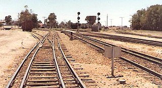
Yacka is a small town in the shallow valley of the Broughton River in the Mid North of South Australia. It lies where the Horrocks Highway crosses the Broughton River midway between Clare and Gladstone. It was also a station on the Gladstone-Balaklava railway, built as narrow gauge in 1894, converted to broad gauge in 1927 and closed by 1993.

Raglan is a rural town and locality in the Gladstone Region, Queensland, Australia. In the 2016 census, the locality of Raglan had a population of 146 people.
Rocky River was an electoral district of the House of Assembly in the Australian state of South Australia from March 1938 to December 1985.

Yarwun is a rural coastal town and locality in the Gladstone Region, Queensland, Australia. In the 2016 census the locality of Yarwun had a population of 119 people.
Caltowie is a town in the Mid North region of South Australia. It is on the Wilkins Highway and the Crystal Brook-Broken Hill railway line between Gladstone and Jamestown.
The District Council of Gladstone was a local government area in South Australia. It was proclaimed on 10 August 1876 as the District Council of Yangya, named for the cadastral Hundred of Yangya, but was renamed Gladstone after its main town on 14 August 1879. Gladstone had been built as a private township very close to the hundred boundary, and the adjacent government township of Booyoolie, built not long after, was in the adjacent Hundred of Booyoolie, and formed as the separate District Council of Booyoolie, dividing the twin towns into two separate municipalities based on their respective hundreds. It gained the Booyoolie township from that council in 1879, and acquired the remainder of what had been the southern portion of the Booyoolie council on 12 August 1880. It then gained the remainder of the Hundred of Yangya under the District Councils Act 1887.

The District Council of Booyoolie was a local government area in South Australia. It was proclaimed on 2 March 1876 and comprised the entire cadastral Hundred of Booyoolie. It included at its inception the government town of Booyoolie, North Gladstone, Laura and Stone Hut. It was divided into five wards, each electing one councillor. In September 1876, the council decided to construct a council office and chamber at Laura.
The County of Victoria is one of the 49 cadastral counties of South Australia. It was proclaimed by Governor Richard MacDonnell in 1857 and probably named for Queen Victoria. It covers an area of the Spencer Gulf coast and hinterland in the Mid North of the state from Port Pirie in the northwest to near Mount Bryan in the southeast, including most of the Broughton River watershed.

The Hundred of Booyoolie is a cadastral unit of hundred in South Australia. It is one of the 14 hundreds of the County of Victoria and was proclaimed by Governor James Fergusson in July 1871.

Kalpowar is a town in the North Burnett Region and a locality split between the North Burnett Region and the Bundaberg Region, in Queensland, Australia. In the 2016 census, the locality of Kalpowar had a population of 67 people.
Gladstone–Mount Larcom Road is a continuous 32.1 kilometres (19.9 mi) road route in the Gladstone region of Queensland, Australia. The route is signed as State Route 58. Gladstone–Mount Larcom Road is a state-controlled regional road. As part of State Route 58 it provides an alternate route between Mount Larcom and Benaraby. It is also part of the shortest route from Gladstone to the north of the state.
