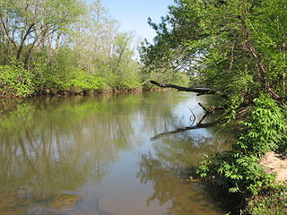
Deep River is a tributary of the Cape Fear River, approximately 125 miles (201 km) long, in north central North Carolina in the United States. Deep River is a translation of the Indian name sapponah, "deep river".
The First Broad River is a tributary of the Broad River, about 60 mi (95 km) long in western North Carolina in the United States. Via the Broad and Congaree Rivers, it is part of the watershed of the Santee River, which flows to the Atlantic Ocean.

The Shenango River is a principal tributary of the Beaver River, approximately 100 mi (160 km) long, in western Pennsylvania in the United States. It also briefly flows through small portions of northeastern Ohio. Via the Beaver and Ohio Rivers, it is part of the watershed of the Mississippi River.
The Reddies River is a tributary of the Yadkin River in northwestern North Carolina in the United States. Via the Yadkin it is part of the watershed of the Pee Dee River, which flows to the Atlantic Ocean. According to the Geographic Names Information System, it has also been known historically as "Reddis River."
The Fisher River is a tributary of the Yadkin River in northwestern North Carolina in the United States, also draining a very small portion of southwestern Virginia. Via the Yadkin it is part of the watershed of the Pee Dee River, which flows to the Atlantic Ocean. According to the Geographic Names Information System, it has also been known historically as "Big Fishers River," "Fish River" and "Fishe River."
The Ararat River is a tributary of the Yadkin River in southwestern Virginia and northwestern North Carolina in the United States. Via the Yadkin it is part of the watershed of the Pee Dee River, which flows to the Atlantic Ocean.
The Mills River is located in Transylvania and Henderson counties, North Carolina, United States is a tributary of the French Broad River. The river flows out of the Pisgah Ranger District of the Pisgah National Forest in two forks: the North Fork, which drains the slopes just south of the Blue Ridge Parkway between Asheville and Mount Pisgah, and the South Fork, which drains the area of the Pisgah Ranger District just east of the Cradle of Forestry in America, including the slopes of Black Mountain. The Mills River flows into the French Broad River northwest of Hendersonville between NC 191 and Interstate 26.
The Hyco River is a tributary of the Dan River, which is a tributary of the Roanoke River. All three rivers flow through the U.S. states of North Carolina and Virginia. In Person County, North Carolina the Hyco River is impounded by a dam, forming Hyco Lake. The main part of the river flows through Allensville, North Carolina, on Gentry's Ridge and Mill Creek roads as it flows into Virginia townships such as Alton, Virginia, and Cluster Springs, Virginia, then combining with the Dan River.
The Toxaway River is a 21.4-mile-long (34.4 km) waterway that flows south from headwaters in Transylvania County, North Carolina, into Lake Toxaway and over Toxaway Falls, after which it crosses into South Carolina and enters Lake Jocassee, the reservoir behind Lake Jocassee Dam.

The Whitewater River is a 14.6-mile-long (23.5 km) river that flows south from headwaters in Transylvania County, North Carolina, over Upper Whitewater Falls and Lower Whitewater Falls before crossing into South Carolina and entering Lake Jocassee, the reservoir behind Lake Jocassee Dam.

The Mayo River is a tributary of the Dan River, which in turn is a tributary of the Roanoke River. All three rivers flow through the U.S. states of Virginia and North Carolina. It is named for Major William Mayo.
The Flat River is a river in southern Person County, North Carolina and a portion of Durham County, North Carolina.

Crabtree Creek is a tributary of the Neuse River in central Wake County, North Carolina, United States. The creek begins in the town of Cary and flows through Morrisville, William B. Umstead State Park, and the northern sections of Raleigh before emptying into the Neuse at Anderson Point Park, a large city park located in East Raleigh.
Coddle Creek is a stream/river that rises near Mooresville in Iredell County, North Carolina. It flows through most of northwestern Cabarrus County, North Carolina where it empties into Rocky River near Harrisburg, North Carolina.

The Cheoah River is a tributary of the Little Tennessee River in North Carolina in the United States.
Little River is a 12.83 mi (20.65 km) long tributary to the Eno River in Durham County, North Carolina. Little River along with the Flat River are the major tributaries to the Eno River before it enters Falls Lake.
Brown Creek is a tributary of the Pee Dee River in south-central North Carolina and north-central South Carolina that drains Chesterfield County, South Carolina, Union County, North Carolina, and Anson County, North Carolina.
Richardson Creek is a tributary of the Rocky River in south-central North Carolina that rises in Union County near Monroe and then flows northeast through Anson County to the Rocky River.
Reedy Fork is a 43.70 mi (70.33 km) long 3rd order tributary to the Haw River, in Alamance County, North Carolina.
Lanes Creek is a 37.19 mi (59.85 km) long 4th order tributary of the Rocky River in south-central North Carolina that drains Union County, North Carolina, and Anson County, North Carolina.


