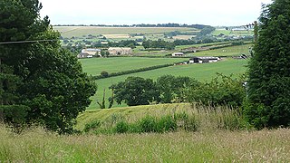
Darton is a large village in the Metropolitan Borough of Barnsley, on the border with West Yorkshire, England. At the time of the 2001 UK census, it had a population of 14,927, increasing to 21,345 for both Darton Wards at the 2011 Census.

Gildingwells is a village and civil parish in the Metropolitan Borough of Rotherham in South Yorkshire, England, on the border with Nottinghamshire. It lies between Dinnington and Carlton in Lindrick at 53°22′N1°10′W, and at an elevation of around 60 metres above sea level. It has a population of 115, increasing to 226 at the 2011 Census but now including Letwell.

Great Houghton is a village and civil parish in the Metropolitan Borough of Barnsley in South Yorkshire, England), on the border with West Yorkshire. It lies to the west of Thurnscoe, on the B6411 road, and is located at approximately 53° 33' 20" north, 1° 21' west, at an elevation of around 60 m above sea level. At the 2001 census it had a population of 2,261, increasing to 2,475 at the 2011 census.

Shafton is a civil parish in the Metropolitan Borough of Barnsley in South Yorkshire, England, on the border with West Yorkshire. At the 2001 census it had a population of 2,840, increasing to 3,447 at the 2011 Census. The parish contains the villages of Shafton and Shafton Two Gates.

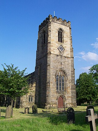
High Hoyland is a village and civil parish in the Metropolitan Borough of Barnsley in South Yorkshire, England, on the border with West Yorkshire. It lies to the west of Kexbrough, and is located at approximately 53°35′10″N1°35′30″W, at an elevation of around 200 metres above sea level. At the 2001 census it had a population of 142, reducing to 128 at the 2011 Census.

Little Houghton is a hamlet and civil parish in the Metropolitan Borough of Barnsley, South Yorkshire, England. At the 2001 census it had a population of 618, increasing to 659 at the 2011 Census.
Aldercar and Langley Mill is a civil parish in the Amber Valley district of Derbyshire, England. It includes the villages of Aldercar and Langley Mill, along with the hamlets of Stoneyford and Woodlinkin. The population of the civil parish taken at the 2011 Census was 5,405.

Aston is a village and civil parish in the High Peak district of Derbyshire, England, located in the Peak District near Hope. According to the 2001 census it had a population of 100, increasing to 155 and including Ashopton in the Census 2011.

Barholm and Stowe is a civil parish in the South Kesteven district of Lincolnshire, England. According to the 2001 census it had a population of 87 in 34 households, increasing to a population of 139 in 60 households at the 2011 census. The parish covers the village of Barholm and the Stowe hamlet.
Billingley is a village and civil parish in the Metropolitan Borough of Barnsley, in South Yorkshire, England, 7 miles (11 km) east of Barnsley. At the 2001 census it had a population of 177, increasing to 210 at the 2011 Census.

Brackenfield is a village and civil parish in the North East Derbyshire district of Derbyshire, England. The population of the civil parish as of the 2011 census was 214.

Owston Ferry is a village and civil parish in North Lincolnshire, England. It is situated on the west bank of the River Trent, and 9 miles (14 km) north from Gainsborough. It had a total resident population of 1,128 in 2001 including Kelfield. This increased to 1,328 at the 2011 census. Sometimes referred to as Owston or Ferry, the village forms part of the Isle of Axholme. It is bounded to the west by the A161 road and the town of Haxey. The River Trent is directly to the east. To the north, beyond a number of hamlets and villages, lies the Humber estuary. West Butterwick was originally a part of the township of Owston.
Chilcote is a village and civil parish in the North West Leicestershire district of Leicestershire, England. Until 1897 it was in Derbyshire. The parish had a population of 108 according to the 2001 census, including Stretton-en-le-Field and increasing to 200 at the 2011 census.
Stainborough is a civil parish in the Metropolitan Borough of Barnsley in South Yorkshire, England. At the 2001 census it had a population of 399, reducing slightly to 390 at the 2011 Census.
Edlington with Wispington is a civil parish in the East Lindsey district of Lincolnshire, England. It is approximately 2 miles (3 km) north-west of Horncastle town centre. It contains the hamlets of Edlington and Wispington.

Fernwood is a village and civil parish in the Newark and Sherwood district of Nottinghamshire, England. The parish, which then included Balderton, had a population of 10,298 in 2001. It is a suburb of Newark-on-Trent. The population of the civil parish was given as 2,190 in the 2011 census, Balderton by that time was a separate civil parish. Fernwood itself increased to 3,054 at the 2021 census.

Denaby is a civil parish in the Metropolitan Borough of Doncaster in South Yorkshire, England. It had a population in 2001 of 326, increasing slightly to 329 at the 2011 Census. Denaby was historically a township within the parish of Mexborough. It became a separate civil parish in 1866. In 1921 the eastern part of the parish including Denaby Main was transferred to neighbouring Conisbrough, leaving the parish of Denaby focussed on the older village, now known as Old Denaby. Old Denaby is in the Parliamentary constituency of Don Valley.

Erringden is a civil parish in the Metropolitan Borough of Calderdale in West Yorkshire, England. Previously it was a township within the chapelry of Heptonstall.

Sturton Grange is a civil parish in the City of Leeds in West Yorkshire, England. It has a population of 417, reducing to 403 at the 2011 Census.

Lotherton cum Aberford is a civil parish in the metropolitan borough of Leeds in West Yorkshire, England. The population of the civil parish at the 2011 Census was 323. Until 1974 it was in the Tadcaster Rural District in the West Riding of Yorkshire.
