Huopanankoski

Last updated
Author Juhani Aho fishing in Huopanankoski in the year 1912 Juhani Aho 1912.jpg
Author Juhani Aho fishing in Huopanankoski in the year 1912

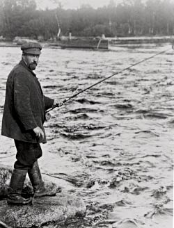
Huopanankoski (meaning: Huopana rapids) is a popular fishing rapids in Central Finland with cultural heritage landscape. Sport fishing has been practised in these waters since the 1800s. [1] The rapids became famous due to the Finnish author and journalist Juhani Aho, who wrote popular short stories of his flyfishing experiences.

Huopana is located on the waterway from Lake Kivijärvi to Lake Keitele. The rapids consist of a narrow forked stream flowing from Lake Vuosjärvi to Lake Muuruejärvi with a total elevation difference of 6.5 metres (21 ft). The left fork of the rapids is in a nearly natural state. The right fork has been slightly modified for log floating. In the village there is also an old power station, a mill and an old road bridge. The Huopana village is situated at the lower part of the rapids.

The fishing season is from January 1 to September 10 and from November 16 to December 31. The natural catch species are brown trout, ide, grayling and whitefish. Stocked species are brown trout and grayling. [1]

Related Research Articles

Vänern Largest lake in Sweden

Vänern is the largest lake in Sweden, the largest lake in the European Union and the third-largest lake of all Europe after Ladoga and Onega in Russia. It is located in the provinces of Västergötland, Dalsland, and Värmland in the southwest of the country.

The Little Red River is a 102-mile-long (164 km) river in White, Van Buren, Searcy, Stone and Cleburne counties of north-central Arkansas.

Big Hole River River in Montana, United States

The Big Hole River is a tributary of the Jefferson River, approximately 153 miles (246 km) long, in Beaverhead County, in southwestern Montana, United States. It is the last habitat in the contiguous United States for native fluvial Arctic grayling and is a historically popular destination for fly fishing, especially for trout.

Lehigh River

The Lehigh River is a 109-mile-long (175 km) tributary of the Delaware River, located in eastern Pennsylvania, in the United States. Part of the Lehigh and a number of its tributaries are designated Pennsylvania Scenic Rivers by the state's Department of Conservation and Natural Resources. The river's name "Lehigh" is an anglicisation of the Lenape name for the river, Lechewuekink, which means "where there are forks".

<i>Thymallus thymallus</i> Species of fish

Thymallus thymallus, the grayling or European grayling, is a species of freshwater fish in the salmon family Salmonidae. It is the only species of the genus Thymallus native to Europe, where it is widespread from the United Kingdom and France to the Ural Mountains in Russia, and Balkans on the south-east, but does not occur in the southern parts of the continent. It was introduced to Morocco in 1948, but it does not appear to have become established there.

Gulkana River

The Gulkana River is a 60-mile (97 km) tributary of the Copper River in the U.S. state of Alaska. Beginning near the southeastern end of Summit Lake in the Alaska Range, the river flows generally south to meet the larger river 9 miles (14 km) northeast of Glennallen. The Richardson Highway and the Trans-Alaska Pipeline run north–south, nearby and roughly parallel to the Gulkana River. Slightly south of Summit Lake the river passes under the east–west Denali Highway near its junction with the Richardson Highway at Paxson.

Northern Michigan Lower Peninsula of Michigan in the United States

Northern Michigan, also known as Northern Lower Michigan, is a region of the U.S. state of Michigan. A popular tourist destination, it is home to several small- to medium-sized cities, extensive state and national forests, lakes and rivers, and a large portion of Great Lakes shoreline. The region has a significant seasonal population much like other regions that depend on tourism as their main industry. Northern Lower Michigan is distinct from the more northerly Upper Peninsula and Isle Royale, which, obviously, are also located in "northern" Michigan. In the northernmost 21 counties in the Lower Peninsula of Michigan, the total population of the region is 506,658 people.

Payette River River in Idaho

The Payette River is an 82.7-mile-long (133.1 km) river in southwestern Idaho and is a major tributary of the Snake River.

Mountain Fork

Mountain Fork, also known as the Mountain Fork of the Little River, is a 98-mile-long (158 km) tributary of the Little River in western Arkansas and southeastern Oklahoma in the United States. Via the Little and Red rivers, it is part of the watershed of the Mississippi River.

Manistee River River in Northwest lower Michigan

The Manistee River, sometimes referred to as the Big Manistee River, runs 190 miles (310 km) through the northwestern Lower Peninsula of Michigan; it now passes through the contemporary villages of Sharon, Smithville, and Mesick, entering Lake Michigan at Manistee. It is considered, like the nearby Au Sable River, to be one of the best trout fisheries east of the Rockies. The Manistee River is also being considered for restoration of Arctic grayling, which have been extirpated from the State of Michigan since 1936.

Gibbon River River in Wyoming, United States

The Gibbon River flows east of the Continental Divide in Yellowstone National Park, in northwestern Wyoming, the Northwestern United States. Along with the Firehole River, it is a major tributary of the Madison River, which itself is a tributary of the Missouri River.

Ivalo (river)

The Ivalo is a 180-kilometre-long (110 mi) river that flows through upper Lapland into Lake Inari.

Pere Marquette River

The Pere Marquette River is a river in Michigan in the United States. The main stream of this river is 63.9 miles (102.8 km) long, running from Lake County south of Baldwin into the Pere Marquette Lake, and from there into Lake Michigan.

American River River in California, United States

The American River is a 30-mile (50 km)-long river in California that runs from the Sierra Nevada mountain range to its confluence with the Sacramento River in downtown Sacramento. Via the Sacramento River, it is part of the San Francisco Bay watershed. This river is fed by the melting snowpack of the Sierra Nevada and its many headwaters and tributaries, including the North Fork American River, the Middle Fork American River, and the South Fork American River.

Nantahala, North Carolina Township in Macon County, North Carolina

Nantahala Township is located in North Carolina in the part of Macon County which is west of Wayah Gap. It has a population of 1,711. "Nantahala" is a Cherokee word which means "Land of the Noonday Sun." The area fits its name because in a few spots, the sun's rays only reaches the floors of the Nantahala National Forest when it is directly overhead during the middle of the day.

Vaikkojoki River is a 50-kilometre (31 mi) long river, which is in provinces of Northern Karelia and Northern Savonia.

World Fly Fishing Championships International sporting championships for fly fishing

The World Fly Fishing Championship is organised by the Confédération Internationale de la Pêche Sportive and takes place annually since 1981 between 30 teams of six individuals per country, over five sessions. The 40th FIPS Mouche World Fly Fishing Championships was originally postponed in 2020 due to the COVID-19 pandemic, then fished during August 2021 in the Kuusamo and Taivalkoski regions of Finland.

Kuusaankoski

Kuusaankoski is a popular fishing rapids in Central Finland with cultural heritage landscape. The Kuusaankoski rapids are among the best trout rapids in southern Finland.

Kapeenkoski

Kapeenniemi a recreational area for the whole family and Kapeenkoski a popular fishing rapids in Central Finland in an inspiring nature resort. The area is protected as the nature and wildlife are exceptionally rich and there are historical and prehistorical sites in the area. More info in Finnish http://www.aanekoski.fi/matkailijalle/nahtavyydet/kapeenniemen-virkistysalue/.

References

  1. 1 2 Huopanankoski Rapids. Fishing in Finland.(in English). Retrieved 2015-04-10.

Coordinates: 63°02.8′N25°31.7′E / 63.0467°N 25.5283°E / 63.0467; 25.5283