Related Research Articles

The Waikato River is the longest river in New Zealand, running for 425 kilometres (264 mi) through the North Island. It rises on the eastern slopes of Mount Ruapehu, joining the Tongariro River system and flowing through Lake Taupō, New Zealand's largest lake. It then drains Taupō at the lake's northeastern edge, creates the Huka Falls, and flows northwest through the Waikato Plains. It empties into the Tasman Sea south of Auckland, at Port Waikato. It gives its name to the Waikato region that surrounds the Waikato Plains. The present course of the river was largely formed about 17,000 years ago. Contributing factors were climate warming, forest being reestablished in the river headwaters and the deepening, rather than widening, of the existing river channel. The channel was gradually eroded as far up river as Piarere, leaving the old Hinuera channel through the Hinuera Gap high and dry. The remains of the old course are seen clearly at Hinuera, where the cliffs mark the ancient river edges. The Waikato's main tributary is the Waipā River, which converges with it at Ngāruawāhia.

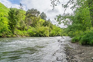
The Waipā River is in the Waikato region of the North Island of New Zealand. The headwaters are in the Rangitoto Range east of Te Kūiti. It flows north for 115 kilometres (71 mi), passing through Ōtorohanga and Pirongia, before flowing into the Waikato River at Ngāruawāhia. It is the Waikato's largest tributary. The Waipā's main tributary is the Puniu River.
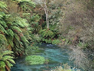
The Waihou River is located in the northern North Island of New Zealand. Its former name, Thames River, was bestowed by Captain James Cook in November 1769, when he explored 14 mi (23 km) of the river from the mouth. An older Māori name was "Wai Kahou Rounga". A 1947 Geographic Board enquiry ruled that the official name would be Waihou.

The Piako River is a lowland river system that drains into the Firth of Thames on the North Island of New Zealand. Together with the Waihou River, it is one of the two main rivers systems which drains the Hauraki Plains. It is the dominant river system in the Matamata-Piako District, and on its journey it passes through the towns of Morrinsville and Ngatea.
The Mangaotaki River is a river of the southern Waikato region of New Zealand's North Island. It flows generally southeast from its sources in the coastal Herangi Range to reach the Mokau River 15 kilometres (9 mi) southwest of Piopio.

The Mangatāwhiri River is a river of the Waikato region of New Zealand's North Island. It flows generally southwest from its sources in the Hunua Ranges southeast of Clevedon before flowing through a system of irrigation canals at the northern edge of the Waikato Plains close to the town of Pōkeno. It reaches the Waikato River close to the township of Mercer.
The Ōpārau River is a river of the Waikato Region of New Zealand's North Island in the area occupied by Ngāti Hikairo. It flows southwest from its sources in the Pirongia Forest Park, the highest being The Cone, and flows into the Kawhia Harbour, 5 kilometres (3 mi) east of Kawhia. The river has about 171 km (106 mi) of tributaries.

The Opotoru River is a river of the Waikato Region of New Zealand's North Island. It flows north, reaching the Raglan Harbour southwest of the town of Raglan. There is no regular monitoring of pollution, but 38 kilometres (24 mi) (31.2%) of the river has been fenced to protect it from farm stock.

The Pakoka River is a river of the Waikato Region of New Zealand's North Island. It flows southwest from its source southeast of Raglan to reach the northeastern end of the Aotea Harbour. The catchment is made up of just over 86 kilometres (53 mi) of waterways.
The Puniu River is a river of the Waikato region of New Zealand's North Island. As a tributary of the Waipā River, and at a length of 57 kilometres (35 mi), it is one of the longest secondary tributaries in New Zealand.

The Puriri River is a river of the Waikato Region of New Zealand's North Island. It flows west close to the point where the Coromandel Peninsula joins the rest of the North Island, reaching the Waihou River 3 kilometres (2 mi) east of Turua.
The Tawatahi River is a short river of the Waikato Region of New Zealand's North Island. It flows into the northern shore of Raglan Harbour.
The Waitakaruru River is a river of the Waikato Region of New Zealand's North Island. It flows initially north before turning northwest across the northwestern corner of the Hauraki Plains, reaching the southwestern corner of the Firth of Thames close to the settlement of Waitakaruru.

The Waitetuna River is a river of the Waikato Region of New Zealand's North Island. It flows generally northwest from its sources southwest of Whatawhata to reach the southeastern coast of the Raglan Harbour.
The Waingaro River is a river of the Waikato region of New Zealand's North Island. It flows generally southwest from its origins near Glen Afton and Glen Massey, west of Ngāruawāhia, to reach a northern arm of Raglan Harbour. Its main tributary is Kahuhuru Stream, which Highway 22 follows for several kilometres. Tributaries total about 170 kilometres (110 mi). At Waingaro it is fed by a hot spring.
The Awaroa River is a short river in the Waikato District of New Zealand's North Island. It flows east from its source in the dunes near Karioitahi Beach and Lake Puketi, then south from Waiuku joining with the Aka Aka Stream before reaching the Waikato River in its tidal reaches close to Motutieke Island.
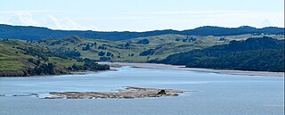
Lake Whangape is shallow, supertrophic, lateral and the second largest lake in the lower Waikato River basin in New Zealand. One source said the name translated to 'a large sheet of water', another that it was a chief's name.
The Mangatangi River, or Mangatangi Stream, originates on the eastern slopes of the Hunua Ranges in New Zealand and flows roughly southwards until it is joined by the Ruaotehuia Stream just north of State Highway 2 between Mangatāwhiri and Maramarua, where it becomes the Maramarua River. Mangatangi can be translated as manga tangi to stream of weeping, or as rippling stream, or babbling brook.
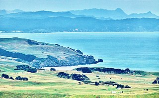
Te Ākau is a small farming settlement in the North Island of New Zealand, located 62 km (39 mi) north west of Hamilton, 39 km (24 mi) south west of Huntly, 45 km (28 mi) south of Port Waikato and 47 km (29 mi), or 19 km (12 mi) by ferry and road, north of Raglan. It has a hall and a school.
Herangi Range is a range of hills south of Marokopa and north of Awakino, in the Waikato region of New Zealand, reaching to the Tasman Sea at Tapirimoko, Tirua, Taungaururoa, Te Mauku and Ngarupupu Points. Just to the south of Ngarupupu, the Waikawau River enters the sea. Other rivers draining the range are Mangaotaki River, Awakino River and Manganui River. Herangi is part of the Whareorino conservation area.
References
- ↑ "Huriwai River, Waikato". NZ Topo Map. Retrieved 8 December 2022.
- ↑ Challinor, A. B. (2001). "Stratigraphy of Tithonian (Ohauan‐Puaroan ) marine beds near Port Waikato". New Zealand Journal of Geology and Geophysics. 44 (2): 219–242. CiteSeerX 10.1.1.540.1575 . doi: 10.1080/00288306.2001.9514936 . ISSN 0028-8306. S2CID 54820190.
- ↑ "APPENDIX 3. DETAILS ON EXISTING AND PROPOSED NON-VOLCANIC GEOHERITAGE ONFs" (PDF). Waikato District Council. 2018. pp. 9–10.
- ↑ "Huriwai Stream at Waikaretu Road MCI River Quality". Land, Air, Water Aotearoa (LAWA). 2021. Retrieved 8 December 2022.
- "Place name detail: Huriwai River". New Zealand Gazetteer. New Zealand Geographic Board . Retrieved 12 July 2009.