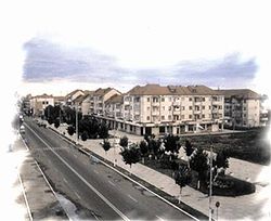
Ianca

Last updated • 2 min readFrom Wikipedia, The Free Encyclopedia
Ianca
Ayuntamiento Ianca.jpg
Ianca town hall
Flag of Ianca.png
ROU BR Ianca CoA.jpg
Ianca jud Braila.png
Location in Brăila County
Romania location map.svg
Red pog.svg
Ianca
Location in Romania
Coordinates: 45°8′6″N27°28′29″E / 45.13500°N 27.47472°E / 45.13500; 27.47472
CountryRomania
County Brăila
Government
  Mayor (20202024) Fănel-George Chiriță [1] (PSD)
Area
186.14 km2 (71.87 sq mi)
Elevation
40 m (130 ft)
Population
 (2021-12-01) [2]
8,969
  Density48/km2 (120/sq mi)
Time zone EET/EEST (UTC+2/+3)
Postal code
815200
Area code (+40) 02 39
Vehicle reg. BR
Website www.primaria-ianca.ro

Ianca (Romanian pronunciation: [ˈjaŋka] ) is a town in Brăila County, Muntenia, Romania. With a population of 8,969 people as of 2021, it is the second-largest urban locality in the county. The town's area is 186 km2 (72 sq mi), of which 10.9 km2 (4.2 sq mi) have the status of residential area. The town administers six villages: Berlești, Gara Ianca, Oprișenești, Perișoru, Plopu, and Târlele Filiu.

Contents

Geography

The town is situated at the northern edge of the Bărăgan Plain, at an altitude of 40 m (130 ft). It is located in the central part of the county, 44 km (27 mi) southwest of the county seat, Brăila.

History

The first mention of the settlement dates to 1834. At the end of the 19th century, it comprised two villages (Ianca and Niculești); with a population of 1,483, it was the residence of plasa Ianca of Brăila County. In 1950, Ianca commune became part of the Făurei raion of Galați Region  [ ro ]. It became again part of Brăila County in 1968, and it officially became a town in 1989, as a result of the Romanian rural systematization program.

From 1941 to 2001 Ianca was the home of the 49th Air Base of the Romanian Air Force; since July 2022, the airfield is owned by the Romanian Aeroclub  [ ro ].

Demographics

Historical population
YearPop.±%
1992 11,736    
2002 12,886+9.8%
2011 10,049−22.0%
2021 8,969−10.7%
Source: Census data

At the 2021 census, Ianca had a population of 8,969; of those, 88.77% were Romanians and 2% Roma. [3]

Natives

Transportation and economy

Ianca is crossed by the national road DN2B, which runs from Buzău to Galați. The Ianca and Ianca Sat train stations serve the CFR Main Line 700, which connects Bucharest to Brăila, Galați, and the Moldova border at Giurgiulești.

The Oprișenești oil field is located on the administrative territory of the town.

Sports

The football club Viitorul Ianca is based here; the home ground of the club is the Ștefan Vrăbioru Stadium.

International relations

Ianca is twinned with La Chapelle-sur-Erdre, France since 2005.

References

  1. "Results of the 2020 local elections". Central Electoral Bureau. Retrieved 6 June 2021.
  2. "Populaţia rezidentă după grupa de vârstă, pe județe și municipii, orașe, comune, la 1 decembrie 2021" (XLS). National Institute of Statistics.
  3. "Populația rezidentă după grupa de vârstă, pe județe și municipii, orașe, comune, la 1 decembrie 2021" (in Romanian). INSSE. 31 May 2023.
Ianca postcard Ianca postcard.jpg
Ianca postcard