Related Research Articles
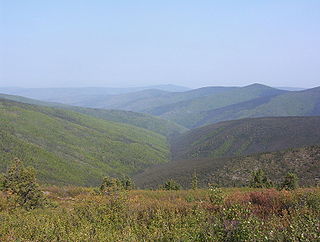
The klondike is a region of the territory of Yukon, in northwestern Canada. It lies around the Klondike River, a small river that enters the Yukon River from the east at Dawson City.

The Gulf of St. Lawrence is the outlet of the North American Great Lakes via the St. Lawrence River into the Atlantic Ocean. The gulf is a semi-enclosed sea, covering an area of about 226,000 square kilometres (87,000 sq mi) and containing about 34,500 cubic kilometres (8,300 cu mi) of water, at an average depth of 152 metres (500 ft).

Foxley River is a Canadian rural community in Prince County, Prince Edward Island.
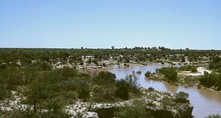
The Desaguadero River is a river in Argentina. Originating near the Tipas volcano in La Rioja at about 5,500 m (18,000 ft) elevation, the river is known in its upper reaches as the Bermejo or Vinchina. In its lower reaches it is also known as the Salado. It joins the Colorado River in La Pampa Province near Pichi Mahuida. The Desaguadero River has a total length of 1,498 km (931 mi) and its drainage basin is about 260,000 km2 (100,000 sq mi).
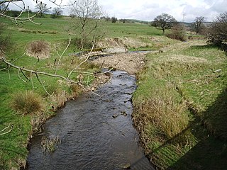
The River Don is a river in Lancashire, England. It is 6.64 miles (10.69 km) long and has a catchment area of 4.18 square miles (1,082.31 ha).
The Waccamaw River Heritage Preserve is a 5,347-acre (21.64 km2), 30-mile (48 km) stretch of protected wetland that follows the Waccamaw River in northeastern Horry County, South Carolina.
Farrells River, formerly known as Parrsboro River, is a small river that flows south into an aboiteau on Parrsboro Harbour on the Minas Basin near the town of Parrsboro, Nova Scotia.
Hog Island is an island in the wetlands of the Petaluma River in Sonoma County, California, located at 38°09′33″N122°32′18″W near the Marin County line. San Antonio Creek enters the river just west of this island. It is mentioned in a newspaper article from 1914.
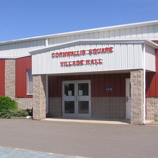
Cornwallis Square is a Canadian village in Kings County, Nova Scotia. It is located on the Cornwallis River.
Cleardale is a hamlet in northern Alberta, Canada within Clear Hills County. It is located on Highway 64 approximately 29 kilometres (18 mi) east of the British Columbia border and 98 kilometres (61 mi) northwest of Fairview.

The Richibucto River is a river in eastern New Brunswick, Canada which empties into the Northumberland Strait north of Richibucto. It is 80 kilometres long.
The Mizque River is a river of Bolivia in the Cochabamba Department. It is a tributary of Río Grande.

Vidbol Glacier is the 5.5 km long and 1.5 km wide glacier on Arctowski Peninsula on Danco Coast in Graham Land on the Antarctic Peninsula draining the north slopes of Pulfrich Peak. Flowing northwestwards west of Henryk Peak and east of Mount Dedo to enter Gerlache Strait at Orne Harbour.

Kolosh Glacier is the 6.7 km long and 3.6 km wide glacier on Magnier Peninsula, Graham Coast on the west side of Antarctic Peninsula, situated south of Nesla Glacier. It drains the west slopes of Lisiya Ridge north of Mount Bigo, and flows northwestwards into Bigo Bay next south of the terminus of Nesla Glacier.
Stringfellow Glacier is a glacier just west of Henson Glacier, flowing north from the Detroit Plateau of Graham Land into Wright Ice Piedmont. Mapped from air photos by Hunting Aerosurveys (1953–57). Named by United Kingdom Antarctic Place-Names Committee (UK-APC) for John Stringfellow (1799–1883), English designer of the first powered model airplane to make a flight, in 1848.

Marla Glacier is a glacier 8 nmi long and 1 nmi wide on the northeast side of Detroit Plateau on the southern Trinity Peninsula in Graham Land, Antarctica, situated south of Aitkenhead Glacier and north of Diplock Glacier. It is draining southeastwards along the east slopes of Povien Bluff, then turning east between Mount Roberts and Bezenšek Spur, and flowing into Prince Gustav Channel in Weddell Sea.
The Rolling River First Nation is an Ojibwe First Nations community in Manitoba, located south of Riding Mountain National Park.
The Buctouche River is a river in eastern New Brunswick, Canada which empties into the Buctouche Bay in the Northumberland Strait in the town of Bouctouche.

Dodelen Glacier is the 3.6 km long and 2.8 km wide glacier on Pasteur Peninsula, Brabant Island in the Palmer Archipelago, Antarctica, situated southwest of Podayva Glacier, northwest of Lister Glacier and north of Oshane Glacier. It drains the west slopes of Mount Hunter in Stribog Mountains, and flows westwards into Guyou Bay.