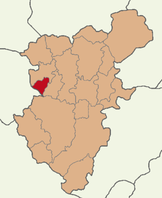
Babadağ, formerly Kadıköy, is a municipality and district of Denizli Province, Turkey. Its area is 124 km2, and its population is 6,340 (2022). It is a highland town, reached by a steep, winding road uphill from the town of Sarayköy. It was known in antiquity as Salbacos.
The Indian Institute of Remote Sensing is an institute for research, higher education and training in the field of remote sensing, geoinformatics and GPS technology for natural resources, environmental and disaster management under the Indian Department of Space, which was established in the year 1966. It is located in the city of Dehradun, Uttarakhand.
Prasthala was the capital of king Susharman of Trigarta Kingdom. As per the epic Mahabharata, this city was under the constant attack of Matsya kings like the king Virata. Susharman tried to avenge the Matsyas with the help of Duryodhana of Hastinapura, but the attempt was foiled by the Pandavas staying in the domains of the Matsyas. Prasthala is either identified to be the modern city Patiala in Punjab, India or Jalandhar in Punjab, India.

Applanix, based in Richmond Hill, Ontario, Canada, develops and manufactures a line of Inertial Navigation System products. The company's Position and Orientation Systems (POS) are used worldwide for a variety of applications such as aerial survey and mapping, remote sensing, road profiling, GIS data acquisition, and hydrographic surveying.
The International Society for Photogrammetry and Remote Sensing (ISPRS) is an international non-governmental organization that enhances international cooperation between the worldwide organizations with interests in the photogrammetry, remote sensing and spatial information sciences. Originally named International Society for Photogrammetry (ISP), it was established in 1910, and is the oldest international umbrella organization in its field, which may be summarized as addressing “information from imagery”.
Maged N. Kamel Boulos is a British health informatician, scientist and Full Professor of Digital Health with Sun Yat-sen University (China), having worked before that at the Alexander Graham Bell Centre of Digital Health, University of the Highlands and Islands, at the University of Plymouth, at the University of Bath and at City University London. Other held affiliations include Universidade de Lisboa. He is particularly known for his research into Geographic Information Systems (GIS) applications in health and healthcare, which received wide news media coverage. He is credited with coining the phrases 'online consumer geoinformatics services' and 'wikification of GIS by the masses' in 2005, when neogeography and virtual globes were still very new.

George Joseph is an Indian space scientist, best known for his contributions to the development of remote sensing technology in India, especially in the field of earth observation sensors. He is a former chairman of the Lunar Mission Study Task Force of the Indian Space Research Organization and an elected fellow of the National Academy of Sciences, India, Indian Academy of Sciences and Indian National Academy of Engineering. The Government of India awarded him the Padma Bhushan, the third highest civilian award, in 1999.
Prof. em. Dr. Armin Gruen is, since 1984, professor and head of the Chair of photogrammetry at the Institute of Geodesy and Photogrammetry (IGP), Federal Institute of Technology (ETH) Zurich, Switzerland. Since 1 August 2009, he is retired and is now with the Chair of Information Architecture, ETH Zurich Faculty of Architecture. He is currently acting as a principal investigator on the Simulation Platform of the SEC-FCL in Singapore.

Shailesh Nayak is an Indian scientist and is currently Director of the National Institute of Advanced Studies and Distinguished Scientist in the Ministry of Earth Sciences. He was the Chair of the Earth System Science Organization (ESSO) and Secretary to the Government of India for Ministry of Earth Sciences (MoES) Indian government, between August 2008 – 2015. He was also the Chairman of Earth Commission in India. He served as the interim chairman of ISRO between 31 December 2014 and 11 January 2015.

The Institute of Geomatics (IG) was a public consortium made up of the Autonomous Government of Catalonia and the Polytechnic University of Catalonia, created by Decree Law 256/1997 of the Autonomous Government of Catalonia, on September 30, 1997. It was a founding member of the Associació Catalana d'Entitats de Recerca (ACER).
Remote Sensing is a semimonthly peer-reviewed open access academic journal focusing on research pertaining to remote sensing and other disciplines of geography. It was established in 2009 and is published by MDPI. The founding editor-in-chief was Wolfgang Wagner until September 2, 2011, when he resigned over the journal's publication of a paper co-authored by Roy Spencer, which had received significant criticism from other scientists soon after its publication. Since then, the editor-in-chief has been Prasad S. Thenkabail.
The ISPRS Journal of Photogrammetry and Remote Sensing is the official journal of International Society for Photogrammetry and Remote Sensing (ISPRS), publishes scientific and technical articles and reviews in photogrammetry, remote sensing, and related fields. It is published by Elsevier and is edited by Clément Mallet and Qihao Weng. The journal was originally established as Internationales Archiv für Photogrammetrie in 1908, changing its name to Photogrammetria in 1938, and taking its current name in 1989.
Intrinsic localization is a method used in mobile laser scanning to recover the trajectory of the scanner, after, or during the measurement. Specifically, it is a way to recover the spatial coordinates and the rotation of the scanner without the use of any other sensors, i.e, extrinsic information. To function in practice, intrinsic localization relies on two things. First, a priori knowledge of the scanning instruments, and second, on sensor data overlap employing simultaneous localization and mapping (SLAM) methods. The term was coined in.

Pix4D is a Swiss software company that specializes in photogrammetry. It was founded in 2011 as a spinoff from the École Polytechnique Fédérale de Lausanne (EPFL) Computer Vision Lab in Switzerland. It develops a suite of software products that use photogrammetry and computer vision algorithms to transform DSLR, fisheye, RGB, thermal and multispectral images into 3D maps and 3D modeling. The company has 7 international offices, with its headquarters in Lausanne, Switzerland.
Sisi Zlatanova is a Bulgarian/Dutch researcher in geospatial data, geographic information systems, and 3D modeling. She works as a professor in the faculty of the Built Environment, at the University of New South Wales (UNSW), and is president of Technical Commission IV (Spatial Information Science) of the International Society for Photogrammetry and Remote Sensing.
OpenDroneMap is an open source photogrammetry toolkit to process aerial imagery into maps and 3D models. The software is hosted and distributed freely on GitHub.
The Japan Society of Photogrammetry and Remote Sensing (JSRS) is a Japanese learned society devoted to photogrammetry and remote sensing. It is a member of the International Society for Photogrammetry and Remote Sensing. ISRS publishes the Journal of the Japan Society of Photogrammetry and Remote Sensing.

Qihao Weng is an American geographer, urban, environmental sustainability, and remote sensing scientist. He has been a Chair Professor at the Hong Kong Polytechnic University since July 2021, and was the Director of the Center for Urban and Environmental Change and is a professor of geography in the Department of Earth and Environmental Systems at the Indiana State University.
Babadağ in Denizli Province is one of two mountains in Turkey with the same name, which translates into English as "Father Mountain". The other Babadağ mountain is in Muğla Province on the Aegean Sea. Both are part of the Taurus Mountains. The summit of the Babadağ in Denizli Province is located 23 km away in southwestern direction from Denizli, the capital of the province.
Asian Association on Remote Sensing or AARS is a non-governmental organization established in 1981 to promote remote sensing in the Asia-Pacific region; it currently has members from 29 countries.