
U.S. Route 27 or U.S. Highway 27 (US 27) is a north–south United States Numbered Highway in the Southern and Midwestern U.S. The southern terminus is at US 1 in Miami, Florida. The northern terminus is at Interstate 69 (I-69) in Fort Wayne, Indiana. From Miami, it goes up the center of Florida, then west to Tallahassee, Florida, and north through such cities and towns as Columbus, Georgia; Rome, Georgia; Chattanooga, Tennessee; Lexington, Kentucky; Cincinnati, Ohio; Oxford, Ohio; Richmond, Indiana; and Fort Wayne, Indiana. It once extended north through Lansing, Michigan, to Cheboygan, Mackinaw City, and, for about three years, even as far as St. Ignace. US 27 was first signed in 1926, replacing what had been the eastern route of the Dixie Highway in many states.

U.S. Route 3 (US 3) is a United States Numbered Highway running 277.90 miles (447.24 km) from Cambridge, Massachusetts, through New Hampshire, to the Canada–United States border near Third Connecticut Lake, where it connects to Quebec Route 257.

Interstate 495 (I-495) is an auxiliary route of I-95 in the US state of Massachusetts, maintained by the Massachusetts Department of Transportation (MassDOT). Spanning 121.56 miles (195.63 km), it is the second-longest auxiliary route in the Interstate Highway System, being roughly 11 miles (18 km) shorter than I-476 in Pennsylvania.

New Hampshire Route 1A is an 18.32-mile (29.48 km) long state highway located in southeast New Hampshire. The route runs along the Atlantic coastline from the Massachusetts border north to Rye, then turns toward downtown Portsmouth. The southern terminus is at the Massachusetts state line in Seabrook where it continues south as Massachusetts Route 1A. The northern terminus is at a junction with U.S. Route 1 in downtown Portsmouth. For the length of the road's run along the shore, its local name is Ocean Boulevard. In the northern part of Rye, it is known as Pioneer Road, and in Portsmouth, it is known as Miller Avenue and Sagamore Avenue.

New Hampshire Route 3A is a designation held by two separate state highways in New Hampshire. The two segments, although not directly connected, are linked by U.S. Route 3, from which they derive their route number.

New Hampshire Route 11 is a 108.223-mile-long (174.168 km) east–west state highway in New Hampshire, running completely across the central part of the state. Its western terminus is at the Vermont state line in Charlestown, where it continues west as Vermont Route 11. The eastern terminus is at the Maine state line in Rochester, where it crosses the border with U.S. Route 202 and continues as Maine State Route 11.

State Road 101 in the U.S. state of Indiana is a north–south state highway in the eastern portion of Indiana that exists in four sections with a combined length of 79.42 miles (127.81 km).

State Road 11 in the U.S. state of Indiana is located in south central Indiana and is divided into a northern and southern section. These sections were never connected.
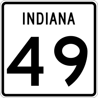
State Road 49 (SR 49) is a 44.15-mile (71.05 km), north–south state highway in the northwestern part of the U.S. state of Indiana. Its northern terminus is at an intersection with U.S. Route 12 in Porter near the entrance to Indiana Dunes State Park. The southern terminus is a rural intersection with State Road 14 in Barkley Township at Lewiston, 10 miles (16 km) northeast of Rensselaer.
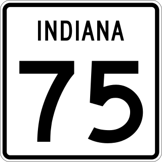
State Road 75, the highest two-digit route in the U.S. state of Indiana consists of two discontinuous north–south segments.

State Route 294 is a 7.973-mile (12.831 km) state highway in southeastern Humboldt County, Nevada, United States, that runs along the northernmost part of Grass Valley Road and connects Winnemucca with the Grass Valley area south of the town.

Interstate 65 (I-65) in the US state of Indiana traverses from the south-southeastern Falls City area bordering Louisville, Kentucky, through the centrally located capital city of Indianapolis, to the northwestern Calumet Region of the Hoosier State which is part of the Chicago metropolitan area. The Indiana portion of I-65 begins in Jeffersonville after crossing the Ohio River and travels mainly north, passing just west of Columbus prior to reaching the Indianapolis metro area. Upon reaching Indianapolis, the route alignment of I-65 begins to run more to the northwest and subsequently passes Lafayette on that city's east and north sides. Northwest of there, in west-central Jasper County, the route again curves more northward as it approaches the Calumet Region. Shortly after passing a major junction with I-80 and I-94, I-65 reaches its northern national terminus in Gary at I-90 which is carried on the Indiana East–West Toll Road. I-65 covers 261.27 miles (420.47 km) in the state of Indiana. This is one of the principal Interstate Highways that cross the state, and, more specifically, intersect at the city of Indianapolis, that has given the state the nickname of "Crossroads of America".

State Route 75 (SR 75) is a 33.4-mile-long (53.8 km) state highway that travels south-to-north through portions of White and Towns counties in the northern part of the U.S. state of Georgia. It connects Cleveland and the North Carolina state line, via Helen, Macedonia, and Hiawassee.
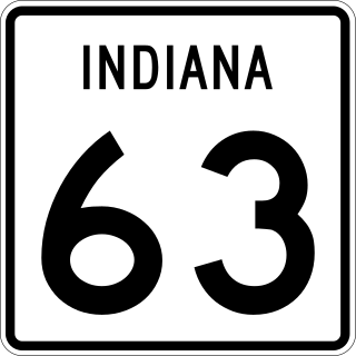
State Road 63 (SR 63) in the U.S. state of Indiana is a north–south route in the western portion of the state. Until mid-2008, it covered a distance of just over 96 miles (154 km), but now is a discontinuous route. For 63 miles (101 km), from the city of Terre Haute until it rejoins U.S. Route 41 (US 41) near Carbondale, it is a four-lane divided highway and replaces US 41 as the major north–south artery in this portion of the state.

State Route 762 is an east–west state highway in central Ohio, a U.S. state. The highway has its western terminus at a signalized intersection with the concurrency of U.S. Route 62 and SR 3 just 0.25 miles (0.40 km) south of the village limits of Harrisburg. SR 762's eastern terminus is at an intersection of Pickaway County Route 385 near the Rickenbacker International Airport.

State Route 320 (SR 320) is a short north–south state highway in western Ohio, a U.S. state. The southern terminus of SR 320 is at U.S. Route 35 (US 35) approximately three miles (4.8 km) southeast of New Paris, 3⁄4 mile (1.2 km) south of US 35's eastern junction with Interstate 70 (I-70). The northern terminus of the state highway is located in New Paris at a signalized intersection with SR 121.

U.S. Route 70 is a transcontinental U.S. highway extending from Globe, Arizona to Atlantic, North Carolina. Along the way, 289.81 miles (466.40 km) of its route passes through the state of Oklahoma. Entering the state south of Davidson, the highway serves Oklahoma's southern tier before exiting the state east of Broken Bow. It serves the cities of Ardmore, Durant, Hugo, and Idabel, as well as Tillman, Cotton, Jefferson, Carter, Marshall, Bryan, Choctaw, and McCurtain counties.
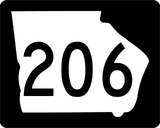
State Route 206 (SR 206) is a state highway in the southeastern part of U.S. state of Georgia. It runs southeast–northwest through portions of Ben Hill, Irwin, and Coffee counties. The route's southern terminus is in Douglas, and its northern terminus is just east of Fitzgerald.

