Inglefield Gulf

Last updated
Inglefield Gulf
Inglefield Bredning
Inglefield Fjord
Inglefield Gulf.jpg
Envisat radar image showing Inglefield Fjord
Greenland edcp relief location map.jpg
Red pog.svg
Inglefield Gulf
Location in Greenland
Location Arctic
Coordinates 77°27′N67°48′W / 77.450°N 67.800°W / 77.450; -67.800
Native nameKangerlussuaq (Greenlandic)
Ocean/sea sources Baffin Bay
Basin  countries Greenland
Max. length70 km (43 mi)
Max. width20 km (12 mi)
Settlements Qeqertat

Inglefield Gulf or Inglefield Fjord (Danish : Inglefield Bredning; Greenlandic : Kangerlussuaq) is a fjord in northwestern Greenland. To the west, the fjord opens into the Baffin Bay. Administratively it belongs to the Avannaata municipality.

Contents

Inglefield Gulf was named after English explorer Edward Augustus Inglefield.

Settlements

Qaanaaq is located in the northern entrance of the fjord. The village of Qeqertat is located in the Harvard Islands, in the inner area of the fjord. [1]

Geography

Together with Wolstenholme Fjord, Inglefield Gulf is one of the two main indentations in the stretch of coast between Cape York and Cape Alexander. [2] On the northern shore of the fjord there is a branch, the Bowdoin Fjord, and on the southern there are two, the Academy Bay in the inner fjord with the Leidy Glacier at its head and the narrow Olrik Fjord running roughly from east to west. [3]

The Heilprin Glacier, flowing from the Greenland Ice Sheet in the east, is the largest glacier that has its terminus in the fjord. The Tracy Glacier has its terminus further north near Josephine Peary Island in a bay at the northern side of the head of the fjord where the smaller Hart Glacier, Sharp Glacier, Melville Glacier, and Farquhar Glacier have their terminus. As they discharge into the fjord all these glaciers are separated by nunataks, the largest of which is the Smithson Range. [4] In the central area of the fjord the Hubbard Glacier discharges on the northern shore and the Hurlbut Glacier on the southern shore. [3]

The islands of Qeqertarsuaq (Herbert Island) and Kiatak (Northumberland Island) lie off the fjord's mouth. They are aligned from east to west, dividing the outer gulf into two sounds, the Murchison Sound to the north beyond Cape Ackland, and the Hvalsund to the south, west of Kangeq. [3]

19th century map of the Inglefield Gulf. Northward over the great ice - a narrative of life and work along the shores and upon the interior ice-cap of northern Greenland in the years 1886 and 1891-1897, with a description of the little tribe (14779963574).jpg
19th century map of the Inglefield Gulf.

See also

Related Research Articles

Wolstenholme Fjord is a fjord in Avannaata municipality, Northwest Greenland. It is located to the north of the Thule Air Base and adjacent to the abandoned Inuit settlement of Narsaarsuk.

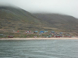
Qeqertarsuaq or Herbert Island is an island in Baffin Bay near Qaanaaq in the Avannaata municipality, NW Greenland. The island has an area of 223 km2.

<span class="mw-page-title-main">Kaiser Franz Joseph Fjord</span>

Kaiser Franz Joseph Fjord is a major fjord system in the NE Greenland National Park area, East Greenland.

The Harvard Islands are an island group east of Qaanaaq in the Avannaata Municipality, northwestern Greenland.

<span class="mw-page-title-main">Umivik Bay</span>

Umivik Bay, also known as Umiivik and Umerik, is a bay in King Frederick VI Coast, southeastern Greenland. It is part of the Sermersooq municipality.

<span class="mw-page-title-main">Timmiarmiut Fjord</span> Fjord in Greenland

Timmiarmiut Fjord ) is a fjord of the King Frederick VI Coast in the Sermersooq municipality, southeastern Greenland.

<span class="mw-page-title-main">Sehested Fjord</span>

Sehested Fjord ) is a fjord of the King Frederick VI Coast in the Sermersooq municipality, southeastern Greenland.

Ingolf Fjord, also known as Ingolf Sound, is a fjord of Greenland's northeastern coast in northern King Frederick VIII Land.

Academy Fjord or Academy Bay is a fjord in northern Greenland. Administratively it belongs to the Avannaata municipality.

<span class="mw-page-title-main">Farquhar Glacier</span>

Farquhar Glacier, is a glacier in northwestern Greenland. Administratively it belongs to the Avannaata municipality.

MacCormick Fjord is a fjord in northern Greenland. To the southwest, the fjord opens into the Murchison Sound of the Baffin Bay.

<span class="mw-page-title-main">Bowdoin Fjord</span> Fjord in northern Greenland.

Bowdoin Fjord is a fjord in northern Greenland. To the south the fjord opens into the Inglefield Gulf of the Baffin Bay.

<span class="mw-page-title-main">Olrik Fjord</span> Fjord in northern Greenland.

Olrik Fjord is a fjord in the Avannaata municipality, Northwestern Greenland. To the east the fjord opens into the Hvalsund, at the end of the Inglefield Gulf of the Baffin Bay.

<span class="mw-page-title-main">Siorapaluup Kangerlua</span>

Siorapaluup Kangerlua, also known as Robertson Fjord and Robertson Bay, is a fjord in northern Greenland. To the southwest, the fjord opens into the Murchison Sound of the Baffin Bay. Administratively it belongs to the Avannaata municipality.

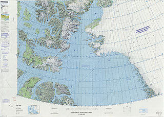
The Murchison Sound is a sound in the Avannaata municipality, NW Greenland. It was named after Scottish geologist Roderick Murchison.

<span class="mw-page-title-main">Nordvestfjord</span> Fjord in Greenland

Nordvestfjord, meaning 'Northwest Fjord', is a fjord in King Christian X Land, eastern Greenland.

<span class="mw-page-title-main">Ofjord</span> Fjord in eastern Greenland

Ofjord is a fjord in King Christian X Land, eastern Greenland. This fjord is part of the Scoresby Sound system. Administratively it lies in the area of Sermersooq municipality.

Hurry Inlet is a fjord in King Christian X Land, eastern Greenland. This fjord is part of the Scoresby Sound system. Administratively it lies in the area of Sermersooq municipality.

<span class="mw-page-title-main">Godthab Gulf</span>

Godthab Gulf, also known as Godthaab Golf, Clavering Fjord, Clavering Sound and Inner Bay, is a fjord in King Christian X Land, East Greenland. Administratively it is part of the Northeast Greenland National Park zone.

References

  1. "Qaanaaq". Mapcarta. Retrieved 27 March 2019.
  2. Prostar Sailing Directions 2005 Greenland and Iceland Enroute, p. 77
  3. 1 2 3 "Inglefield Bredning". Mapcarta. Retrieved 26 March 2019.
  4. GoogleEarth