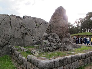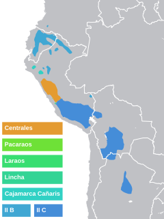
Cusco, also spelled Cuzco, is a department in Peru. It is bordered by the departments of Ucayali on the north; Madre de Dios and Puno on the east; Arequipa on the south; and Apurímac, Ayacucho and Junín on the west. Its capital is Cusco, the capital of the Inca Empire.

Canchis Province is one of thirteen provinces in the Cusco Region in the southern highlands of Peru.

Raqch'i (Quechua) is an Inca archaeological site in Peru located in the Cusco Region, Canchis Province, San Pedro District, near the populated place Raqch'i. It is 3480 meters above sea level and 110 kilometers from the city of Cuzco. It also known as the Temple of Wiracocha, one of its constituents. Both lie along the Vilcanota River. The site has experienced a recent increase in tourism in recent years, with 83,334 visitors to the site in 2006, up from 8,183 in 2000 and 452 in 1996.
Combapata District is one of eight districts of the province Canchis in Peru.
San Pablo District is one of eight districts of the province Canchis in Peru.

Qenko,Kenko,Q'enqo or Quenco is an archaeological site in the Sacred Valley of Peru located in the Cusco Region, Cusco Province, Cusco District, about 6 km north east of Cusco. The site was declared a Cultural Heritage (Patrimonio Cultural) of the Cusco Region by the National Institute of Culture.

Incahuasi or Incawasi is an archaeological site in Peru. It is located in the Lima Region, Cañete Province, Lunahuaná District.

Inka Wasi or Inkawasi is an archaeological site in Peru. It is located in the Ayacucho Region, Parinacochas Province, Pullo District.

Inka Wasi is an archaeological site in the Huancavelica Region in Peru. The Inca palace is considered one of the most important monuments of the Huancavelica Region. Inka Wasi is located in the Huaytará Province, Huaytará District, about 25 km from Huaytará. It is situated at a height of 3,804 m (12,480 ft).
Tupu Inka is an archaeological site in Peru. It is located in the Puno Region, Yunguyo Province, Unicachi District.
Inka Mach'ay is an archaeological site in Peru. It is situated in the Huancavelica Region, Tayacaja Province, Ñahuimpuquio District.
Inka Tampu or Inkatampu is an archaeological site in Peru. It is situated in the Cusco Region, La Convención Province, Huayopata District, at a height of about 2,127 metres (6,978 ft).
Inka Tampu or Inkatampu is an archaeological site in Peru. It is located in the Cusco Region, La Convención Province, Vilcabamba District. The archaeological group is situated on top of a mountain named Inka Tampu (Inka Tambo).
Ayamachay is an archaeological site with rock paintings in Peru. It is situated in the Cusco Region, Canchis Province, Combapata District, above the left bank of the Salqa or Salcca river near the village of Oroscocha or Oroscocha. The paintings are predominantly white and show abstract or geometrical figures.
Inkapintay or Inkapintayuq is an archaeological site in Peru with a rock painting. It is situated in the Cusco Region, Urubamba Province, Ollantaytambo District, near Ollantaytambo. The figure which draws the attention possibly depicts a noble person.

Inka Paqcha is a mountain in the Andes of Peru, about 4,400 metres (14,436 ft) high. It is located in the Ayacucho Region, Lucanas Province, Carmen Salcedo District. Inka Paqcha lies northwest of Inka Pallanka where the archaeological site of Quriwayrachina is situated.

Puka Urqu is a mountain in the Andes of Peru, about 4,800 m (15,700 ft) high. It is situated in the Cusco Region, Canchis Province, Combapata District. Puka Urqu lies northwest of Inka Pirqa. The Llanqha Mayu flows along its slopes. It is a right affluent of the Willkanuta River.
Inka Pirqa or Inka Pirka may refer to:

Inca Huagansa or Inka Waqanqa is a mountain in the Andes of Peru which reaches a height of approximately 4,000 m (13,000 ft). It is located in the Ancash Region, Bolognesi Province, Cajacay District. It lies south of a place named Inca Huacanca.


