Fulhadhoo is one of the inhabited islands of Southern Maalhosmadulhu Atoll, code letter "Baa", in Maldives. It is 31.5 hectares in area.

Ilhéu Grande is an uninhabited island of Cape Verde. It is the largest of the Ilhéus do Rombo islet group, located 4 km (2 mi) west of Ilhéu de Cima, the other main islet of the group, and 7 km (4 mi) north of the island Brava. Its length is 2.3 km (1.4 mi) from southwest to northeast and the width is approximately 1.1 km (0.7 mi) from southeast to northwest. It is 96 m high. The islet forms a part of the integral nature reserve Ilhéus do Rombo.
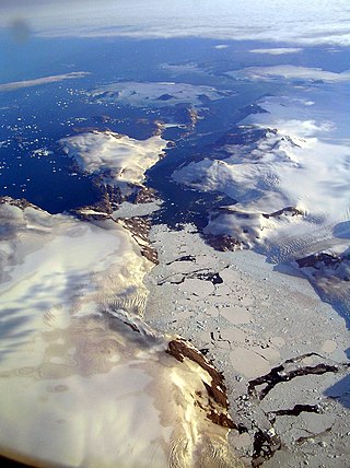
Alanngorsuaq Fjord, also known as Coppermine Bay, is a fjord in the Kujalleq municipality in southern Greenland. At the mouth of the fjord the coastline of southwestern Greenland turns to the east towards Qaqortoq.
Søren Norby Islands, named after Søren Norby, is an uninhabited archipelago close to the shores of Eastern Greenland. Administratively it is part of the Sermersooq municipality.

The Moscos Islands are an island chain in the Andaman Sea off the northern coast of the Tanintharyi Region of southern Burma.

Cape Farewell Archipelago is an island group located at the southern end of Greenland in Kujalleq municipality. The archipelago takes its name from Cape Farewell, a headland of Egger Island.
Avallersuaq, old spelling Avatdlerssuaq, is an uninhabited island of the Cape Farewell Archipelago in Kujalleq municipality of southern Greenland.
The Calventuras Islands are a small group of islands off the coast of Ayeyarwady Region, Burma.
Kitak is an island in the Sermersooq municipality in southeastern Greenland.

The Carey Islands are an island group off Baffin Bay, in Avannaata municipality, northwest Greenland. Located relatively far offshore the Carey Islands are the westernmost point of Greenland as a territory. The sea surrounding the islands is clogged by ice most of the year.
The Bonsall Islands is a small coastal island cluster in the Avannaata municipality, off northwest Greenland.
The McGary Islands is a small coastal island group in Avannaata municipality, off NW Greenland.
Kitsissut is an island group in the Kujalleq municipality in southern Greenland.
Outer Kitsissut, also known as Thorstein Islands or Torstein Islands, is an island group in the Kujalleq municipality in southern Greenland.
Anorituup Kangerlua, also known as Anoritoq or Anortek Fjord, is a fjord in King Frederick VI Coast, southern Greenland.

Torsukattak is a fjord in western Greenland. Administratively it is part of Avannaata municipality.

Harder Fjord is a fjord in Peary Land, far northern Greenland.

Bjorne Islands, Danish: Bjørne Øer; Greenlandic: Nannut Qeqertaat) meaning 'Bear Islands', is an island group in the Scoresby Sound, NE Greenland. The islands are uninhabited.
Ofjord is a fjord in King Christian X Land, eastern Greenland. This fjord is part of the Scoresby Sound system. Administratively it lies in the area of Sermersooq municipality.

Bjorne Island, Danish: Bjørneø, meaning 'Bear Island', is an island in NE Greenland. Administratively it belongs to the Northeast Greenland National Park.
