
Kennedy Channel is an Arctic sea passage between Greenland and Canada's most northerly island, Ellesmere Island.
Cape Atholl, also known as Kangaarasuk, is a headland in Northwest Greenland, Avannaata municipality.
Sokongen is an island in the Sermersooq municipality, in eastern Greenland.

Appat Island is an uninhabited island in the Avannaata municipality in northwestern Greenland. At 211 km2 (81.5 sq mi), it is one of the larger islands in the Uummannaq Fjord system, located in its north-central part. It is the site of the former settlements of Ritenbenck and Qaqortuatsiaq.
Søren Norby Islands, named after Søren Norby, is an uninhabited archipelago close to the shores of Eastern Greenland. Administratively it is part of the Sermersooq municipality.

Crown Prince Christian Land is a large peninsula in northern Greenland. It is a part of King Frederick VIII Land and administratively it belongs to the Northeast Greenland National Park.
Steward Island is an uninhabited island in King Christian IX Land, at the eastern end of Greenland. Administratively it is part of the Sermersooq municipality.

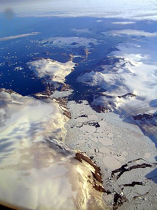
The Carey Islands are an island group off Baffin Bay, in Avannaata municipality, northwest Greenland. Located relatively far offshore the Carey Islands are the westernmost point of Greenland as a territory. The sea surrounding the islands is clogged by ice most of the year.
Sutherland Island is an island in Baffin Bay, in Avannaata municipality, off the NW shores of Greenland.
Outer Kitsissut, also known as Thorstein Islands or Torstein Islands, is an island group in the Kujalleq municipality in southern Greenland.
Inner Kitsissut is an island group in the Kujalleq municipality in southern Greenland.
Qulleq, Qutdleq or Kutdlek is an uninhabited island in the King Frederick VI Coast, Sermersooq municipality in southern Greenland.
Nanuuseq, also known as Nanûseq or Nanusek is an uninhabited island in the Kujalleq municipality in southern Greenland.
The Murchison Sound is a sound in the Avannaata municipality, NW Greenland. It was named after Scottish geologist Roderick Murchison.

The Antarctic Sound is a sound in King Christian X Land, Northeast Greenland. Administratively it is part of the Northeast Greenland National Park zone.
Cape Discord, also known as Kangeq, is a headland in the North Atlantic Ocean, southeast Greenland, Kujalleq municipality.

The Dijmphna Sound is a sound in King Frederick VIII Land, Northeast Greenland. Administratively it is part of the Northeast Greenland National Park zone.

Cape Moltke is a headland in the North Atlantic Ocean, southeast Greenland, Kujalleq municipality.
The Davy Sound is a sound in King Christian X Land, Northeast Greenland. Administratively it is part of the Northeast Greenland National Park zone.
Jens Munk Island, uninhabited coastal island in eastern Greenland in the Sermersooq municipality. It is named after the Dano-Norwegian navigator and explorer Jens Munk. The island is the largest in the Søren Norby Islands archipelago.

