
Greenland is located between the Arctic Ocean and the North Atlantic Ocean, northeast of Canada and northwest of Iceland. The territory comprises the island of Greenland—the largest island in the world—and more than a hundred other smaller islands. Greenland has a 1.2-kilometer-long (0.75 mi) border with Canada on Hans Island. A sparse population is confined to small settlements along certain sectors of the coast. Greenland possesses the world's second-largest ice sheet.

The Northwest Passage (NWP) is the sea lane between the Atlantic and Pacific oceans through the Arctic Ocean, along the northern coast of North America via waterways through the Arctic Archipelago of Canada. The eastern route along the Arctic coasts of Norway and Siberia is accordingly called the Northeast Passage (NEP). The various islands of the archipelago are separated from one another and from Mainland Canada by a series of Arctic waterways collectively known as the Northwest Passages, Northwestern Passages or the Canadian Internal Waters.

Ellesmere Island is Canada's northernmost and third largest island, and the tenth largest in the world. It comprises an area of 196,236 km2 (75,767 sq mi), slightly smaller than Great Britain, and the total length of the island is 830 km (520 mi).

Baffin Bay, located between Baffin Island and the west coast of Greenland, is defined by the International Hydrographic Organization as a marginal sea of the Arctic Ocean. It is sometimes considered a sea of the North Atlantic Ocean. It is connected to the Atlantic via Davis Strait and the Labrador Sea. The narrower Nares Strait connects Baffin Bay with the Arctic Ocean. The bay is not navigable most of the year because of the ice cover and high density of floating ice and icebergs in the open areas. However, a polynya of about 80,000 km2 (31,000 sq mi), known as the North Water, opens in summer on the north near Smith Sound. Most of the aquatic life of the bay is concentrated near that region.

Devon Island is an island in Canada and the largest uninhabited island in the world. It is located in Baffin Bay, Qikiqtaaluk Region, Nunavut, Canada. It is one of the largest members of the Arctic Archipelago, the second-largest of the Queen Elizabeth Islands, Canada's sixth-largest island, and the 27th-largest island in the world. It has an area of 55,247 km2 (21,331 sq mi). The bedrock is Precambrian gneiss and Paleozoic siltstones and shales. The highest point is the Devon Ice Cap at 1,920 m (6,300 ft) which is part of the Arctic Cordillera. Devon Island contains several small mountain ranges, such as the Treuter Mountains, Haddington Range and the Cunningham Mountains. The notable similarity of its surface to that of Mars has attracted interest from scientists.

Bylot Island lies off the northern end of Baffin Island in Nunavut Territory, Canada. Eclipse Sound to the southeast and Navy Board Inlet to the southwest separate it from Baffin Island. Parry Channel lies to its northwest. At 11,067 km2 (4,273 sq mi) it is ranked 71st largest island in the world and Canada's 17th largest island. The island measures 180 km (110 mi) east to west and 110 km (68 mi) north to south and is one of the largest uninhabited islands in the world. While there are no permanent settlements on this Canadian Arctic island, Inuit from Pond Inlet and elsewhere regularly travel to Bylot Island. An Inuit seasonal hunting camp is located southwest of Cape Graham Moore.

Disko Bay is a large bay on the western coast of Greenland. The bay constitutes a wide southeastern inlet of Baffin Bay.

The Lomonosov Ridge is an unusual underwater ridge of continental crust in the Arctic Ocean. It spans 1,800 kilometres (1,100 mi) between the New Siberian Islands over the central part of the ocean to Ellesmere Island of the Canadian Arctic Archipelago. The ridge divides the Arctic Basin into the Eurasian Basin and the Amerasian Basin. The width of the Lomonosov Ridge varies from 60 to 200 kilometres. It rises 3,300 to 3,700 metres above the 4,200-metre (13,800 ft) deep seabed. The minimum depth of the ocean above the ridge is less than 400 metres (1,300 ft). Slopes of the ridge are relatively steep, broken up by canyons, and covered with layers of silt. It is an aseismic ridge.

Kane Basin is an Arctic waterway lying between Greenland and Ellesmere Island, Canada's northernmost. It links Smith Sound to Kennedy Channel and forms part of Nares Strait. It is approximately 180 km (110 mi) in length and 130 km (81 mi) at its widest.
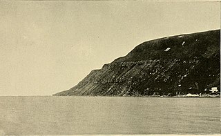
Cape Alexander is a headland in the Baffin Bay, northwest Greenland, Avannaata municipality. It is one of the important landmarks of Greenland.

Wilczek Land, is an island in the Arctic Ocean at 80.58°N 60.5°E. At 2,000 km2 (770 sq mi) it is the second-largest island in Franz Josef Land, in Arctic Russia.

The Nordenskiöld Archipelago or Nordenskjold Archipelago is a large and complex cluster of about 90 islands in the eastern region of the Kara Sea. Its eastern limit lies 120 km (75 mi) west of the Taymyr Peninsula. The archipelago is part of the Taymyrsky Dolgano-Nenetsky District of the Krasnoyarsk Krai administrative division of Russia.

Etah is an abandoned settlement in the Avannaata municipality in northern Greenland. It was a starting point of discovery expeditions to the North Pole and the landing site of the last migration of the Inuit from the Canadian Arctic.

.

This timeline of European exploration lists major geographic discoveries and other firsts credited to or involving Europeans during the Age of Discovery and the following centuries, between the years AD 1418 and 1957.

The Geography of Franz Josef Land refers to an island group belonging to Arkhangelsk Oblast of Russia. It is situated in the Barents Sea of the Arctic, north of Novaya Zemlya and east of Svalbard. At latitudes between 80.0° and 81.9° north, it is the most northerly group of islands associated with Eurasia. The extreme northernmost point is Cape Fligely on Rudolf Island. The archipelago consists of 191 ice-covered islands with a total area of 16,134 km2 (6,229 sq mi). It is currently uninhabited. The archipelago is only 900 to 1,110 km from the North Pole, and the northernmost islands are closer to the Pole than any other land except for Canada's Ellesmere Island and Greenland. The largest island is Zemlya Georga which measures 110 km (68 mi) from end to end. The highest point in the archipelago is on Ostrov Viner-Neyshtadt which reaches 620 m (2,034 ft) above sea level. The central cluster of large islands in the midst of the archipelago forms a compact whole, known as Zichy Land, where islands are separated from each other by very narrow sounds that are frozen most of the year.

Johan Alfred Björling was a Swedish botanist and Arctic explorer. He led the ill-fated Swedish NW Greenland Expedition, also known as Björling–Kallstenius Expedition, in 1892.

Thomas Abernethy was a Scottish seafarer, gunner in the Royal Navy, and polar explorer. Because he was neither an officer nor a gentleman, he was little mentioned in the books written by the leaders of the expeditions he went on, but was praised in what was written. In 1857, he was awarded the Arctic Medal for his service as an able seaman on the 1824–25 voyage of HMS Hecla, the first of his five expeditions for which participants were eligible for the award. He was in parties that, for their time, reached the furthest north, the furthest south (twice), and the nearest to the South Magnetic Pole. In 1831, along with James Clark Ross's team of six, Abernethy was in the first party ever to reach the North Magnetic Pole.

The Canadian Arctic Rift System is a major North American geological structure extending from the Labrador Sea in the southeast through Davis Strait, Baffin Bay and the Arctic Archipelago in the northwest. It consists of a series of interconnected rifts that formed during the Paleozoic, Mesozoic and Cenozoic eras. Extensional stresses along the entire length of the rift system have resulted in a variety of tectonic features, including grabens, half-grabens, basins and faults.


