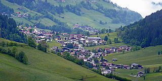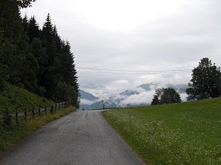
The Engadin or Engadine is a long high Alpine valley region in the eastern Swiss Alps in the canton of Graubünden in southeasternmost Switzerland with about 25,000 inhabitants. It follows the route of the Inn from its headwaters at Maloja Pass in the southwest running roughly northeast until the Inn flows into Austria, little less than one hundred kilometers downstream. The En/Inn subsequently flows at Passau into the Danube, making it the only Swiss river to drain into the Black Sea. The Engadine is protected by high mountain ranges on all sides and is famous for its sunny climate, beautiful landscapes and outdoor activities.

The Prince-Bishopric of Brixen was an ecclesiastical principality of the Holy Roman Empire in the present-day northern Italian province of South Tyrol. It should not be confused with the larger Catholic diocese, over which the prince-bishops exercised only the ecclesiastical authority of an ordinary bishop. The bishopric in the Eisack/Isarco valley was established in the 6th century and gradually received more secular powers. It gained imperial immediacy in 1027 and remained an Imperial Estate until 1803, when it was secularised to Tyrol. The diocese, however, existed until 1964, and is now part of the Diocese of Bolzano-Brixen.

Obergurgl is a village in the Ötztal Alps in Tyrol, Austria. Located in the municipality of Sölden, the village has approximately 400 year-round inhabitants, and is mainly a tourist resort.
Oberhofen may refer to several places:

Wildschönau is a municipality within the district of Kufstein in the state of Tyrol 6 km south of Wörgl.

Nauders is a municipality in the district of Landeck in the Austrian state of Tyrol.

Prutz is a municipality in the Landeck district in the Austrian state of Tyrol. Located at the mouth of the Kauner valley on the upper Inn, it is 10 km south of the city of Landeck and 36 km north of Reschen Pass, that forms the border to Italy. The border to Switzerland is located 23 km away towards the south-west.

The Brenner Autobahn refers to a major European truck route that connects Innsbruck in Austria to Verona in northern Italy.

Bundesautobahn 93 is an autobahn in Bavaria with a length of 276 km. It consists of two parts: one is a short track, from the A 8, near the Austrian border, to the Inntal Autobahn (A12) in Tyrol, Austria, the other from Hof A 72 in the north of Bavaria to Holledau A 9. A connection between the two parts was planned but not implemented. For a connection of the two tracks Bundesstraße B 15n is in construction and will be the foundation of the Autobahn A 93 later on.

Südzucker AG is a German company, the largest sugar producer in the world, with an annual production of around 4.8 million tonnes.

The Tyrol S-Bahn provides regional rail services in metropolitan Innsbruck, Austria and its hinterlands in the state of Tyrol. At present, it is only a nominally an S-Bahn in that it only operates on the lines of the Austrian Federal Railways. Expansion projects, including new stations, however, are being planned.

The Innsbruck bypass is a 14.853 kilometre-long double-track electrified main line of the Austrian railways. It connects the Lower Inn Valley railway with the Brenner railway, bypassing Innsbruck. It was opened on 29 May 1994. The line is at a major part of the rail freight network of Austrian Federal Railways (ÖBB).

The Inn Valley Motorway or Inntal Autobahn A12 is an autobahn in the Austrian federal state of Tyrol and part of Euroroutes E45 and E60.

The Tischofer Cave is a cave in the Kaisertal valley in the Kaisergebirge mountains in Austria. It was a locally important gathering place and weapons cache during the Tyrolean Rebellion in the Napoleonic Wars. The roughly 40 m (130 ft) long cave, which is about 8.5 m (28 ft) high at the entrance, was occupied by cave bears and other predators as shelter during the Paleolithic as evidenced by numerous excavated skeletal remains. Bone tools of paleo-human inhabitants made of cave bear bones and skulls discovered here and dated to about 27,000 - 28,000 years ago may be viewed in the local history museum in the fortress at Kufstein. That dating makes the Tischofer Cave the oldest known uncontested site of human occupation in Tyrol.

The Kerschbaum Saddle is a 1,111 m (AA) high mountain pass between Alpbachtal and Zillertal in the Austrian federal state of Tyrol.
The Lower Inn Valley is that part of the Inntal valley through which the Inn river flows from a point a few kilometres west of Innsbruck near its confluence with the Melach downstream to a few kilometres before Rosenheim. A further distinction can be made between the Tyrolean Lower Inn Valley and the Bavarian Lower Inn Valley.

The Inn Glacier, also called the Inn Valley Glacier (Inntal-Gletscher). was the ice age glacier of the Alpine river, the Inn. Originating in the Swiss Upper and Lower Engadine, it flowed through the state of Tyrol in Austria. On German territory it pushed its ice front far into the Bavarian Alpine Foreland. The Inn Glacier attained its greatest thickness and extent during the Riss glaciation. The overwhelming part of the landforms seen today in the valley carved by the Inn Glacier date, however, to the last ice age, the Würm glaciation.

The Pitztal is an alpine valley located in Tyrol, Austria. The Pitztal is a southern side valley of the Upper Inntal, and runs between the valleys Ötztal and Kaunertal. The Pitze river runs the length of the valley and flows into the Rifflsee lake (2232 m) west of the upper coarse; its average rate of flow is 2.7 m3/s. The uppermost section of the river produces the Gries waterfall.
Oberes Gericht is an area in the southwest of Austria and one of 36 microregions of the federal state of Tirol. The area located in the Landeck District reaches from Pontlatzbrücke to Finstermünzpass. It borders Switzerland in the southwest and Italy in the south. According to data from January 2016, the area counts 12,787 inhabitants. Most of the settlements in the area are located among the river Inn and form part of the Inntal. In addition the area compromises another side valley of the Inntal called Kaunertal.

The Engadine Line is an over 50 kilometres (30 mi) long strike-slip fault in the Swiss canton of Graubünden, which extends into Italy and Austria. It runs along the Engadine Valley and the Bregaglia Valley and offsets Austroalpine and Penninic units in a sinistral direction. The western end of the fault appears to peter out into ductile deformation in the Bregaglia Valley or continues as the Gruf Line to the southwest; the eastern end is buried by the Ötztal tectonic block and may continue as the "Inntal fault", "Isar fault" or "Loisach fault".


