
Geomatics is defined in the ISO/TC 211 series of standards as the "discipline concerned with the collection, distribution, storage, analysis, processing, presentation of geographic data or geographic information". Under another definition, it consists of products, services and tools involved in the collection, integration and management of geographic (geospatial) data. It is also known as geomatic(s) engineering. Surveying engineering was the widely used name for geomatic(s) engineering in the past.

A cadastre or cadaster is a comprehensive recording of the real estate or real property's metes-and-bounds of a country. Often it is represented graphically in a cadastral map.
The Land Title and Survey Authority of British Columbia (LTSA) is a publicly accountable, statutory corporation which operates and administers the land title and survey systems in British Columbia, Canada. The LTSA delivers secure land titles through timely, efficient registration of land title interests and survey records; these services are an essential underpinning to BC’s private property market and the civil justice system, and to BC’s civic governance, taxation and Crown land management frameworks.
A Land Information System (LIS) is a geographic information system for cadastral and land-use mapping, typically used by local governments.
The New Westminster Land District is one of 59 land districts of British Columbia, Canada, which are the underlying cadastral divisions of that province, created with rest of those on Mainland British Columbia via the Lands Act of the Colony of British Columbia in 1860. The British Columbia government's BC Names system, a subdivision of GeoBC, defines a land district as "a territorial division with legally defined boundaries for administrative purposes". All land titles and surveys use the Land District system as the primary point of reference, and entries in BC Names for placenames and geographical objects are so listed.
The Estonian Land Board is an official body, dealing with cartography and cadastre issues in Estonia. It is subordinated the Ministry of the Environment. The Land Board is a government agency that participates actively in the development and implementation of national land policy and provides the society with up-to-date land-related information. The Land Board's vision is to guarantee the availability and fitness for use of the up-to-date national land information and an efficient management of state assets.
Esri Canada is the Canadian provider of enterprise geographic information system (GIS) solutions from Esri. GIS allows multiple layers of information to be displayed on a single map. Esri Canada’s solutions are based on ArcGIS technology. The company also distributes vertical-focused solutions. from technology partners such as Schneider Electric. A third of its offerings are professional services.
Survey of Israel - SOI is the survey and mapping department of the Israeli Ministry of Housing and Construction. It is the successor of the Survey Department of Palestine, established by the British Mandate authorities in 1920.
Jordi Guimet is an Industrial Engineer. He is an expert on Information Technologies applied to land management, specially related with the Cadastre, Land Use and Urban Plan, and more recently in the fields of GIS, maps in Internet, GeoWeb and interoperability technologies.
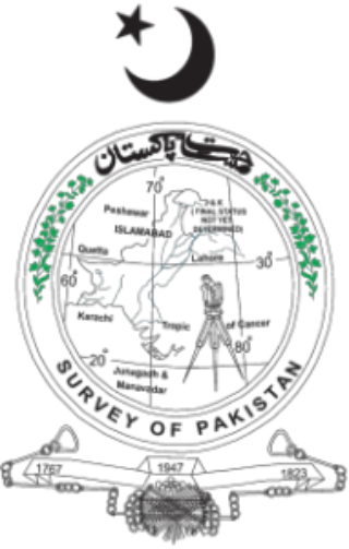
Survey of Pakistan is the sole national mapping and land surveying government agency of Pakistan. Its head of department is titles as "Surveyor General of Pakistan".
Land administration is the way in which the rules of land tenure are applied and made operational. Land administration, whether formal or informal, comprises an extensive range of systems and processes to administer. The processes of land administration include the transfer of rights in land from one party to another through sale, lease, loan, gift and inheritance; the regulating of land and property development; the use and conservation of the land; the gathering of revenues from the land through sales, leasing, and taxation; and the resolving of conflicts concerning the ownership and the use of land. Land administration functions may be divided into four components: Juridical, regulatory, fiscal, and information management. These functions of land administration may be organized in terms of agencies responsible for surveying and mapping, land registration, land valuation and land revenue generation. The purpose and scope of this knowledge domain appear from the following introducing notes:
The Osoyoos Division Yale Land District is one of the 59 land districts of British Columbia, Canada, which are the underlying cadastral divisions of that province. All land titles and surveys use the Land District system as the primary point of reference, and entries in BC Names for placenames and geographical objects are so listed.
The Cassiar Land District is a cadastral survey subdivision of the province of British Columbia, Canada, created with rest of those on Mainland British Columbia via the Lands Act of the Colony of British Columbia in 1860. The British Columbia government's BC Names system, a subdivision of GeoBC, defines a land district as "a territorial division with legally defined boundaries for administrative purposes" All land titles and surveys use the Land District system as the primary point of reference, and entries in BC Names for placenames and geographical objects are so listed.
The Comox Land District is one of the 59 land districts of British Columbia, Canada, which are part of the cadastral divisions of British Columbia, created with rest of those on Vancouver Island via the Lands Act of the Colony of Vancouver Island. The British Columbia government's BC Names system, a subdivision of GeoBC, defines a land district as "a territorial division with legally defined boundaries for administrative purposes". All land titles and surveys use the Land District system as the primary point of reference, and entries in BC Names for placenames and geographical objects are so listed.
The Lillooet Land District is one of the 59 cadastral subdivisions of British Columbia, which were created by the Lands Act of the Colony of British Columbia in 1859, defined as "a territorial division with legally defined boundaries for administrative purposes". The land district's boundaries came to be used as the boundary of the initial Lillooet riding for the provincial Legislature from 1871, when the colony became a province. In addition to use in descriptions of land titles and lot surveys, the Land District was also the basis of the Lillooet Mining District.
The Kootenay Land District is a cadastral survey subdivision of the province of British Columbia, Canada, created with rest of those on Mainland British Columbia via the Lands Act of the Colony of British Columbia in 1860. The British Columbia government's BC Names system, a subdivision of GeoBC, defines a land district as "a territorial division with legally defined boundaries for administrative purposes" All land titles and surveys use the Land District system as the primary point of reference, and entries in BC Names for placenames and geographical objects are so listed.
Cadastral surveying is the sub-field of cadastre and surveying that specialises in the establishment and re-establishment of real property boundaries. It involves the physical delineation of property boundaries and determination of dimensions, areas and certain rights associated with properties. This is regardless of whether they are on land, water or defined by natural or artificial features. It is an important component of the legal creation of properties. A cadastral surveyor must apply both the spatial-measurement principles of general surveying and legal principles such as respect of neighboring titles.
The Cariboo Land District is a cadastral survey subdivision of the province of British Columbia, Canada, created with rest of those on Mainland British Columbia via the Lands Act of the Colony of British Columbia in 1860. The British Columbia government's BC Names system, a subdivision of GeoBC, defines a land district as "a territorial division with legally defined boundaries for administrative purposes" All land titles and surveys use the Land District system as the primary point of reference, and entries in BC Names for placenames and geographical objects are so listed.

The Association of British Columbia Land Surveyors (ABCLS) is a self-governing, non-profit, non-governmental organization which sets educational requirements, examines for admission, and regulates professional land surveyors within British Columbia, Canada. The ABCLS is responsible for developing bylaws and guidelines for the conduct of its members, establishing and administering entry requirements for the profession, and liaising with governmental bodies and other associations to improve the quality of the profession's service to the public.

ShoreZone is a mapping program that acquires oblique aerial images at low altitude during the lowest daylight tides of the year to inventory alongshore and across-shore geomorphological and biological features of the Pacific Northwest intertidal shoreline. Habitat attributes are interpreted from the aerial images and categorized in a geographic database. The mapping program was first developed as an oil spill response tool for British Columbia, and now ShoreZone extends from Oregon to Alaska. Other uses of the spatial data include ecological studies, marine conservation planning, shoreline erosion monitoring, coastal flooding and vulnerability assessments, developing climate change adaptation strategies, and community education.