
Tarragindi is a southern suburb of the City of Brisbane, Queensland, Australia. It is represented through the Holland Park and Moorooka Ward councillors on the Brisbane City Council. In the 2016 census, Tarragindi had a population of 10,779 people.

Toowong Cemetery is a heritage-listed cemetery on the corner of Frederick Street and Mt Coot-tha Road, Toowong, City of Brisbane, Queensland, Australia. It was established in 1866 and formally opened in 1875. It is Queensland's largest cemetery and is located on forty-four hectares of land at the corner of Frederick Street and Mount Coot-tha Road approximately four and a half kilometres west of Brisbane. It was previously known as Brisbane General Cemetery. It was added to the Queensland Heritage Register on 31 December 2002.

Haigslea is a locality split between the City of Ipswich and the Somerset Region in South East Queensland, Australia. In the 2016 census Haigslea had a population of 468 people.

Nundah Cemetery is a heritage-listed cemetery at 88 Hedley Avenue, Nundah, City of Brisbane, Queensland, Australia. It was built from 1840s to 1963. It is also known as German Station Cemetery. It was added to the Queensland Heritage Register on 21 October 1992.

Ipswich is the central suburb and central business district in Ipswich in the City of Ipswich, Queensland, Australia. It is also known as Ipswich CBD. In the 2016 census, the suburb had a population of 2,459 people.
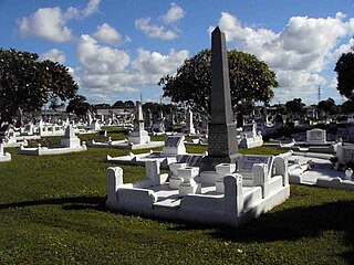
South Brisbane Cemetery is a heritage-listed cemetery at 21 Fairfield Road and Annerley Road, Dutton Park, City of Brisbane, Queensland, Australia, adjacent to the Brisbane River. It was built from 1870 to 1990s. It is also known as Dutton Park Cemetery. It was added to the Queensland Heritage Register on 1 October 2003.

Karori Cemetery is New Zealand's second largest cemetery, located in the Wellington suburb of Karori.

Lutwyche Cemetery is an Australian cemetery located at Kedron, Brisbane. It opened in 1878 and saw its first burial in the same year. It is located at the corner of Gympie and Kitchener Roads, approximately ten kilometres north of Brisbane.
Gympie Cemetery is the cemetery for Gympie, Queensland, Australia. The cemetery is located on Corella Road and is managed by the Gympie Cemetery Trust.

Purga is a rural locality in the City of Ipswich, Queensland, Australia. In the 2016 census, Purga had a population of 576 people.
Swan Creek is a rural locality in the Southern Downs Region, Queensland, Australia. In the 2016 census, Swan Creek had a population of 139 people.

Peak Crossing is a rural locality split between the City of Ipswich and the Scenic Rim Region of Queensland, Australia. In the 2016 census, Peak Crossing had a population of 965 people.

Drayton and Toowoomba Cemetery is a heritage-listed cemetery at the corner of South Street and Anzac Avenue, Harristown, Queensland, Australia. It was surveyed in May 1850, and is one of the earliest surviving cemeteries in Queensland. The cemetery is large, containing over 45,000 burials. It has been run by the City of Toowoomba, and its successor the Toowoomba Regional Council, since 1974; previously it was run by government-appointed trustees. Many prominent people associated with the Darling Downs are buried in the cemetery, and all sections of the cemetery remain in use. Notable Toowoomba stonemasons R. C. Ziegler & Son, Henry Bailey, Walter Bruce, John H. Wagner and the Bruce Brothers are all associated with monuments within the cemetery.

Alfred John Stephenson (1845–1914) was a politician in Queensland, Australia. He was a Member of the Queensland Legislative Assembly and a Member of the Queensland Legislative Council.

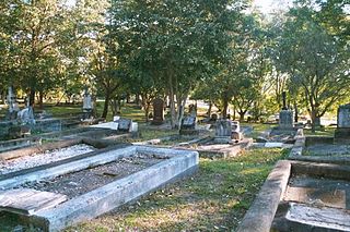
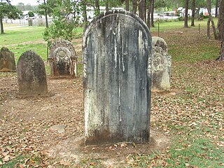
Allora Cemetery is a heritage-listed cemetery on Allora-Clifton Road, Allora, Southern Downs Region, Queensland, Australia. It was established in 1864. It was added to the Queensland Heritage Register on 27 April 2001.

Warwick General Cemetery is a heritage-listed cemetery at Wentworth Street, Warwick, Southern Downs Region, Queensland, Australia. It was designed by Dornbusch & Connolly and built from 1853 onwards by Phil Thornton. It was added to the Queensland Heritage Register on 27 April 2001.

South Rockhampton Cemetery is a heritage-listed cemetery at Upper Dawson Road, Allenstown, Rockhampton Region, Queensland, Australia. It was built from 1860 to 1970. It is also known as Dawson Road Cemetery and Rockhampton Cemetery. It was added to the Queensland Heritage Register on 15 February 1993.
Mackay General Cemetery is a heritage-listed cemetery at Cemetery Road, West Mackay, Mackay Region, Queensland, Australia. It was designed by Thomas Henry Fitzgerald and built in 1865 onwards. It was added to the Queensland Heritage Register on 19 November 2010.

Proserpine Cemetery is a cemetery located in Proserpine a town in the Whitsunday Region of Queensland, Australia. It opened in the late 1880s and has seen the burials of many of the town's and regions pioneers. It is made up of two sections. The "Old" section which was used from the late 1880s up until the 1980s and a "New" section which is the lawn cemetery that opened in the 1980s.


