The Mississippi River is the second-longest river and chief river of the second-largest drainage system on the North American continent, second only to the Hudson Bay drainage system. From its traditional source of Lake Itasca in northern Minnesota, it flows generally south for 2,320 miles (3,730 km) to the Mississippi River Delta in the Gulf of Mexico. With its many tributaries, the Mississippi's watershed drains all or parts of 32 U.S. states and two Canadian provinces between the Rocky and Appalachian mountains. The main stem is entirely within the United States; the total drainage basin is 1,151,000 sq mi (2,980,000 km2), of which only about one percent is in Canada. The Mississippi ranks as the fifteenth-largest river by discharge in the world. The river either borders or passes through the states of Minnesota, Wisconsin, Iowa, Illinois, Missouri, Kentucky, Tennessee, Arkansas, Mississippi, and Louisiana.
Snake River a major river of the greater Pacific Northwest region in the United States.

The Kern River, originally Rio de San Felipe, later La Porciuncula, is a river in the U.S. state of California, approximately 165 miles (270 km) long. It drains an area of the southern Sierra Nevada mountains northeast of Bakersfield. Fed by snowmelt near Mount Whitney, the river passes through scenic canyons in the mountains and is a popular destination for whitewater rafting and kayaking. It is the southernmost major river system in the Sierra Nevada, and is the only major river in the Sierra that drains in a southerly direction.

Charles Eugene Flandrau was an American lawyer who became influential in the Minnesota Territory, and later state, after moving there in 1853 from New York City. He served on the Minnesota Territorial Council, in the Minnesota Constitutional Convention, and on the Minnesota territorial and state supreme courts. He was also an associate justice on the Minnesota Supreme Court.

Superior National Forest, part of the United States National Forest system, is located in the Arrowhead Region of the state of Minnesota between the Canada–United States border and the north shore of Lake Superior. The area is part of the greater Boundary Waters region along the border of Minnesota and the Canadian province of Ontario, a historic and important thoroughfare in the fur trading and exploring days of New France and British North America.

Isabella Dinsmore Selmes Ferguson Greenway King is best known as the first U.S. congresswoman in Arizona history, and as the founder of the Arizona Inn of Tucson. During her life she was also noted as a one-time owner and operator of Los Angeles-based Gilpin Airlines, a speaker at the 1932 Democratic National Convention, and a bridesmaid at the wedding of Eleanor and Franklin D. Roosevelt.
Alexander is a male given name.

Isabella is an unincorporated community in Stony River Township, Lake County, Minnesota, United States.

The Little Isabella River is a 33.17 mi (53.38 km) stream in Superior National Forest, a United States National Forest in the U.S. state of Minnesota. The stream runs through Stony River Township, which is part of Lake County. The Little Isabella River Campground, which is operated by the United States Forest Service, is about 5 miles (8.0 km) north of Isabella, Minnesota, an unincorporated community. The Minnesota Department of Natural Resources has designated it as a trout stream and it is populated with Brook trout.
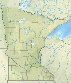
The Snake River is a river of Minnesota. It is a tributary of the Isabella River.

The Lake Isabella State Forest is a state forest located in Lake County, Minnesota. The forest is located completely within the Superior National Forest and the Boundary Waters Canoe Area Wilderness, and is thus subject to the management of the United States Forest Service. At 638 acres (258 ha), it one of the smallest forests in the Minnesota state system.

The Isabella Ranger Station is a complex of 21 buildings in Stony River Township, Minnesota, United States, near the town of Isabella. It is located on Minnesota State Highway 1 about one mile east of Isabella. The complex is listed on the National Register of Historic Places for its association with New Deal federal relief construction.

The Manitou River is a 24.9-mile-long (40.1 km) river in northern Minnesota, which drains into Lake Superior along its north shore about three miles northeast of Little Marais. It flows southeast through the Superior National Forest, Finland State Forest, and George H. Crosby Manitou State Park in Lake County.
Isabella River may refer to:

Sawbill Landing is an unincorporated community in Lake County, Minnesota, United States; located 10 miles northeast of Isabella.
Isabella River, a perennial stream that is part of the Lachlan catchment within the Murray–Darling basin, is located in the central–western region of New South Wales, Australia.


