Kagera is one of Tanzania's 31 administrative regions. The region is located in the northwestern corner of Tanzania on the western shore of Lake Victoria. The region neighbors Uganda, Rwanda, and Burundi and lies across the lake from Kenya. The region was known as West Lake before June 1979. The regional capital is the city of Bukoba. According to the 2012 national census, the region had a population of 2,458,023, which was lower than the pre-census projection of 2,763,329. For 2002-2012, the region's 3.2 percent average annual population growth rate was tied for the third highest in the country. It was also the ninth-most densely populated region, with 97 people per square kilometer.
Muleba is one of the six districts of the Kagera Region of Tanzania. It is bordered to the north by the Bukoba Urban and Bukoba Rural districts, to the south by the Biharamulo District, to the east by Lake Victoria and to the west by the Ngara and Karagwe districts.

Biharamulo District is one of the eight districts of the Kagera Region of Tanzania. It is bordered to the north by Karagwe District and Muleba District, to the east and south by Geita Region, to the west by Ngara District, and to the southwest by the Kigoma Region. Its administrative seat is Biharamulo town. Biharamulo Game Reserve is located within the borders of the district.
Karagwe is one of the eight districts of the Kagera Region of Tanzania. It is bordered to the north by Uganda, to the east by the Bukoba Rural District, to the southeast by the Muleba District, to the south by the Ngara District and to the west by Rwanda, from which it is divided by the River Kagera.

The Haya are an ethnic and linguistic tribe based in the Bukoba District, Muleba District and Karagwe District of Kagera Region in northwestern Tanzania, East Africa. In 1991 the Haya population was estimated to number 1,200,000. They speak the Haya language.
The Tanzania Mainland Premier League is the top-level professional football league in Tanzania and is administered by the Tanzania Football Federation. This league was created in 1965, when it was known as the "National League". Its name was changed later to the "First Division Soccer League" and changed again in 1997 to the "Premier League".

Bukoba Airport is an airport in northwestern Tanzania serving the town of Bukoba and the surrounding Kagera Region. It is adjacent to Lake Victoria.
The Roman Catholic Diocese of Bukoba is a diocese located in Bukoba in the Ecclesiastical province of Mwanza in Tanzania.

Mutukula, sometimes spelled as Mtukula, is a small town in Misenyi District, Kagera Region, in northwestern Tanzania, at the border with Uganda. Formerly, the settlement on the border was known as Kyebisagazi, and Mutukula was a kilometre to the south on the east side of the Masaka-Bukoba Road (B8).

Kikagati is a town in Western Uganda.
The Mbarara–Kikagati Road is in southwestern Uganda, connecting the city of Mbarara in Mbarara District and the town of Kikagati in Isingiro District, at the border between Uganda and Tanzania. The road continues into Tanzania as Highway B182.

Geita Region is one of Tanzania's 31 administrative regions. The town of Geita is the capital. The regional commissioner of the Geita Region is Magalula Saidi Magalula.
Mirama Hills is a town in the Western Region of Uganda.
Kagitumba is a town in Rwanda. It is located at the extreme North Eastern extremity at the confluence of the Kagitumba River and Akagera River. This location is also the tri-point border between Rwanda, Uganda and Tanzania.

Bukoba Rural District is one of the eight districts of the Kagera Region of Tanzania. It is bordered to the north by Missenyi District, to the east by Lake Victoria and Bukoba Urban District, to the south by Muleba District and to the west by Karagwe District. Its administrative seat is Bukoba town.

Bukoba Urban District is one of the eight districts of the Kagera Region of Tanzania. It is bordered to east by Lake Victoria and to the west by Bukoba Rural District. Its administrative seat is the town of Bukoba.

Jambo Bukoba is a charity in Germany. It has 350 members. Since 2008 it uses sport and games to improve education, health and equal opportunity for children and adolescents in Tanzania.
The Masaka–Mutukula–Mwanza High Voltage Power Line is a proposed high voltage electricity power line, connecting the high voltage substation at Masaka, in Masaka District, in the Central Region of Uganda, to another high voltage substation at Mwanza, in Mwanza Region, in the Republic of Tanzania.

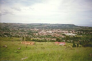
Rusumo is a town in northwestern Tanzania, at the border with Rwanda. It sits across the Kagera River from Rusumo, Rwanda.