Isla de Yáquil

Last updated
Isla de Yáquil
Village
Isla de Yáquil
Country Flag of Chile.svg  Chile
Region Flag of O'Higgins Region, Chile.svg Libertador General Bernardo O'Higgins
Province Logo de la Gobernacion de Colchagua.svg Colchagua
Commune Santa Cruz

Isla de Yáquil (Spanish for Island of Yáquil; also known as La Isla) is a Chilean town located in Santa Cruz, Colchagua Province, Libertador General Bernardo O'Higgins Region.

Town settlement that is bigger than a village but smaller than a city

A town is a human settlement. Towns are generally larger than villages but smaller than cities, though the criteria to distinguish them vary considerably between different parts of the world.

Santa Cruz, Chile City and Commune in OHiggins, Chile

Santa Cruz is a Chilean city and commune, located in the Colchagua valley, in the O'Higgins Region, located on the southern shore of the Tinguiririca river, 110 miles from Santiago, Chile's capital city and 27 miles from San Fernando.

Colchagua Province Province in OHiggins, Chile

Colchagua Province is one of three provinces of the central Chilean region of O'Higgins (VI). Its capital is San Fernando. It is bordered on the north by Cachapoal Province, on the east by the Argentine Republic, on the south by Curicó Province, and on the west by Cardenal Caro Province.

In 1899 it was described in Francisco Solano Astaburuaga y Cienfuegos' Diccionario Geográfico de la República de Chile as "a location of the northern section of the Curicó Department located in some hills of the same name, north of the village of Santa Cruz and Quinchañihue". [1]

Notable residents

Michelle Bachelet 34th & 36th President of Chile

Verónica Michelle Bachelet Jeria is a Chilean politician who served as President of Chile from 2006 to 2010 and again from 2014 to 2018, the first woman to occupy the position. After leaving the presidency in 2010 and while not immediately reelectable, she was appointed the first executive director of the newly created United Nations Entity for Gender Equality and the Empowerment of Women. In December 2013, Bachelet was reelected with over 62% of the vote, bettering the 54% she obtained in 2006. She was the first President of Chile to be reelected since 1932.

Related Research Articles

Petrel Lake salt lake in Chile

Petrel Lake is a salt lake located in Pichilemu beach, Chile, in front of Pichilemu railway station.
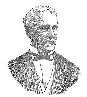
Francisco Astaburuaga Cienfuegos Chilean politician

Francisco Solano Asta-Buruaga y Cienfuegos was a Chilean politician and lawyer.

Las Garzas human settlement in Chile

Las Garzas is a village located in Marchigue, Cardenal Caro Province, Chile, near Pichilemu. It was formerly a farm.

San Antonio de Petrel is a small Chilean village located near the hacienda of the same name, in Pichilemu. It is located 18 kilometres (11 mi) east of Pichilemu. According to the 2002 census, the population of San Antonio de Petrel comprised 371 people, and 94 households.

Cardonal de Panilonco, or just Panilonco is a Chilean village located north of Pichilemu, Cardenal Caro Province. In 2002, the population was 852 people in 235 households.

Ciruelos Village in OHiggins, Chile

Ciruelos is a Chilean village located southeast of Pichilemu, Cardenal Caro Province. In 1899, it had very few inhabitants, a free school, and a post office.

El Durazno is a Chilean village located southwest of Combarbalá, Coquimbo Region.

Abránquil is a Chilean village located in current Linares Province, near Yerbas Buenas. It is located in the riverside of the creek also named Abránquil.

Abarca is a village located in Talca Province, Chile. It's at the south of Tapihue, at the west of Las Ñipas, and north of Los Puercos Creek.

Paniahue

Paniahue is a Chilean village located north of Santa Cruz, Colchagua Province, O'Higgins Region.

El Huique is a Chilean village located north of Palmilla, Colchagua Province.

Cabeceras is a Chilean hamlet (caserío) located in Paredones, Cardenal Caro Province.

Cabo Blanco is a Chilean hamlet (caserío) located in Valdivia, Valdivia Province, Los Ríos Region.

Chinguetué is a Chilean area located in Valdivia, Valdivia Province, Los Ríos Region. It was described in 1899 by Francisco Solano Asta-Buruaga y Cienfuegos on his book Diccionario Geográfico de la República de Chile as a "very productive area". Chinguetué means "land of chingues".

Colchagua is a Chilean village located in Quillón, Ñuble Province, Bío Bío Region. It is located close to the villages of Cerro Negro and Chancal.

Colchagua is a Chilean village located in San Rosendo, Bío Bío Province, Bío Bío Region. It is located close to the historic town of Rere and the Estación Buenuraqui railway station.

Colchagua is a Chilean village located northwest of Palmilla, Colchagua Province, Libertador General Bernardo O'Higgins Region.

Quechereguas is a Chilean village located in Molina, Talca Province, Maule Region.

Barreales is a Chilean village located in Santa Cruz, Colchagua Province, Libertador General Bernardo O'Higgins Region.

Alto Colorado is a Chilean village located 15 kilometres (9.3 mi) northeast of Pichilemu, Cardenal Caro Province.

References

  1. Wikisource-logo.svg  Astaburuaga Cienfuegos, Francisco, ed. (1899). "Yaquil". Diccionario Geográfico de la República de Chile (Geographic Dictionary of the Republic of Chile) (in Spanish).

Coordinates: 34°38′S71°11′W / 34.633°S 71.183°W / -34.633; -71.183

Geographic coordinate system Coordinate system

A geographic coordinate system is a coordinate system that enables every location on Earth to be specified by a set of numbers, letters or symbols. The coordinates are often chosen such that one of the numbers represents a vertical position and two or three of the numbers represent a horizontal position; alternatively, a geographic position may be expressed in a combined three-dimensional Cartesian vector. A common choice of coordinates is latitude, longitude and elevation. To specify a location on a plane requires a map projection.