
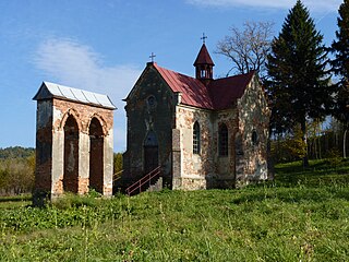
Ulucz is a village in the administrative district of Gmina Dydnia, within Brzozów County, Subcarpathian Voivodeship, in south-eastern Poland. The village has a population of 150. It lies approximately 9 kilometres (6 mi) east of Dydnia, 20 km (12 mi) east of Brzozów, and 44 km (27 mi) south-east of the regional capital Rzeszów.

Lwów Voivodeship was an administrative unit of interwar Poland (1918–1939). Because of the Nazi-Soviet invasion of Poland in accordance with the secret Molotov–Ribbentrop Pact, it became occupied by both the Wehrmacht and the Red Army in September 1939. Following the conquest of Poland however, the Polish underground administration existed there until August 1944. The Voivodeship was not returned to Poland after the war ended. It was split diagonally just east of Przemyśl; with its eastern half ceded to the Ukrainian SSR at the insistence of Joseph Stalin during the Tehran Conference confirmed at the Yalta Conference of 1945.
Gmina Nozdrzec is a rural gmina in Brzozów County, Subcarpathian Voivodeship, in south-eastern Poland. Its seat is the village of Nozdrzec, which lies approximately 17 kilometres (11 mi) north-east of Brzozów and 32 km (20 mi) south-east of the regional capital Rzeszów.

Dydnia is a village in Brzozów County, Subcarpathian Voivodeship, in south-eastern Poland. It is the seat of the gmina called Gmina Dydnia. It lies approximately 11 kilometres (7 mi) east of Brzozów and 40 km (25 mi) south of the regional capital Rzeszów.

Grabówka is a village in the administrative district of Gmina Dydnia, within Brzozów County, Subcarpathian Voivodeship, in south-eastern Poland. It lies approximately 3 kilometres (2 mi) south of Dydnia, 10 km (6 mi) east of Brzozów, and 43 km (27 mi) south of the regional capital Rzeszów. There are approximately 450 people living in Grabowka.

Jabłonka is a village in the administrative district of Gmina Dydnia, within Brzozów County, Subcarpathian Voivodeship, in south-eastern Poland. It lies approximately 4 kilometres (2 mi) west of Dydnia, 7 km (4 mi) east of Brzozów, and 39 km (24 mi) south of the regional capital Rzeszów.

Końskie is a village in the administrative district of Gmina Dydnia, within Brzozów County, Subcarpathian Voivodeship, in south-eastern Poland. It lies approximately 7 kilometres (4 mi) south-east of Dydnia, 17 km (11 mi) east of Brzozów, and 46 km (29 mi) south of the regional capital Rzeszów.
Krzemienna is a village in the administrative district of Gmina Dydnia, within Brzozów County, Subcarpathian Voivodeship, in south-eastern Poland. It lies approximately 4 kilometres (2 mi) east of Dydnia, 14 km (9 mi) east of Brzozów, and 40 km (25 mi) south of the regional capital Rzeszów.

Krzywe is a village in the administrative district of Gmina Dydnia, within Brzozów County, Subcarpathian Voivodeship, in south-eastern Poland. It lies approximately 4 kilometres (2 mi) south-east of Dydnia, 13 km (8 mi) east of Brzozów, and 43 km (27 mi) south of the regional capital Rzeszów.

Niebocko is a village in the administrative district of Gmina Dydnia, within Brzozów County, Subcarpathian Voivodeship, in south-eastern Poland. It lies approximately 4 kilometres (2 mi) west of Dydnia, 8 km (5 mi) east of Brzozów, and 40 km (25 mi) south of the regional capital Rzeszów.

Niewistka is a village in the administrative district of Gmina Dydnia, within Brzozów County, Subcarpathian Voivodeship, in south-eastern Poland. It lies approximately 6 kilometres (4 mi) north-east of Dydnia, 15 km (9 mi) east of Brzozów, and 38 km (24 mi) south-east of the regional capital Rzeszów.

Obarzym is a village in the administrative district of Gmina Dydnia, within Brzozów County, Subcarpathian Voivodeship, in south-eastern Poland. It lies approximately 3 kilometres (2 mi) north of Dydnia, 11 km (7 mi) east of Brzozów, and 38 km (24 mi) south of the regional capital Rzeszów.
Temeszów is a village in the administrative district of Gmina Dydnia, within Brzozów County, Subcarpathian Voivodeship, in south-eastern Poland. It lies approximately 5 kilometres (3 mi) east of Dydnia, 15 km (9 mi) east of Brzozów, and 41 km (25 mi) south of the regional capital Rzeszów.
Witryłów is a village in the administrative district of Gmina Dydnia, within Brzozów County, Subcarpathian Voivodeship, in south-eastern Poland. It lies approximately 6 kilometres (4 mi) south-east of Dydnia, 16 km (10 mi) east of Brzozów, and 44 km (27 mi) south of the regional capital Rzeszów.
Wydrna is a village in the administrative district of Gmina Dydnia, within Brzozów County, Subcarpathian Voivodeship, in south-eastern Poland. It lies approximately 6 kilometres (4 mi) north of Dydnia, 10 km (6 mi) north-east of Brzozów, and 35 km (22 mi) south of the regional capital Rzeszów.
Rudawiec is a village in the administrative district of Gmina Nozdrzec, within Brzozów County, Subcarpathian Voivodeship, in south-eastern Poland. It lies approximately 10 kilometres (6 mi) south-west of Nozdrzec, 8 km (5 mi) north-east of Brzozów, and 34 km (21 mi) south of the regional capital Rzeszów.
Wołodź is a village in the administrative district of Gmina Nozdrzec, within Brzozów County, Subcarpathian Voivodeship, in south-eastern Poland. It lies approximately 6 kilometres (4 mi) south of Nozdrzec, 14 km (9 mi) east of Brzozów, and 37 km (23 mi) south-east of the regional capital Rzeszów.
Wara is a village in the administrative district of Gmina Nozdrzec, within Brzozów County, Subcarpathian Voivodeship, in south-eastern Poland. It lies approximately 3 kilometres (2 mi) south-east of Nozdrzec, 17 km (11 mi) north-east of Brzozów, and 34 km (21 mi) south-east of the regional capital Rzeszów.
Ruska Wieś is a village in the administrative district of Gmina Węgorzewo, within Węgorzewo County, Warmian-Masurian Voivodeship, in northern Poland, close to the border with the Kaliningrad Oblast of Russia. It lies approximately 4 kilometres (2 mi) south-west of Węgorzewo and 92 km (57 mi) north-east of the regional capital Olsztyn.


