
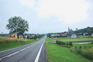
Ulucz is a village in the administrative district of Gmina Dydnia, within Brzozów County, Subcarpathian Voivodeship, in south-eastern Poland. The village has a population of 150. It lies approximately 9 kilometres (6 mi) east of Dydnia, 20 km (12 mi) east of Brzozów, and 44 km (27 mi) south-east of the regional capital Rzeszów.
Gmina Brzozów is an urban-rural gmina in Brzozów County, Subcarpathian Voivodeship, in south-eastern Poland. Its seat is the town of Brzozów, which lies approximately 38 kilometres (24 mi) south of the regional capital Rzeszów.
Gmina Nozdrzec is a rural gmina in Brzozów County, Subcarpathian Voivodeship, in south-eastern Poland. Its seat is the village of Nozdrzec, which lies approximately 17 kilometres (11 mi) north-east of Brzozów and 32 km (20 mi) south-east of the regional capital Rzeszów.
Gmina Sanok is a rural gmina in Sanok County, Subcarpathian Voivodeship, in south-eastern Poland. Its seat is the town of Sanok, although the town is not part of the territory of the gmina.
Grabownica Starzeńska is a village in the administrative district of Gmina Brzozów, within Brzozów County, Subcarpathian Voivodeship, in south-eastern Poland. It lies approximately 6 kilometres (4 mi) south-east of Brzozów and 42 km (26 mi) south of the regional capital Rzeszów.

Humniska is a village in the administrative district of Gmina Brzozów, within Brzozów County, Subcarpathian Voivodeship, in south-eastern Poland. It lies approximately 5 kilometres (3 mi) south-east of Brzozów and 41 km (25 mi) south of the regional capital Rzeszów.

Dydnia is a village in Brzozów County, Subcarpathian Voivodeship, in south-eastern Poland. It is the seat of the gmina called Gmina Dydnia. It lies approximately 11 kilometres (7 mi) east of Brzozów and 40 km (25 mi) south of the regional capital Rzeszów.

Grabówka is a village in the administrative district of Gmina Dydnia, within Brzozów County, Subcarpathian Voivodeship, in south-eastern Poland. It lies approximately 3 kilometres (2 mi) south of Dydnia, 10 km (6 mi) east of Brzozów, and 43 km (27 mi) south of the regional capital Rzeszów. There are approximately 450 people living in Grabowka.

Jabłonica Ruska is a village in the administrative district of Gmina Dydnia, within Brzozów County, Subcarpathian Voivodeship, in south-eastern Poland. It lies approximately 4 kilometres (2 mi) east of Dydnia, 14 km (9 mi) east of Brzozów, and 40 km (25 mi) south of the regional capital Rzeszów.

Jabłonka is a village in the administrative district of Gmina Dydnia, within Brzozów County, Subcarpathian Voivodeship, in south-eastern Poland. It lies approximately 4 kilometres (2 mi) west of Dydnia, 7 km (4 mi) east of Brzozów, and 39 km (24 mi) south of the regional capital Rzeszów.
Końskie is a village in the administrative district of Gmina Dydnia, within Brzozów County, Subcarpathian Voivodeship, in south-eastern Poland. It lies approximately 7 kilometres (4 mi) south-east of Dydnia, 17 km (11 mi) east of Brzozów, and 46 km (29 mi) south of the regional capital Rzeszów.
Krzemienna is a village in the administrative district of Gmina Dydnia, within Brzozów County, Subcarpathian Voivodeship, in south-eastern Poland. It lies approximately 4 kilometres (2 mi) east of Dydnia, 14 km (9 mi) east of Brzozów, and 40 km (25 mi) south of the regional capital Rzeszów.

Krzywe is a village in the administrative district of Gmina Dydnia, within Brzozów County, Subcarpathian Voivodeship, in south-eastern Poland. It lies approximately 4 kilometres (2 mi) south-east of Dydnia, 13 km (8 mi) east of Brzozów, and 43 km (27 mi) south of the regional capital Rzeszów.

Niebocko is a village in the administrative district of Gmina Dydnia, within Brzozów County, Subcarpathian Voivodeship, in south-eastern Poland. It lies approximately 4 kilometres (2 mi) west of Dydnia, 8 km (5 mi) east of Brzozów, and 40 km (25 mi) south of the regional capital Rzeszów.

Obarzym is a village in the administrative district of Gmina Dydnia, within Brzozów County, Subcarpathian Voivodeship, in south-eastern Poland. It lies approximately 3 kilometres (2 mi) north of Dydnia, 11 km (7 mi) east of Brzozów, and 38 km (24 mi) south of the regional capital Rzeszów.
Temeszów is a village in the administrative district of Gmina Dydnia, within Brzozów County, Subcarpathian Voivodeship, in south-eastern Poland. It lies approximately 5 kilometres (3 mi) east of Dydnia, 15 km (9 mi) east of Brzozów, and 41 km (25 mi) south of the regional capital Rzeszów.
Witryłów is a village in the administrative district of Gmina Dydnia, within Brzozów County, Subcarpathian Voivodeship, in south-eastern Poland. It lies approximately 6 kilometres (4 mi) south-east of Dydnia, 16 km (10 mi) east of Brzozów, and 44 km (27 mi) south of the regional capital Rzeszów.
Wydrna is a village in the administrative district of Gmina Dydnia, within Brzozów County, Subcarpathian Voivodeship, in south-eastern Poland. It lies approximately 6 kilometres (4 mi) north of Dydnia, 10 km (6 mi) north-east of Brzozów, and 35 km (22 mi) south of the regional capital Rzeszów.

Siedliska is a village in the administrative district of Gmina Nozdrzec, within Brzozów County, Subcarpathian Voivodeship, in south-eastern Poland. It lies approximately 5 kilometres (3 mi) south-east of Nozdrzec, 17 km (11 mi) east of Brzozów, and 36 km (22 mi) south-east of the regional capital Rzeszów.


