Adamów is a village in the administrative district of Gmina Brody, within Starachowice County, Świętokrzyskie Voivodeship, in south-central Poland. It lies approximately 5 kilometres (3 mi) west of Brody, 7 km (4 mi) south-east of Starachowice, and 42 km (26 mi) north-east of the regional capital Kielce.
Bór Kunowski is a village in the administrative district of Gmina Brody, within Starachowice County, Świętokrzyskie Voivodeship, in south-central Poland. It lies approximately 4 kilometres (2 mi) east of Brody, 15 km (9 mi) east of Starachowice, and 49 km (30 mi) east of the regional capital Kielce.
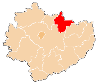
Brody is a village in Starachowice County, Świętokrzyskie Voivodeship, in south-central Poland. It is the seat of the gmina called Gmina Brody. It lies approximately 11 kilometres (7 mi) east of Starachowice and 45 km (28 mi) east of the regional capital Kielce.
Budy Brodzkie is a village in the administrative district of Gmina Brody, within Starachowice County, Świętokrzyskie Voivodeship, in south-central Poland. It lies approximately 2 kilometres (1 mi) north-east of Brody, 12 km (7 mi) east of Starachowice, and 47 km (29 mi) east of the regional capital Kielce.
Dziurów is a village in the administrative district of Gmina Brody, within Starachowice County, Świętokrzyskie Voivodeship, in south-central Poland. It lies approximately 7 kilometres (4 mi) west of Brody, 6 km (4 mi) south-east of Starachowice, and 39 km (24 mi) east of the regional capital Kielce.
Henryk is a village in the administrative district of Gmina Brody, within Starachowice County, Świętokrzyskie Voivodeship, in south-central Poland. It lies approximately 5 kilometres (3 mi) north-west of Brody, 7 km (4 mi) east of Starachowice, and 43 km (27 mi) north-east of the regional capital Kielce.
Krynki is a village in the administrative district of Gmina Brody, within Starachowice County, Świętokrzyskie Voivodeship, in south-central Poland. It lies approximately 2 kilometres (1 mi) south-west of Brody, 11 km (7 mi) south-east of Starachowice, and 44 km (27 mi) east of the regional capital Kielce.
Kuczów is a village in the administrative district of Gmina Brody, within Starachowice County, Świętokrzyskie Voivodeship, in south-central Poland. It lies approximately 7 kilometres (4 mi) west of Brody, 7 km (4 mi) south-east of Starachowice, and 39 km (24 mi) east of the regional capital Kielce.
Lipie is a village in the administrative district of Gmina Brody, within Starachowice County, Świętokrzyskie Voivodeship, in south-central Poland. It lies approximately 9 kilometres (6 mi) north-west of Brody, 5 km (3 mi) north-east of Starachowice, and 42 km (26 mi) north-east of the regional capital Kielce.
Lubienia is a village in the administrative district of Gmina Brody, within Starachowice County, Świętokrzyskie Voivodeship, in south-central Poland. It lies approximately 4 kilometres (2 mi) north-west of Brody, 9 km (6 mi) east of Starachowice, and 45 km (28 mi) north-east of the regional capital Kielce.
Młynek is a village in the administrative district of Gmina Brody, within Starachowice County, Świętokrzyskie Voivodeship, in south-central Poland. It lies approximately 2 kilometres (1 mi) north-west of Brody, 10 km (6 mi) east of Starachowice, and 45 km (28 mi) north-east of the regional capital Kielce.
Połągiew is a village in the administrative district of Gmina Brody, within Starachowice County, Świętokrzyskie Voivodeship, in south-central Poland. It lies approximately 2 kilometres (1 mi) south-east of Brody, 13 km (8 mi) east of Starachowice, and 47 km (29 mi) east of the regional capital Kielce.
Ruda is a village in the administrative district of Gmina Brody, within Starachowice County, Świętokrzyskie Voivodeship, in south-central Poland. It lies approximately 4 kilometres (2 mi) west of Brody, 9 km (6 mi) south-east of Starachowice, and 42 km (26 mi) east of the regional capital Kielce.
Rudnik is a village in the administrative district of Gmina Brody, within Starachowice County, Świętokrzyskie Voivodeship, in south-central Poland. It lies approximately 3 kilometres (2 mi) south of Brody, 13 km (8 mi) south-east of Starachowice, and 45 km (28 mi) east of the regional capital Kielce.
Staw Kunowski is a village in the administrative district of Gmina Brody, within Starachowice County, Świętokrzyskie Voivodeship, in south-central Poland. It lies approximately 4 kilometres (2 mi) south-east of Brody, 15 km (9 mi) east of Starachowice, and 47 km (29 mi) east of the regional capital Kielce.
Styków is a village in the administrative district of Gmina Brody, within Starachowice County, Świętokrzyskie Voivodeship, in south-central Poland. It lies approximately 6 kilometres (4 mi) south-west of Brody, 8 km (5 mi) south-east of Starachowice, and 40 km (25 mi) east of the regional capital Kielce.
Godów is a village in the administrative district of Gmina Pawłów, within Starachowice County, Świętokrzyskie Voivodeship, in south-central Poland. It lies approximately 5 kilometres (3 mi) east of Pawłów, 13 km (8 mi) south-east of Starachowice, and 41 km (25 mi) east of the regional capital Kielce.
Pokrzywnica is a village in the administrative district of Gmina Pawłów, within Starachowice County, Świętokrzyskie Voivodeship, in south-central Poland. It lies approximately 5 kilometres (3 mi) south-east of Pawłów, 15 km (9 mi) south of Starachowice, and 38 km (24 mi) east of the regional capital Kielce.
Świślina is a village in the administrative district of Gmina Pawłów, within Starachowice County, Świętokrzyskie Voivodeship, in south-central Poland. It lies approximately 5 kilometres (3 mi) west of Pawłów, 10 km (6 mi) south of Starachowice, and 32 km (20 mi) east of the regional capital Kielce.
Szeligi is a village in the administrative district of Gmina Pawłów, within Starachowice County, Świętokrzyskie Voivodeship, in south-central Poland. It lies approximately 6 kilometres (4 mi) east of Pawłów, 14 km (9 mi) south-east of Starachowice, and 41 km (25 mi) east of the regional capital Kielce.