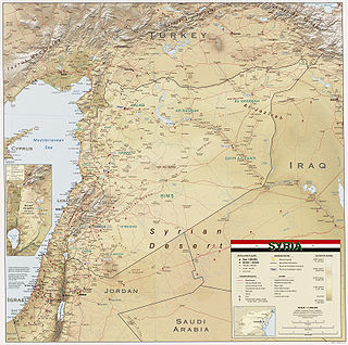
Syria is located in West Asia, north of the Arabian Peninsula, at the eastern end of the Mediterranean Sea. It is bordered by Turkey to the north, Lebanon and Israel to the west and southwest, Iraq to the east, and Jordan to the south. It consists of mountain ranges in the west and a steep area inland. In the east is the Syrian Desert and in the south is the Jabal al-Druze Range. The former is bisected by the Euphrates valley. A dam built in 1973 on the Euphrates created a reservoir named Lake Assad, the largest lake in Syria. The highest point in Syria is Mount Hermon on the Lebanese border at 2,814 metres or 9,232 feet. Between the humid Mediterranean coast and the arid desert regions lies a semiarid steep zone extending across three-quarters of the country, which receives hot, dry winds blowing across the desert. Syria is extensively depleted, with 28 percent of the land arable, 4 percent dedicated to permanent crops, 46 percent utilized as meadows and pastures, and only 3 percent forest and woodland.

Hama Governorate is one of the 14 governorates of Syria. It is situated in western-central Syria, bordering Idlib and Aleppo Governorates to the south, Raqqa Governorate to the west, Homs Governorate to the north, and Tartus and Latakia Governorate to the east. It is the only Governorate that does not border a foreign country. Measures of its area vary from 8,844 km2 to 8,883 km2, with its capital being the city of Hama.
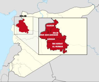
Harim Mountains are highlands in the north of Idlib Governorate in northwestern Syria. The mountains are located in the Harim and Jisr Shughur districts of Idlib Governorate.
Mount Zāwiya or Mount Rīḥā (also in medieval times: Banī-ʻUlaym Mountain is a highland region in Idlib Governorate in northwestern Syria. Around 36 towns and villages exist in the Mount Zawiya region. The biggest towns are Rīḥā and Maʻarrat an-Nuʻmān.
Ain Halaqim is a village in northwestern Syria, administratively part of the Hama Governorate, located west of Hama. Nearby localities include al-Bayda and Masyaf to the north, al-Bayyadiyah to the northeast, Nisaf to the east, Kafr Kamrah to the southeast, Mashta al-Helu to the southwest, Ayn al-Shams to the west and Wadi al-Oyun to the northwest. According to the Syria Central Bureau of Statistics (CBS), Ain Halaqim had a population of 1,216 in the 2004 census. Its inhabitants are predominantly Christians.

Masyaf Castle is a medieval structure in the town of Masyaf in Hama Governorate, Syria, situated in the Orontes Valley, approximately 40.03 kilometres to the west of Hama. It served to protect the approach to other Ismaili castles in the Syrian Coastal Mountain Range at a site controlling the trade routes to cities further inland such as Banyas. The castle itself stands on a platform about 20 metres above the surrounding plain. It became famous as the stronghold from which Rashid ad-Din Sinan, known as the Old Man of the Mountain, ruled from 1166-1193. He was a leader of the Syrian branch of the Shia Nizari Isma'ili sect, also known as the Assassins, and a figure in the history of the Crusades.
Akakir is a village in northwestern Syria, administratively part of the Hama Governorate, located southwest of Hama. Nearby localities include Kafr Ram to the west, Fahel to the south, al-Shinyah to the southeast, al-Taybah al-Gharbiyah to the east, Maryamin to the northeast and Kafr Kamrah and Awj to the north. According to the Syria Central Bureau of Statistics (CBS), Akakir had a population of 2,495 in the 2004 census. Its inhabitants are predominantly Alawites.
Ayyo is a village in northern Syria, administratively part of the Hama Governorate, located south of Hama. Nearby localities include Kafr Buhum to the northwest, al-Khalidiyah to the north, Maarin al-Jabal to the northeast, al-Buraq to the east, Nisrin to the southeast and al-Biyah and Birin to the southwest. According to the Syria Central Bureau of Statistics, Ayyo had a population of 1,980 in the 2004 census. Its inhabitants are predominantly Christians.
Surayhin is a village in northwestern Syria, administratively part of the Hama Governorate, southeast of Hama. Nearby localities include al-Jajiyah to the north, al-Jinan to the southeast, al-Buraq to the south, Maarin al-Jabal to the southwest and al-Khalidiyah to the west. According to the Central Bureau of Statistics, Surayhin had a population of 7,466 in the 2004 census. Its inhabitants are predominantly Sunni Muslims.
Al-Khalidiyah is a village in northwestern Syria, administratively part of the Hama Governorate, south of Hama. Nearby localities include Kafr Buhum to the southwest, Ayyubiyah to the south, Maarin al-Jabal to the southeast, al-Jinan to the east and Surayhin to the northeast. According to the Central Bureau of Statistics, al-Khalidiyah had a population of 4,740 in the 2004 census. Its inhabitants are predominantly Sunni Muslims.
Al-Buraq is a village in northern Syria, administratively part of the Hama Governorate, located southeast of Hama. Nearby localities include Ayyubiyah and Nisrin to the west, Maarin al-Jabal to the northwest, Surayhin to the north, al-Jinan to the northeast, Taqsis to the southeast and Tell Qartal to the south. According to the Syria Central Bureau of Statistics, al-Buraq had a population of 3,235 in the 2004 census.
Kafraa is a Syrian village located near the Jabal Kafraa mountain in the Hama Subdistrict of the Hama District in the Hama Governorate. According to the Syria Central Bureau of Statistics (CBS), Kafraa had a population of 2,621 in the 2004 census.
Maarin al-Jabal is a Syrian village located in the Subdistrict of the Hama District in the Hama Governorate. According to the Syria Central Bureau of Statistics (CBS), Maarin al-Jabal had a population of 3,710 in the 2004 census. Its inhabitants are predominantly Sunni Muslims.

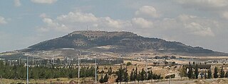
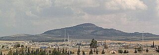
Jabal Zayn al-Abidin is a mountain east of the town of Qamhana and north of Hama in Syria. It has an elevation of 620 meters and is located near Jabal Kafraa. It is the 31st highest mountain in the Hama Governorate and the 544th highest in Syria.

Jabal Kafraa is a mountain near Kafraa in the Hama Governorate in Syria. It has an elevation of 625 meters and is located near Jabal Zayn al-Abidin, it ranks as the 30th highest mountain in Hama and the 540th highest in Syria.
Jabal al-Arba'in is a mountain near Maarin al-Jabal in the Hama Governorate in Syria. It has an elevation of 683 meters, it ranks as the 27th highest mountain in Hama and the 507th highest in Syria.
Jabal Sha'ir is a mountain in Hama Governorate in Syria. It has an elevation of 1,215 meters and ranks as the second highest mountain in the Hama Governorate and the 186th highest in Syria.
Jabal al-Fawwar is a mountain in Hama Governorate in Syria. It has an elevation of 1,174 meters, it ranks as the third highest mountain in Hama and the 203rd highest in Syria.

The 2015 Hama offensive was a military operation launched by Syrian rebels during the Syrian Civil War in the northern parts of Hama Governorate.

The October 2016 Idlib Governorate clashes are violent confrontations between the Salafist jihadist group Jund al-Aqsa and the Salafist Syrian rebel group the Ahrar al-Sham, supported by several other rebel groups. The two groups were previously allied during the 2016 Hama offensive, but sporadic clashes also occurred time by time.


