Related Research Articles

Jacques Cartier was a French-Breton maritime explorer for France. Jacques Cartier was the first European to describe and map the Gulf of Saint Lawrence and the shores of the Saint Lawrence River, which he named "The Country of Canadas" after the Iroquoian names for the two big settlements he saw at Stadacona and at Hochelaga.

Longueuil is a city in the province of Quebec, Canada. It is the seat of the Montérégie administrative region and the central city of the urban agglomeration of Longueuil. It sits on the south shore of the Saint Lawrence River directly across from Montreal. The population as of the Canada 2016 Census totalled 239,700, making it Montreal's second largest suburb, the fifth most populous city in Quebec and twentieth largest in Canada.

Trois-Rivières is a city in the Mauricie administrative region of Quebec, Canada, at the confluence of the Saint-Maurice and Saint Lawrence rivers, on the north shore of the Saint Lawrence River across from the city of Bécancour. It is part of the densely populated Quebec City–Windsor Corridor and is approximately halfway between Montreal and Quebec City. Trois-Rivières is the economic and cultural hub of the Mauricie region. The settlement was founded by French colonists on July 4, 1634, as the second permanent settlement in New France, after Quebec City in 1608. In 2021, the city's population was 140,420.

Mirabel is an off-island suburb of Montreal, located in southern Quebec.

Pointe-Claire is a Quebec local municipality within the Urban agglomeration of Montreal on the Island of Montreal in Canada. It is entirely developed, and land use includes residential, light manufacturing, and retail. As of the 2016 Census the population was 31,380.
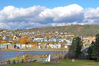
Gaspé is a city at the tip of the Gaspé Peninsula in the Gaspésie–Îles-de-la-Madeleine region of eastern Quebec in Canada. Gaspé is located about 650 km (400 mi) northeast of Quebec City, and 350 km (220 mi) east of Rimouski. As of the 2016 Canadian Census, the city had a total population of 14,568.
Portneuf County is a historic county in Quebec, Canada west of Quebec City on the Saint Lawrence River in Canada.

Ville-Marie is the name of a borough (arrondissement) in the centre of Montreal, Quebec. The borough is named after Fort Ville-Marie, the French settlement that would later become Montreal, which was located within the present-day borough. Old Montreal is a National Historic Site of Canada.
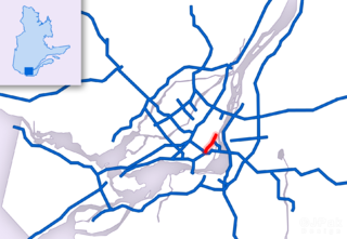
Route 136 (R-136), formerly Autoroute 720, known as the Ville-Marie Expressway (English) or Autoroute Ville-Marie (French) is an Autoroute highway in the Canadian province of Quebec that is a spur route of Autoroute 20 in Montreal. Its western terminus is located at the Turcot Interchange, a junction with Autoroute 15 and Autoroute 20, and its eastern terminus is near the Jacques Cartier Bridge, where the highway merges with Notre-Dame Street. The Autoroute Ville-Marie designation is named after the downtown borough of Ville-Marie, through which the expressway is routed. It was designated Autoroute 720 until 2021 when it was renamed to Route 136.

Anjou is a borough (arrondissement) of the city of Montreal. Prior to its 2002 merger it was a city known as Ville d'Anjou.
Ville Jacques-Cartier was a city located on the south shore of Montreal, Quebec, Canada. It was named after the founder of New France, Jacques Cartier. Now a defunct city, its former territory makes up a third of the city of Longueuil and more than 80% of Le Vieux-Longueuil borough.
There are some hypotheses concerning the origin of the name of Montreal. The best-known is that it is a variant of "Mount Royal".

The Centre-Sud is a neighbourhood located in the easternmost edge of the Ville-Marie borough of the city of Montreal.

Louis-Philippe Hébert (1850–1917) was the son of Théophile Hébert, a farmer, and Julie Bourgeois of Ste-Sophie de Mégantic, Quebec. Hébert was a sculptor who sculpted forty monuments, busts, medals and statues in wood, bronze and terra-cotta. He taught at the Conseil des arts et manufactures in Montreal, Quebec. He married Maria Roy on 26 May 1879 in Montreal, Quebec. The couple's eight children include Henri Hébert, a sculptor, and Adrien Hébert, a painter.
Chambly County was a county of Quebec that existed between 1855 and the early 1980s. The territory of the county today forms part of the Montérégie administrative region and the Urban agglomeration of Longueuil and the Regional county municipality of la Vallée-du-Richelieu. The county seat was Longueuil.
Hochelaga County was a historic county on the Island of Montreal in the province of Quebec. It existed between 1855 and 1921.

The Chécatica River is a salmon river in the Côte-Nord region of Quebec, Canada. It empties into the Gulf of Saint Lawrence.
References
- ↑ (Québec), Québec; (Québec), Québec (1855). "L'acte d'amendement de la representation parliamentaire de 1855". Acte des municipalités et des chemins de 1855, et certains acts y relatifs, comprenant ... p. 145. Retrieved April 11, 2013.
- ↑ Collin, Jean-Pierre. "La Gestion métropolitaine et les relations ville-banlieue à Montréal depuis 1830" (PDF). Villes, régions, monde, Le réseau interuniversitaire d'études urbaines et spatiales. p. 23. Archived from the original (PDF) on December 7, 2014. Retrieved April 11, 2013.