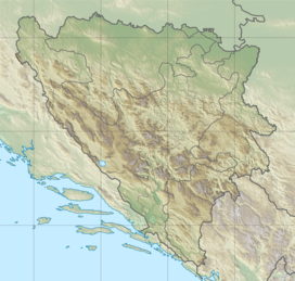
Bosnia and Herzegovina, abbreviated BiH or B&H, sometimes called Bosnia–Herzegovina and often known informally as Bosnia, is a country in South and Southeast Europe, located within the Balkans. Sarajevo is the capital and largest city. Bosnia and Herzegovina is bordered by Serbia to the east, Montenegro to the southeast, and Croatia to the north and southwest. It is not entirely landlocked; to the south it has a narrow coast on the Adriatic Sea, which is about 20 kilometres long and surrounds the town of Neum. The inland Bosnia region has a moderate continental climate, with hot summers and cold, snowy winters. In the central and eastern interior of the country the geography is mountainous, in the northwest moderately hilly, and in the northeast predominantly flatland. The smaller southern region, Herzegovina, has a Mediterranean climate and mostly mountainous topography.

This article is about the demographic features of the population of Bosnia and Herzegovina, including population density, ethnicity, education level, health of the populace, economic status, religious affiliations and other aspects of the population.

Republika Srpska is one of the two entities of Bosnia and Herzegovina, the other being the Federation of Bosnia and Herzegovina. It is located in the north and east of the country. Its largest city and administrative centre is Banja Luka, lying on the Vrbas river.

The Federation of Bosnia and Herzegovina is one of the two entities that compose the State of Bosnia and Herzegovina, the other being Republika Srpska. The Federation of Bosnia and Herzegovina consists of 10 autonomous cantons with their own governments and legislatures.

The Posavina Canton is one of ten cantons of the Federation of Bosnia and Herzegovina in Bosnia and Herzegovina. It is the smallest canton with an area of only 330.85 km2 (128 sq mi). The canton is an exclave of Federation of Bosnia and Herzegovina, being bordered by Republika Srpska and Brčko District to the south and the river Sava and Croatia to the north. Its capital is Orašje and the largest town is Odžak.

Canton 10 is the largest of the cantons of the Federation of Bosnia and Herzegovina by area and eighth by population. It mainly covers an area of the historical and geographical region of Tropolje. The local government seat is in Livno, while the assembly is in Tomislavgrad.
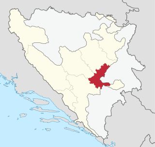
The Sarajevo Canton, officially the Canton of Sarajevo is one of 10 cantons of the Federation of Bosnia and Herzegovina in Bosnia and Herzegovina. Its cantonal seat is the city of Sarajevo, also the capital city of Bosnia and Herzegovina.
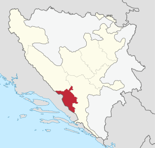
The West Herzegovina Canton is one of the cantons of the Federation of Bosnia and Herzegovina. The West Herzegovina Canton is in the Herzegovina region in the southwest of Bosnia and Herzegovina. Its seat of government is in Široki Brijeg, while other municipalities within the Canton are Grude, Ljubuški and Posušje. It has 94,898 inhabitants, of whom more than 98% are ethnic Croats.
The Lim is a river that flows through Montenegro, Serbia and Bosnia and Herzegovina and is 219 km (136 mi) long. It is also the right and the longest tributary of the Drina.

Herzegovina is the southern and smaller of two main geographical regions of Bosnia and Herzegovina, the other being Bosnia. It has never had strictly defined geographical or cultural-historical borders, nor has it ever been defined as an administrative whole in the geopolitical and economic subdivision of Bosnia and Herzegovina.
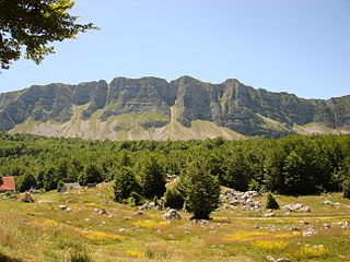
Šator is a mountain in the Dinaric Alps, in the western regions of Bosnia and Herzegovina. The name šator means "tent". The highest peak Veliki Šator is 1,872 m (6,142 ft) above sea level. Dimensions of the mountain are some 15 km in the west–east and 10 km in the north–south direction.

Ivan planina is a mountain near Hadžići, Konjic and Kreševo, in central Bosnia and Herzegovina. Ivan Mountain is part of Dinaric Alps. It is 1,534 metres (5,033 ft) tall.

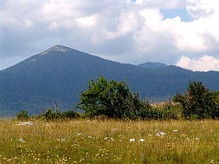
Vran is a mountain in the municipality of Tomislavgrad, Bosnia and Herzegovina. It has an altitude of 2,074 metres (6,804 ft).

Grmeč is a mountain in north-western Bosnia and Herzegovina. It is more than 60 kilometres long, stretching between the city of Bihać and the town of Ključ. The highest peak of Grmeč is Crni vrh at 1,605 metres (5,266 ft) above sea level. Grmeč is surrounded by the city of Bihać and towns Bosanski Petrovac, Ključ, Sanski Most, and Bosanska Krupa.

Osječenica is a mountain in the municipality of Bosanski Petrovac, Bosnia and Herzegovina. It has an altitude of 1,627 metres (5,338 ft).
Lebršnik is a mountain in the municipality of Gacko, East Herzegovina, at the border of Bosnia and Herzegovina and Montenegro. It has an altitude of 1,985 metres (6,512 ft).

Čabulja is a mountain in the municipality of Mostar, Bosnia and Herzegovina. The highest point Velika Vlajna has an altitude of 1,786 metres (5,860 ft).

Crvanj is a mountain in the municipality of Nevesinje, Bosnia and Herzegovina. It has an altitude of 1,921 metres (6,302 ft).
Kruščica or Kruščićka planina is a mountain in Central Bosnia, positioned between municipalities of Vitez and Busovača, Bosnia and Herzegovina. It is bordered by the town of Vitez and Vjetrenice mountain range to the north, Vilenica mountain to the northeast, Radovan mountain to the east, Vranica mountain range to the south and Busovačka planina to the west. It has an altitude of 1,673 metres (5,489 ft).