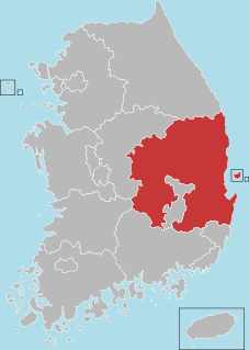
North Gyeongsang Province, also known as Gyeongbuk, is a province in eastern South Korea. The province was formed in 1896 from the northern half of the former Gyeongsang province, remained a province of Korea until the country's division in 1945, then became part of South Korea.
Korea has traditionally been divided into a number of unofficial regions that reflect historical, geographical, and dialect boundaries within the peninsula. Many of the names in the list below overlap or are obsolete today, with Honam, Yeongdong, Yeongnam, and the modern term Sudogwon being the only ones in wide use.

Miryang, often spelled Milyang, is a city in Gyeongsangnam-do Province, South Korea. Neighboring cities include Changnyeong to the west, Cheongdo to the north, Ulsan to the east, and Yangsan, Gimhae, and Changwon to the south. The city bird is the Korean magpie, the city tree is the pine, and the city flower is the royal azalea.

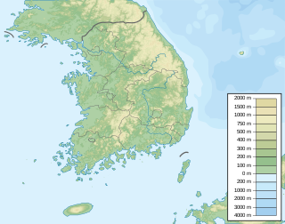
The Sobaek Mountains are a mountain range cutting across the southern Korean peninsula. They split off from the Taebaek Mountains and trend southwest across the center of the peninsula. They are traditionally considered to reach their southwestern limit at Jirisan, which is also the highest peak of the range. Other famous mountains in the range include Songni Mountain, Joryeong Mountain, Gaya Mountain, Worak Mountain, and Sobaek Mountain itself. The peaks of the Sobaek Mountains are generally well over 1000 m above sea level.

Eonyang is an eup, or large village, in Ulju-gun, a largely rural district of Ulsan, South Korea. It is near the Seoknam Nun's Temple. It has a traditional market every five days.
The Alps is a major European mountain range.

The Great Yeongnam Road, or Yeongnamdaero, was one of the principal roads of Korea during the Joseon Dynasty, 1392-1910. It ran between Hanseong and Dongnae. More generally, it served to connect the Gyeongsang province to the capital. It takes its name from Yeongnam, an alternate name for the Gyeongsang region. In addition to officials and merchants, the road was used by scholars from Gyeongsang on their way to and from the gwageo, national examinations held in the capital.

Paljoryeong is a mountain pass in southeastern South Korea, lying between the peaks of Bonghwasan and Sangwonsan, which are both slightly over 660 meters high. The pass itself is slightly less than 400 metres (1,300 ft) above sea level. It lies on the border of modern-day Daegu metropolitan city and Cheongdo, Gyeongsangbuk-do province. At one time it was the major overland route between Daegu and the region to its south. The north side of the pass is in Daegu, in Gachang-myeon, Dalseong-gun. The south side is in Cheongdo's Iseo-myeon.
Cheontaesan is a 631-meter-high mountain in Gyeongsangnam-do, South Korea, on the border between Miryang and Yangsan cities. It lies near the southern end of the Yeongnam Alps, and looks south across the Nakdong River to Gimhae. Cheontaesan is connected to Geumosan to its north.
Pyochungsa, originally Jungnimsa, is a Korean Buddhist temple of the Jogye Order of Korean Buddhism. It stands on the slopes of Jaeyaksan mountain near Cheonhwangsan in the Yeongnam Alps in Danjang-myeon, northern Miryang, South Korea.

Cheonhwangsan is a mountain in South Korea. It sits on the boundary between the city of Ulsan and the city of Miryang, in the province of Gyeongsangnam-do. Cheonhwangsan has an elevation of 1,189 m (3,901 ft). It is part of the Yeongnam Alps mountain range.
Gajisan is a mountain in South Korea. It sits on the boundary between the city of Ulsan, the city of Miryang in the province of Gyeongsangnam-do, and Cheongdo County in Gyeongsangbuk-do. Gajisan has an elevation of 1,240 m (4,068 ft). It is part of the Yeongnam Alps mountain range.
Ganwolsan is a mountain in the city of Ulsan, South Korea. It has an elevation of 1,083.1 m (3,553 ft). It is part of the Yeongnam Alps mountain range.
Goheonsan is a mountain in the vicinity of the city of Ulsan, South Korea. It has an elevation of 1,032 m (3,386 ft). It is part of the Yeongnam Alps mountain range.
Sinbulsan is a mountain in South Korea. It extends over the cities of Ulsan and Yangsan in Gyeongsangnam-do. Sinbulsan has an elevation of 1,209 m (3,967 ft). It is part of the Yeongnam Alps mountain range.
Yeongchuksan is a mountain in South Korea. It extends over the cities of Ulsan and Yangsan in Gyeongsangnam-do. This mountain is also referred to as Yeongchwisan (영취산), Chwiseosan (취서산), and Chukseosan (축서산). Yeongchuksan has an elevation of 1,081 m (3,547 ft). It is part of the Yeongnam Alps mountain range.
Unmunsan is a mountain of Gyeongsangbuk-do, eastern South Korea. It has an elevation of 1,195 metres. It is part of the Yeongnam Alps mountain range.
Munboksan is a mountain located in Gyeongju, North Gyeongsang Province and Cheongdo County, South Korea. It has an elevation of 1,015 m (3,330 ft). It is part of the Yeongnam Alps mountain range.

