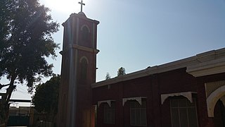
Toba Tek Singh District is a district of Faisalabad Division in the Punjab province of Pakistan. It is located between 30°33' to 31°2' Degree north latitudes and 72°08' to 72°48' Degree longitudes. It became a separate district in 1982.

Sheikhan town is situated in Chiniot Tehsil and in District Chiniot in Punjab province of Pakistan.
Nowshera Virkan is a town and a tehsil situated to the west of the industrial city of Gujranwala, Punjab, Pakistan. Nowshera Virkan is a hub of rice-growing villages.
Barana is a union council of Lalian tehsil in Chiniot District, Punjab province, Pakistan.
The Esk'etemc First Nation, also known as the Alkali Lake Indian Band, is a First Nations government of the Secwepemc (Shuswap) people, located at Alkali Lake in the Cariboo region of the Central Interior of the Canadian province of British Columbia. It was created when the government of the then-Colony of British Columbia established an Indian reserve system in the 1860s. It is one of three Secwepemc bands that is not a member of either the Shuswap Nation Tribal Council or the Northern Shuswap Tribal Council.
Balkassar is a village and union council, an administrative subdivision, of Chakwal District in the Punjab Province of Pakistan. Part of Chakwal Tehsil, the village attains its name from the Kassar tribe, who also make up most of the population. It is one of a cluster of villages such as Chawli, Dhudial, Mangwal, Bikhari Khurd and Balokassar, which form the tribal homeland of the Kassar tribe.
Khothian is a village in Union Council chakwal, of Chakwal District in the Punjab Province of Pakistan It is part of chakwal Tehsil.
Haveli Majoka is a big village located at the Jhelum River in Pakistan. The geographical coordinates are 31° 49' 37" North, 72° 15' 39" East. The village comprises almost only a single tribe, the Majoka. That is also the reason for the name, Haveli being the word of for a large house with courtyard.
Shumlai is a town, and one of twenty union councils in Battagram District, in Khyber Pakhtunkhwa province of Pakistan. It is located at 34°42'20N 73°7'0E and has an altitude of 1567 metres.
Babozai is a town and union council of Mardan District in Khyber-Pakhtunkhwa. It is located at 34°50'0N 72°8'0E and has an altitude of 1754 metres.
Khai is a village in the Punjab province of Pakistan.
Lopoke is a village in the Punjab province of Pakistan. It is located at 31°8'0N 72°50'0E with an altitude of 166 metres (547 feet).
Kohali is a village and union council of Jhelum District in the Punjab province of Pakistan. It is part of Sohawa Tehsil, and located at 31°8'0N 72°48'0E with an altitude of 166 metres (547 feet).

Kandwal is a village and union council of Pind Dadan Khan Tehsil, Jhelum District in Punjab province of Pakistan. The village has a population of about 33,000.It is last village of district Jhelum and touches two districts of province Punjab i.e Khoushab and Chakwal.
Gar Munara is a village located on the bank of the Indus River, in Swabi, Khyber Pakhtunkhwa, Pakistan, near the town of Marghuz. Thousands of visitors across Pakistan visit Gar Munara every year, especially in summer to enjoy the Indus River. It has a population of around 5,000. Most of the people are government workers or public servants. Many of them go abroad for work. The village's only bank, HBL, is located in the center of the village. The main crops are wheat, corn, sugarcane, and tobacco. Resorts in Gar Munara include Rahat Khan Bangla and Ameer Sher Khan Bangla. Gar Munara village is surrounded by several other villages: Dhok to its east, Moosa Banda to its west, and Marghuz to its north, with the Indus River to its south. The literacy rate is high in this area. There is one matriculation school for boys, and one for girls. There is also one primary school for boys and one for girls. A new college for girls.
Sarangra is a village in Chogawan-2 Tehsil in Amritsar District of Punjab State, India. It is located 33 km to the west of District headquarters Amritsar. 8 km from Chogawan-2. 275 km from State capital Chandigarh
KhuduKhel or Khudu Khel is a tehsil and Totalai is its central town. Totalai is located near district Swabi in the northwestern region of the country.
Ghurghushto is an administrative unit, known as Union council of Buner District in the Khyber Pakhtunkhwa province of Pakistan.
Gokand is an administrative unit, known as Union council of Buner District in the Khyber Pakhtunkhwa province of Pakistan.


