
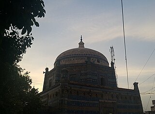
Ghazipur, is a city in the state of Uttar Pradesh, India. Ghazipur city is the administrative headquarters of the Ghazipur district, one of the four districts that form the Varanasi division of Uttar Pradesh. It is located on the Ganges (Ganga) River near the border with Bihar state, about 40 miles (65 km) northeast of Varanasi (Benares).The city of Ghazipur also constitutes one of the seven distinct tehsils, or subdivisions, of the Ghazipur district.

Shahjahanpur is a district of Uttar Pradesh India. It is a part of Bareilly division. It was established in 1813 by the British Government. Previously it was a part of district Bareilly. Geographically the main town is Shahjahanpur which is its headquarters. Its 5 Tehsils are: Powayan, Kalan, Tilhar, Jalalabad and Sadar.

Jodhaa Akbar is a 2008 Indian Hindi-language epic historical romantic drama musical fiction film directed by Ashutosh Gowariker. It stars Hrithik Roshan and Aishwarya Rai Bachchan in the titular roles. Set in the 16th century, the film shows the fictional life and love between the Muslim Emperor Akbar of the Mughal Empire and a Hindu Princess Jodhaa Bai of Amber, and their political marriage. A. R. Rahman composed the musical score which proved to be critically and commercially successful. The film marks the second collaboration between Roshan and Rai Bachchan after Dhoom 2 (2006).
Jalalabad (Jalālābād) is a town and a nagar panchayat in Bijnor district in the Indian state of Uttar Pradesh. Habib khan was 1st pradhan of jalalabad after independence of India for many years. On his name NGO habibia gram vikas sansthan jalalabad running a school named Habib memorial school and Madarsa Habibia lilbanat.
Bahadurganj is a Municipality located in Zahurabad pargama of the Kasimabad Tehsil in Ghazipur district of Uttar Pradesh, India. Bahadurganj is located one the banks of Tamsa and Bhainsahi rivers.The town also served as the capital of Qasimabad estate.

Jalalpur Sharif is a town located in the Jhelum district in Punjab, Pakistan.
Jalalpur Pirwala is a city and the capital of Jalalpur Pirwala Tehsil, Multan District, Pakistan. This city is about 90 km south of Multan city. Jalalpur Pirwala is a historical city and it was named after a famous Sufi saint Jalaluddin Surkh-Posh Bukhari. It had a population was over 500,000 in the 2017 census.

Pradhan Mantri Gramin Aawas Yojana is a social welfare programme under the Ministry of Rural Development, Government of India, to provide housing for the rural poor in India. A similar scheme for urban poor was launched in 2015 as Housing for All by 2022. The scheme was officially launched by Prime Minister Narendra Modi on 20 November 2016 from Agra.
Dildarnagar Kamsar is a pargana (region) and a mashra comprising 34 settlements located around the Karamnasa River in the Ghazipur district of Uttar Pradesh and the Kaimur district of Bihar, India. Of these, 18 mouzas are the primary settlements. It is a prominent settlement of Khanzadas, also known as Kamsari Pathans, as well as Afghan Pathans, primarily of the Niazi and Yusufzai clans. The original name of the region was Kamsar, but due to close and historical ties with the family of Bara Pathans, the region is often referred to as Kamsar-O-Bar. It was established in 1542 by Raja Narhar Khan.
Amir Chak is a village in Kamsaar in the Indian state of Uttar Pradesh.

Saraila is a village in Kamsaar in the Indian state of Uttar Pradesh.Saraila is a village in Seorai Tehsil in Ghazipur District of Uttar Pradesh, India. It belongs to Varanasi Division. It is located 30 km to the south of District headquarters Ghazipur. 11 km from Seorai. 372 km from State capital Lucknow. The village was also a part of Daudpur Estate which had its capital at Dewaitha during Mughal and early British era.

Jaburna is a village in Kamsaar in the Indian state of Uttar Pradesh.

Alauddin Khalji, born Ali Gurshasp, was a ruler from the Khalji dynasty that ruled the Delhi Sultanate in the Indian subcontinent. Alauddin instituted a number of significant administrative changes in India, related to revenues, price controls, and society. He also successfully fended off several Mongol invasions of India.

Dakshin Surma, also known as South Surma, is an upazila of Sylhet District in Sylhet Division, Bangladesh.
Chhan is a village in the Sawai Madhopur district of Rajasthan, India. It is identified with Jhain, which is mentioned in the Delhi Sultanate chronicles as an important town of 13th and 14th century India.
Karmahari is a village in Zamania Tehsil's Ghazipur district, Uttar Pradesh, India. Zamindar Qasim Khan established it in 1606. In 1763, most of Qasim Khan's family relocated to Daltonsganj and almost emptied the village. The family of Qasim Khan had 1542 Hectares of ancestral land, which they gave to other people and established Baraura, Karmahari, and Nonar village when they relocated to Daltonsganj. Later, some of his friends and family also relocated to Daltonsganj. The village is a part of Dewaitha Gram Panchayat.
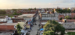
Dildarnagar is a municipality in Kamsaar of Ghazipur District, Uttar Pradesh, India. Dildarnagar is a fast-developing town. It is located 34 km from Ghazipur. It is also known as the heart of the Kamsaar-o-Bar region. The total area of Dildarnagar includes Fatehpur Bazar, Dildarnagar Gao, Tajpur, and Nirahukapura. These four neighbourhoods form the town of Dildarnagar. As of the 2011 census, the population of Dildarnagar was 28,913 and the town had an area of 1,995.95 hectares. Dildarnagar is on the road from Varanasi to Buxar. It was also the capital of Dildarnagar Estate.
Dewaitha is a village of Dildarnagar Kamsar,in Zamania tehsil of Ghazipur, India, located on the banks of the Karmanasa River and it's tributary Eknaiya, The village had a population of 7,104 as of the 2011 Census of India. The place is inhabited by Kamsar Pathans..

Amawan is a village and corresponding community development block in Rae Bareli district, Uttar Pradesh, India. It historically was the seat of a taluqdari estate held by a Pathan family and eventually split into two shares. As of 2011, its population is 5,245, in 973 households. It has five primary schools and no healthcare facilities.

Jalalpur Dhai is a village in Deenshah Gaura block of Rae Bareli district, Uttar Pradesh, India. It is located a short distance north of the Ganges, on the road from Dalmau to Mustafabad. As of 2011, it has a population of 5,520 people, in 966 households. It has one primary school and no healthcare facilities. Jalalpur Dhai hosts markets twice per week, on Wednesdays and Sundays, with cloth and vegetables being the main items traded.