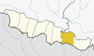
Bhagawanpur is a Village Development Committee in Siraha District in the Sagarmatha Zone of south-eastern Nepal. At the time of the 1991 Nepal census it had a population of 2845 people residing in 455 individual households.

Bhokraha"भोक्राहा" is a Village Development Committee in Siraha District in the Sagarmatha Zone of south-eastern Nepal. At the time of the 2011 Nepal census it had a population of 1757 people residing in 341 individual households.
Govindapur Malahanama is a village development committee in Siraha District in the Sagarmatha Zone of south-eastern Nepal. At the time of the 1991 Nepal census it had a population of 6758.
Hanuman Nagar is a village development committee in Siraha District in the Sagarmatha Zone of south-eastern Nepal. At the time of the 1991 Nepal census it had a population of 4892 people living in 918 individual households.
Harakathi is a village development committee in Siraha District in the Sagarmatha Zone of south-eastern Nepal. At the time of the 1991 Nepal census it had a population of 2202 people living in 358 individual households.
Inarwa, Sagarmatha is a Village Development Committee in Siraha District in the Sagarmatha Zone of south-eastern Nepal. At the time of the 1991 Nepal census it had a population of 8045 people residing in 1451 individual households.
Krishnapur Birta is a village development committee in Siraha District in the Sagarmatha Zone of south-eastern Nepal. At the time of the 1991 Nepal census it had a population of 3147 people living in 544 individual households.
Lagadigoth is a village development committee in Siraha District in the Sagarmatha Zone of south-eastern Nepal. At the time of the 1991 Nepal census it had a population of 2799 people living in 482 individual households.

Lahan is a town and municipality in Siraha District in the Sagarmatha Zone of south-eastern Nepal. It is connected with Mahendra Highway, which is also called the east-west highway. It is located nearly 350 kilometers or 99.3 miles east of the capital, Kathmandu. Lahan is located at the latitude of 26.717 and longitude of 86.483. It is at an elevation of 111 meters above sea level. It follows Nepali time zone, UTC Offset: +05:45 hours.
Lalpur, Nepal is a Village Development Committee in Siraha District in the Sagarmatha Zone of south-eastern Nepal. At the time of the 1991 Nepal census it had a population of 3412 people residing in 621 individual households.
Lakshmipur is a village development committee in Siraha District in the Sagarmatha Zone of south-eastern Nepal. At the time of the 1991 Nepal census it had a population of 2651 people living in 474 individual households.
Malhaniyakhori is a town in Mirchaiya Municipality in Siraha District in the Sagarmatha Zone of south-eastern Nepal. The formerly village development committee was merged to form a new municipality on 18 May 2014 along with the existing Rampur Birta, Malhaniyakhori, Radhopur, Ramnagar Mirchaiya, Fulbariya, Sitapur PraDa and Maheshpur Gamharia Village Development Committees.
Pipra Pra. Dha. is a village development committee in Siraha District in the Sagarmatha Zone of south-eastern Nepal. At the time of the 1991 Nepal census it had a population of 3641.
Pipra Pra. Pi is a village development committee in Siraha District in the Sagarmatha Zone of south-eastern Nepal. At the time of the 1991 Nepal census it had a population of 5692.

Sakhuwanankar Katti is a village development committee in Siraha District in the Sagarmatha Zone of south-eastern Nepal. At the time of the 1991 Nepal census it had a population of 2594 people living in 419 individual households.
Sarashwar is a village development committee in Siraha District in the Sagarmatha Zone of south-eastern Nepal. At the time of the 1991 Nepal census it had a population of 4839 people living in 939 individual households.higher secondary school /+2
Sitapur Pra. Da. is a town in Mirchaiya Municipality in Siraha District in the Sagarmatha Zone of south-eastern Nepal. The formerly village development committee was merged to form new municipality since 18 May 2014 along with existing Rampur Birta, Malhaniyakhori, Radhopur, Ramnagar Mirchaiya, Fulbariya, Sitapur PraDa and Maheshpur Gamharia Village Development Committees. At the time of the 1991 Nepal census it had a population of 4671 people living in 899 individual households.
Sitapur Pra. Dha. is a village development committee in Siraha District in the Sagarmatha Zone of south-eastern Nepal. At the time of the 1991 Nepal census it had a population of 3702 people living in 693 individual households.
Sothayan is a village development committee in Siraha District in the Sagarmatha Zone of south-eastern Nepal. At the time of the 1991 Nepal census it had a population of 3004 people living in 539 individual households.

Tenuwapati is in Bariyarpatti Gaupalikas or Rural municipalities of Siraha District in the Sagarmatha Zone of south-eastern Nepal. At the time of the 1991 Nepal census it had a population of 3365 people living in 601 individual households.


