Ballia is a city with a municipal board in the Indian state of Uttar Pradesh. The eastern boundary of the city lies at the junction of two major rivers, the Ganges and the Ghaghara.The city is situated 140 km (87 mi) east of Varanasi and about 380 km from the state capital Lucknow. It is home to a protected area, the Jai Prakash Narayan bird sanctuary. Ballia is around 4 km (2.5 mi) from Bihar.

Ballia district is one of the districts of Uttar Pradesh, India. Ballia district is a part of Azamgarh division situated in the east of Uttar Pradesh. The main economic activity is agriculture. City is the district headquarters and commercial market of this district. It is the birthplace of former prime minister of India Chandra Sekhar Singh There are six tehsils in this district: Ballia, Bansdih, Rasra, Bairia, Sikandarpur and Belthara. Rasra is the second major commercial area of the district, having a government sugar mill and a cotton weaving industry. Though Ballia's core occupation is agriculture there are some additional small industries. Maniar is known for its bindi industry and is a major supplier.
Ibrahimpatti near Koth is a village in Ballia district of Uttar Pradesh, India. It is situated 69 kilometres (43 mi) from Ballia. As of 2011 Census of India, this village has a population of 1,674.
Koth is a village in the Ballia District of Uttar Pradesh, India. As of 2011 census, this village had a population of 9,345.
Jamalpur Mirzapur is a village in mirzapur district, Uttar Pradesh, India. It is situated in a remote area of Uttar Pradesh and approximately 330 km from the state capital Lucknow. Jamalpur Mirzapur is locally known for its political, social and economic importance. It is a block village of almost 120 villages. There are government hospitals and government primary schools. There is also one school for special training for girls and disabled children for free. the developing villages in the block Ghosi itself. Its nearby town block is the famous block "Ghosi" situated on NH-7 & Varanasi-gorakahpur Highway NH29 and basically famous for bricks. Manufacturing area covering some villages of Jamalpur MIRZAPUR as well as forty percent villages of GHOSI.
Belthara Road is a Nagar Panchayat city with a railway station in the north-western corner of Ballia district of Uttar Pradesh, India.
Narhi (Nagra) is a village in Rasra Tehsil in Ballia district of Uttar Pradesh, India. It belongs to Azamgarh division. It is located 42 km north from District headquarters Balliav, 4 km from Nagra, and 362 km from the state capital, Lucknow.
Bharat Singh was a Member of Parliament, Lok Sabha from the Ballia. He is member of the Bharatiya Janata Party. He won the 2014 Indian general elections from the Ballia Lok Sabha constituency by defeating former Prime Minister Chandra Shekhar's son Neeraj Shekhar with a margin of 1,39,434 votes.
Dumri is a village in the Buxar district of Bihar state in India. It is located 25 km east of the district headquarters Buxar. It is situated 8 km from Simri and 111 km from the state capital Patna. It has a total of 1207 families residing. Dumri has a population of 8794 as per government records.
Phephna, also spelled as Fefana, is a large village in the Ballia district of Indian state of Uttar Pradesh. This village is situated at about 10 kilometers from District headquarters Ballia.
Narahi is a village located in Ballia Sadar tehsil of Ballia district, Uttar Pradesh, India. It has a total of 1,274 families as of 2011. Narahi had a population of 8,960 as per 2011 census.
Lathudih is a village located in Mohammadabad tehsil of Ghazipur district of Uttar Pradesh in India. It has total 646 families residing. Lathudih has population of 4,080 as per government records. It is located at a distance of 18 km towards east from tehsil headquarter Mohammadabad and 41 km from district headquarter Ghazipur.The total geographical area of village is approximately 440 hectares.
Nagra is a town and a municipal board in Ballia district in the Indian state of Uttar Pradesh So the city was named 'Nagra'. It has an important market for the nearby villages. Lounglatta is the famous sweet of Nagra. Its Dushehara fair is famous in Ballia district. Nagra has top schools of district. Nagra has second largest Durga Puja celebration in Uttar Pradesh after Ram Nagar, Varanasi, Kali Mandir, Hanuman Mandir, Masjid, etc. are beautiful places of Nagra. It has a busy Sabzi Mandi Nagra, Fish Market, Chicken Market, Mutton Market. ,etc.

Maurha is a village and a Gram panchayat in Ballia district in the Indian state of Uttar Pradesh. Its population is 555, per the 2011 Census. Maurha's nearest railway station is Belthara Road. During British India it was a Taluqdari
Mahathapar is a village of Ballia district in the Indian state of Uttar Pradesh. Its population is 1889, per the 2011 Census. Mahthapar's nearest railway station is Ballia.
Govindpur is a village of Ballia district in the Indian state of Uttar Pradesh. Its population is 469, per the 2011 Census. Govindpur village is located in Ballia Tehsil of Ballia district in Uttar Pradesh, India.

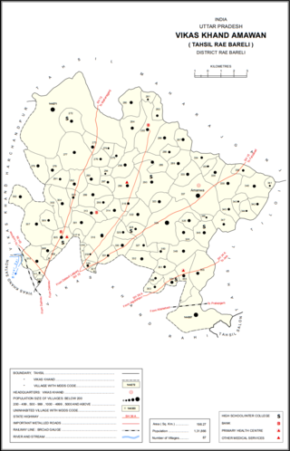
Jamalpur Karaundi is a village in Amawan block of Rae Bareli district, Uttar Pradesh, India. It is located 11 km from Raebareli, the district headquarters. As of 2011, its population is 630, in 125 households.

Jamalpur Nankari is a village in Rahi block of Rae Bareli district, Uttar Pradesh, India. It is located 4 km from Rae Bareli, the district headquarters. As of 2011, it has a population of 1,203 people, in 242 households. It has one primary school and no healthcare facilities.
Doaba was a constituency of the Uttar Pradesh Legislative Assembly covering the city of Bairia in the Ballia district of Uttar Pradesh, India.


